The heat and humidity are on the way out, with cooler temperatures and more clouds on the way for the weekend.
The heat and humidity will continue into Friday with high pressure offshore, but a backdoor cold front will drop southward by late in the day. As the winds shift into the east and northeast, much cooler air will settle into the region. The front may be accompanied by a few showers or thunderstorms, but much of the region should remain dry.
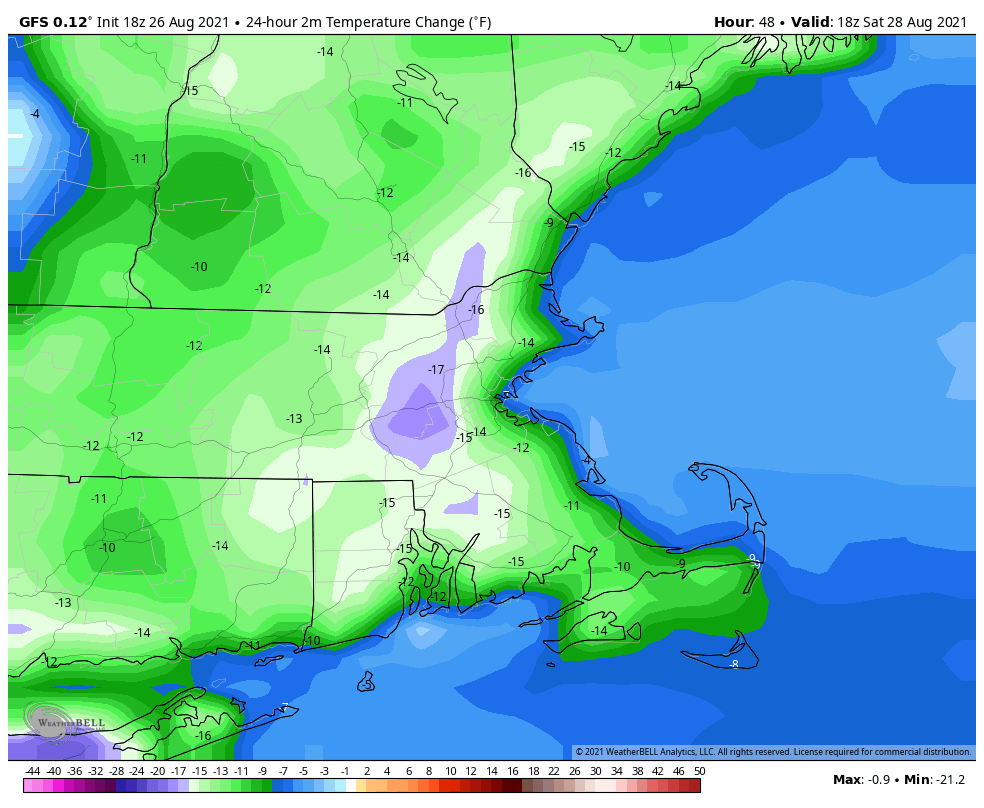
That front will stall out just to our south for the weekend, keeping plenty of clouds in place along with the cooler temperatures. By later on Sunday, that front will start to lift northward again as a warm front. This may bring in a better chance for showers and thunderstorms for Sunday night and Monday, but it will also bring warmer and more humid weather back in.
Thursday night: Partly cloudy. Low 67-74.
Friday: A mix of sun and clouds, slight chance for a shower. High 85-92.
Friday night: Partly to mostly cloudy. Low 60-67.
Saturday: More clouds than sun. High 70-77, coolest along the coast.
Saturday night: Mostly cloudy. Low 57-64.
Sunday: Intervals of clouds and sun. High 72-79.
Sunday night: Partly cloudy, chance for a few showers. Low 62-69.
Monday: More clouds than sun with some showers and thunderstorms possible. High 79-86.
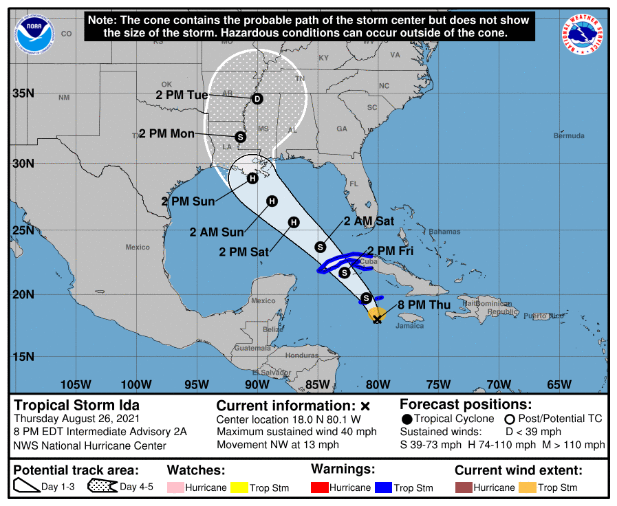
Finally, a quick word on the tropics. Tropical Storm Ida has developed west of Jamaica. Current forecasts call for it to rapidly strengthen and head northwestward. It could become an increasing threat to parts of the Gulf coast, especially Louisiana or Mississippi, by late in the weekend as a hurricane, possibly a very strong one. There are two other areas, one east of Bermuda and another east of the Lesser Antilles, that could also become tropical depressions over the next few days.
