Henri isn’t done with us yet, but once it finally pulls away, hot and humid weather will return.
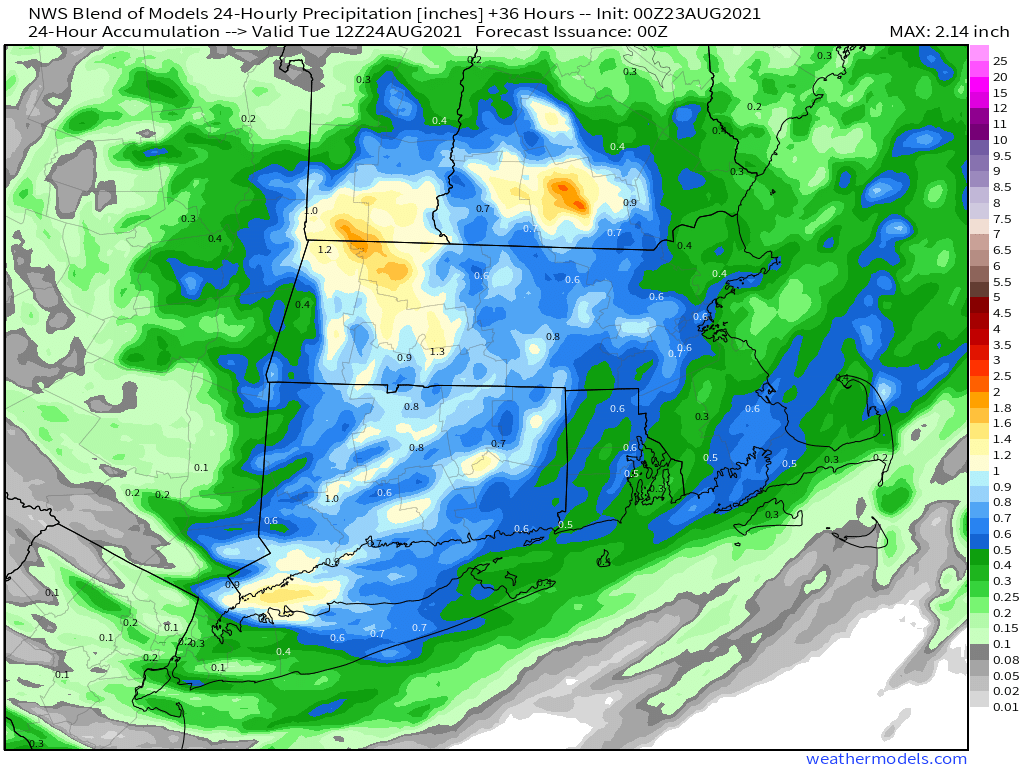
What’s left of Henri will slowly make its way eastward across the region today. It will be a warm and humid day, with some break of sunshine possible, especially early on. Showers and thunderstorms will redevelop, and some of them may produce heavy downpours. As was the case a few days ago when the remains of Fred moved through, a couple of spin-up tornadoes aren’t out of the question. If any of these do form, they’ll be short-lived and fairly weak, but can cause damage in their immediate vicinity. As for the rainfall, the heaviest rain will likely fall from western New England across southern New Hampshire, just to the north of the track of the low. This is consistent with what we normally see with tropical systems up in this neck of the woods, with most of the rainfall to the left of the track. That was certainly the case yesterday, with little rainfall across eastern Massachusetts after the initial band went through in the morning.

Everything finally pulls away overnight, then high pressure builds in for Tuesday through Thursday with warm to hot and humid conditions. Temperatures will be well into the 80s each afternoon with some lower 90s possible. Dewpoints will also be in the upper 60s and 70s across the region, so it will feel quite oppressive. A cold front will bring an end to the heat and humidity late Thursday, but there is a chance that it may not come through until Friday, which would result in another warm to hot and humid day. High pressure builds in with cooler and drier conditions for Saturday. We may start to warm up again next Sunday as another warm front approaches the region.

Monday: More clouds than sunshine with some showers and thunderstorms likely, especially during the afternoon. High 77-84.
Monday night: Mostly cloudy with showers and storms ending, some clear may develop late at night. Low 65-72.
Tuesday: Becoming partly to mostly sunny and humid. High 81-88.
Tuesday night: Clear to partly cloudy. Low 65-72.
Wednesday: Sunshine and some afternoon clouds, humid. High 83-90.
Thursday: A mix of sun and clouds, humid, with showers and thunderstorms possible during the afternoon and evening. High 85-92.
Friday: Partly sunny, a few showers and thunderstorms are possible. High 79-86.
Saturday: Intervals of clouds and sun, much cooler. High 70-77.
Sunday: Partly sunny. High 73-80.