If you like heat and humidity, then the first half of the week is perfect for you. If you don’t, well, the end of the week and the weekend might be better, but certainly not perfect.
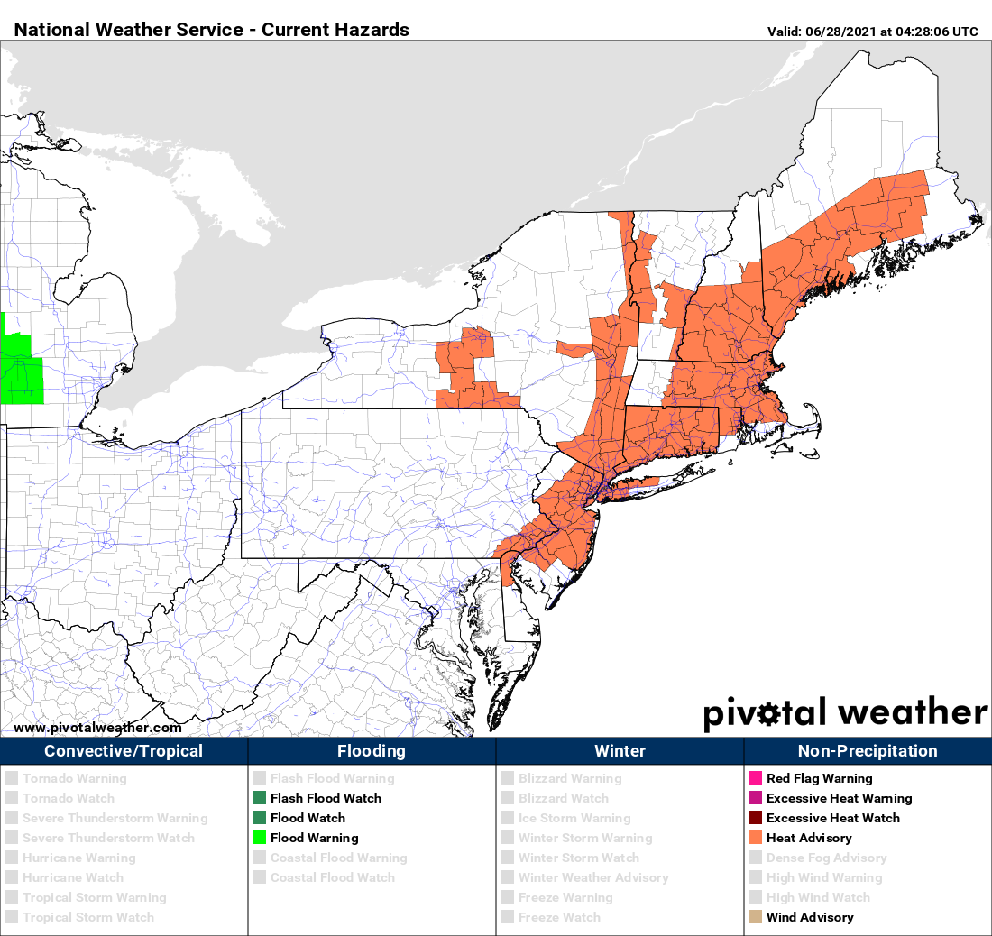
We start the week off with high pressure anchored off the Eastern Seaboard, pumping hot and humid air into the region. Most locations away from the South Coast should get well into the 90s today, tomorrow, and Wednesday. With the humidity factored in, it’s going to feel like it’s near or over 100 degrees. That’s why Heat Advisories have been issued for much of the area. At night, it’ll remain warm and muggy, with lows generally in the 70s. A few showers and thunderstorms may pop up Tuesday and again on Wednesday afternoon, providing a little late-day relief.

A cold front will move in late Wednesday or early Thursday, taking the edge off the heat, but with some more widespread showers and thunderstorms accompanying it. Beyond that, things get a little tricky. That front is expected to wash out near or just south of the region on Thursday. Waves of low pressure will ride along it, with showers and thunderstorms possible at times from Friday into the weekend, but this will also depend on how much southward progress the front makes before it washes out. If it’s far enough to the south, then the shower activity may stay a little farther south. No matter where it stalls, we’re looking at one or possibly two very cool days for the end of the week and start of the weekend. Temperatures should start to moderate again for the Fourth of July.

Monday: Partly sunny, hot, and humid. High 90-97, cooler along the South Coast.
Monday night: Clear to partly cloudy, just a slight chance for a shower or two. Low 70-77.
Tuesday: Sunshine and some afternoon clouds, hot, and humid., a few showers and thunderstorms are possible late in the day. High 91-98, cooler along the South Coast.
Tuesday night: Clear to partly cloudy, any showers or storms end during the evening. Low 69-76.
Wednesday: Partly to mostly sunny, breezy, hot, and humid, showers and thunderstorms are possible during the afternoon and evening. High 89-96 cooler along the South Coast.
Thursday: More clouds than sun with scattered showers and thunderstorms. High 81-88.
Friday: Plenty of clouds and much cooler with more showers possible, especially south of the Mass Pike. High 71-78.
Saturday: Partly to mostly cloudy, chance for showers and thunderstorms. High 68-75.
Fourth of July: More clouds than sun with more showers and thunderstorms possible. High 74-81.
