Some milder weather is on tap for part of the week, but that doesn’t mean that winter is over.
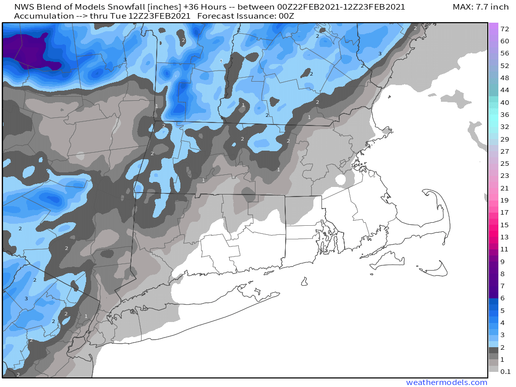
We start the week off with a weak low pressure system heading toward the region. For areas from Boston southward, this will be mostly rain, with a few snowflakes possibly mixed in at the start this afternoon. However, there will still be enough cold air in place for precipitation to start as snow north and west of Boston. Even here, a change to rain is likely, but there could be some minor accumulations, possibly as much as 1-2 inches, before the changeover, mainly in parts of southern and central New Hampshire, but possibly into the Merrimack Valley. Everything ends this evening as the storm pulls away.
High pressure builds in for Tuesday and Wednesday with drier and milder conditions. In fact, parts of the area could make a run at 50 degrees on Wednesday. However, it won’t last long, as a cold front sweeps through at night, with a few showers and colder weather once again. High pressure builds back in for Thursday and Friday with temperatures that are closer to where they should be in late February, maybe even a little below normal again.

Another system moves in for next weekend, bringing some snow or rain to the region. Details are still a bit fuzzy this far out, but it doesn’t look like a big storm, and temperatures may end up cold enough for some snow, at least to start. Of course, given that it is six days away, things will change, so we won’t get into too much detail just yet. Conditions should improve on Sunday as the system pulls away, and it could turn quite mild again.

Monday: Cloudy and becoming breezy with light rain likely, starting as snow north and west of Boston. High 35-42.
Monday night: Showers end in the evening, some clearing late at night. Low 25-32.
Tuesday: More clouds than sunshine. High 37-44.
Tuesday night: Becoming clear. Low 27-34.
Wednesday: Sunny in the morning, clouds return in the afternoon, becoming breezy, a few showers are possible at night. High 41-48.
Thursday: Sunshine and a few clouds, breezy. High 36-43.
Friday: Mostly sunny, breezy, and colder. High 30-37.
Saturday: Cloudy with a chance of snow or rain. High 36-43.
Sunday: Partly to mostly cloudy. High 43-50.
