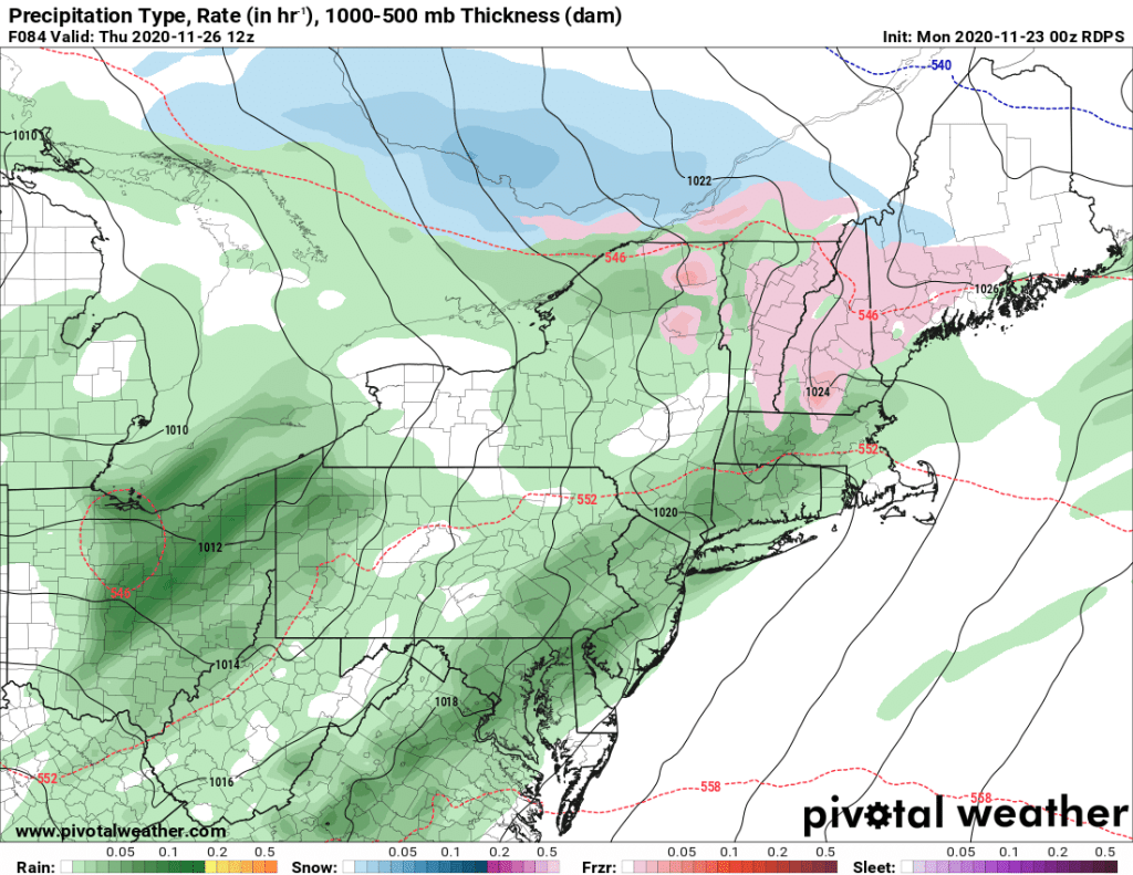
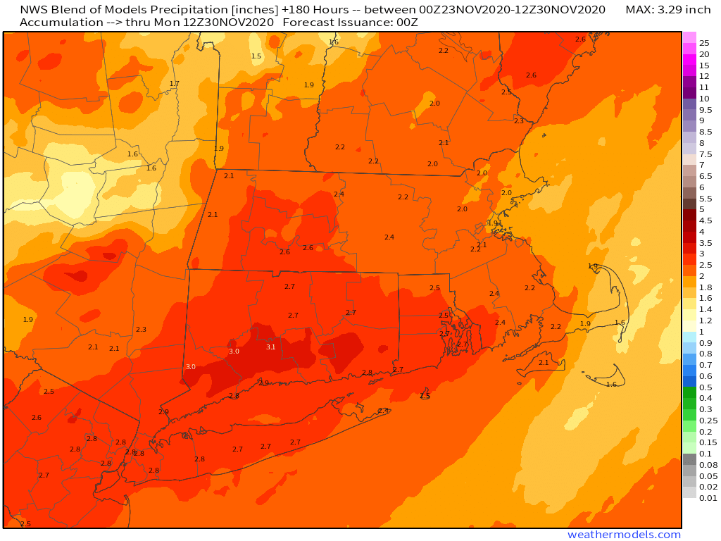
We’re going to put a few dents in that drought this week, as we’ll have a few storms systems to contend with, but it looks like they’ll be mostly rain, with one of them on Thanksgiving Day. Notice that we said “mostly rain”, as we could have some issues Wednesday night, especially in southern New Hampshire.

We start the week off on a wet note as low pressure passes north and west of the region, providing us with a rainy start to the day. Temperatures will be on the mild side this morning, but don’t get used to it. A cold front will cross the region by early afternoon, bringing an end to the rain, but behind it, gusty winds will usher much cooler air back in as skies clear out, leading to a chilly night tonight.

High pressure builds in for Tuesday with dry and cool conditions. It will still be breezy early on as today’s low pressure system continues to pull away, but winds should die down during the afternoon as the high continues to build in. With clear skies and light winds Tuesday night, we’ll have another chilly night, but some high clouds may start to move in late at night, which would prevent temperatures from tumbling too much. Those high clouds will be in advance of a warm front that will approach the region on Wednesday, possibly accompanied by a few showers. This could set up a tricky situation during the late afternoon and evening across southern New Hampshire and possibly the Merrimack Valley. The warm front may have trouble moving northward during the day, and with chilly air in place and a little bit of precipitation possible, it could fall in the form of a little freezing drizzle, especially in southern New Hampshire, which could result in some slippery conditions Wednesday evening. This is a scenario that happens quite often during the fall and winter, and the models usually handle it poorly, or miss it completely, as they usually overestimate how quickly the warmer air will move in and how far north it can get. We’ve seen the models blow this type of forecast countless times, and the setup is there for it to happen again.

That next system brings in more rain for Thanksgiving Day. Right now, it looks like most of the rain will be in the morning, but there are still some timing differences among the models, so showers may linger into the afternoon, and possibly even the evening. High pressure builds in behind that system with drier and cooler weather again on Friday, though a few showers are possible as an upper-level disturbance moves across the region.
Next weekend also has some questions, as the models all have differing solutions. Some models want to bring a weak system through late Saturday with some showers, then have high pressure build back in on Sunday, with another system potentially bringing in some rain next Monday. Others keep high pressure in control for much of the weekend, but have the next system move in at some point late Sunday or Sunday night. They also differ on the track of that system, which has significant implications for temperatures on Sunday. So, our forecast for next weekend is very-low confidence at this point, and may end up significantly different when we issue our weekend outlook (which will be on Wednesday this week instead of the normal Thursday).

Monday: Breezy with showers and some steadier rain this morning, possibly a rumble of thunder as well, ending by early afternoon, then skies start to clear out by evening. High 54-61 in the morning, but temperatures may drop pretty quickly during the afternoon.
Monday night: Clear to partly cloudy and breezy. Low 27-34.
Tuesday: Sunshine and a few clouds, breezy in the morning. High 37-44.
Tuesday night: Clear during the evening, high clouds start to move in after midnight. Low 19-26.
Wednesday: Becoming partly to mostly cloudy, chance for a shower or two, possibly some freezing drizzle across southern New Hampshire during the evening or at night. High 36-43 north of the Mass Pike, 44-51 south of the Pike.
Thanksgiving: Cloudy with periods of rain and showers, ending during the afternoon. High 42-49 in southern New Hampshire and the Merrimack Valley, 50-57 elsewhere.
Friday: Partly sunny, slight chance for a shower. High 49-56.
Saturday: A mix of sun and clouds. High 49-56.
Sunday: A sunny start, clouds move in during the afternoon. High 45-52.