A wet Thanksgiving day appears likely, but much of the rest of the weekend looks dry at this point.
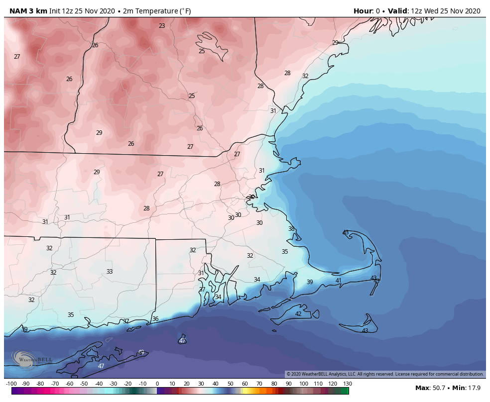
We’ve got plenty of clouds around today, well ahead of a low pressure system moving towards the Great Lakes. As that system continues eastward, we’ll see showers moving in tonight. While temperatures will be fairly mild for most of us, some chilly air is hanging around this afternoon from Southern New Hampshire into north-central Massachusetts and the Merrimack valley. While temperatures are mainly above freezing, a few spots could drop back close to freezing this evening, which may result in a few slippery spots as the rain moves in tonight. Temperatures should gradually rise towards morning even in these areas.
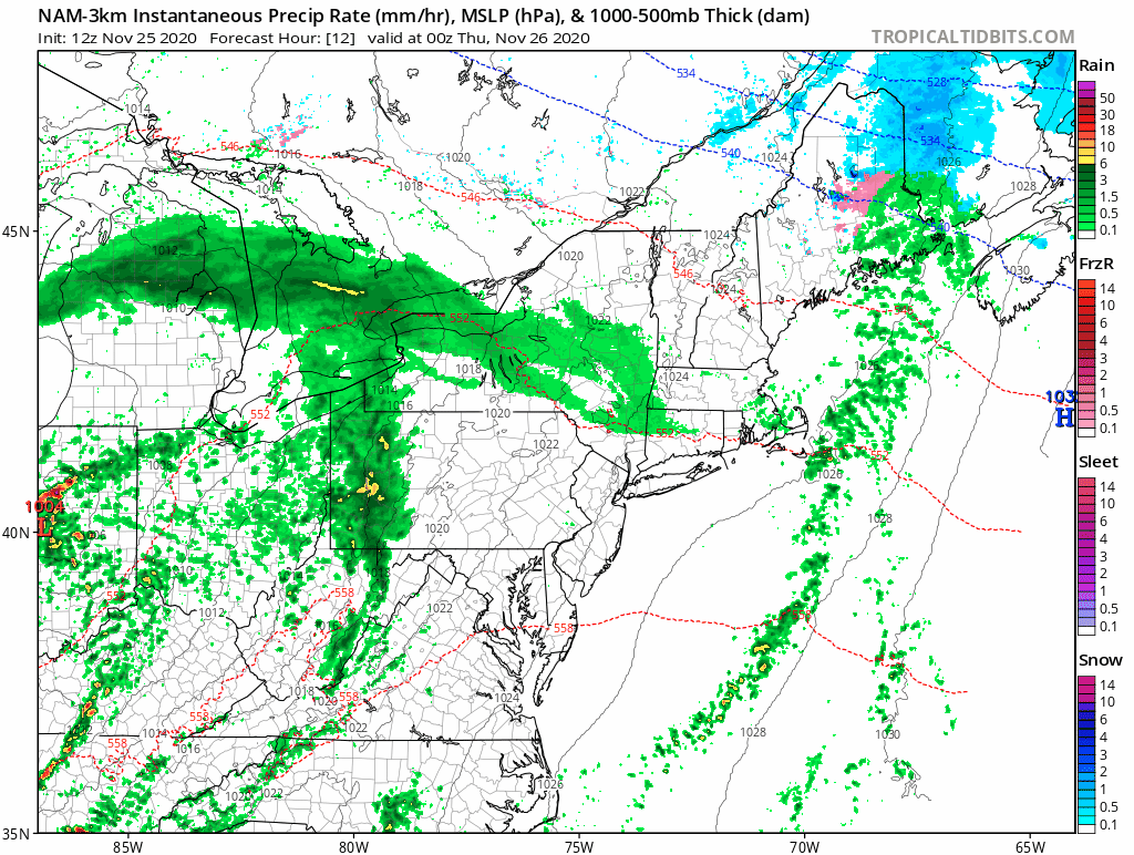
Thanksgiving starts out with some rain, but there may be a bit of a lull around early afternoon as the initial batch of rain moves out. A cold front will be approaching from the west, and a secondary area of low pressure will ride up along it, bringing more rain in by late afternoon and evening. There may even be a rumble of thunder with the rain, mainly across southeastern Massachusetts. Temperatures may remain on the cool side from southern New Hampshire into parts of interior Massachusetts, but across eastern Massachusetts, much milder air is expected, with some places, especially near the South Coast, possibly getting close to 60. Everything finally moves offshore during the evening, but skies remain cloudy overnight, with some patchy fog possible as there will be plenty of low-level moisture in place across the area.
Friday likely features plenty of clouds but only a slight chance for a shower or two as an upper-level disturbance moves through, but temperatures should be mild in most places, with highs generally reaching the 50s. We finally start to clear out Friday night, with high pressure building in for the weekend with sunshine and cooler temperatures.
Monday will feature more changes. Another storm system will head towards the Great Lakes, sending some more clouds into the region. Right now, it looks like this could be a significant rain-maker for Monday night into Tuesday (and possibly Wednesday). This will help put a big dent into our long term rainfall deficit. This may also turn out to be a significant storm system for portions of the Midwest and East Coast. If this is still looking that way by Friday or Saturday, we’ll likely write up a special blog post about it.

Wednesday night: Cloudy with showers developing after midnight. Low 33-40 in southern New Hampshire and north-central Massachusetts, 41-48 elsewhere.
Thanksgiving Day: Periods of rain and showers, maybe even a rumble of thunder. High 45-52 in southern New Hampshire and north-central Massachusetts, 53-60 elsewhere.
Thursday night: Showers end in the evening, otherwise partly to mostly cloudy with some patchy fog likely. Low 36-43 in southern New Hampshire and the Merrimack Valley, 44-51 elsewhere.
Friday: Intervals of clouds and sun, just a slight chance for a late-day shower. High 52-59.
Friday night: Becoming partly cloudy to clear. Low 36-43.
Saturday: Partly to mostly sunny. High 46-53.
Saturday night: Clear skies. Low 28-35.
Sunday: Sunshine. Lots of sunshine. High 44-51.
Sunday night: Clear during the evening, clouds start to move in overnight. Low 29-36.
Monday: Becoming cloudy High 51-58.
