Temperatures will be riding a rollercoaster around here through the weekend, but as has been the case more often than not recently, little rainfall is expected.

We’re starting off with a sunny and warm afternoon, but high pressure building in tonight will result in some cooler weather for Friday, as winds shift into the east. There may be a little patchy fog again tonight, but otherwise, we’ll have generally clear to partly cloudy skies into Friday.
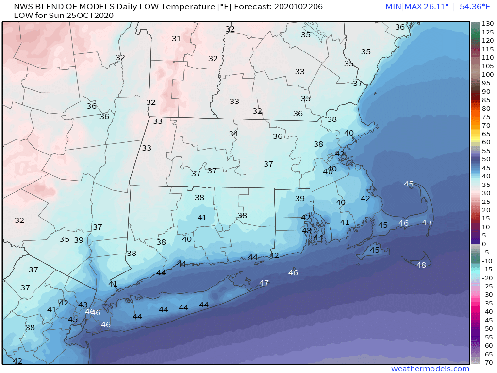
That high will slide off to our east on Saturday, allowing us to warm back up, but clouds will also be streaming in ahead of a cold front. That cold front will move through during the afternoon, but it will be starved for moisture, so other than a spot shower or two, it should remain dry. However, you will notice the front in the temperature department. Temperatures could approach 70 during the afternoon, but will start to drop pretty quickly behind the front. By Sunday morning, many of us will see temperatures in the 30s to lower 40s. With high pressure building back in on Sunday we’ll have some sunshine, but north to northeast winds will keep temperatures in the upper 40s and 50s all afternoon.
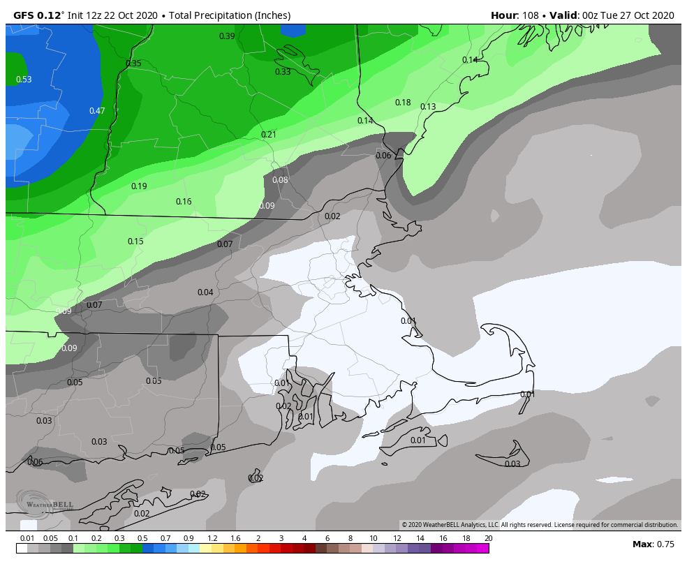
We start heading back up the rollercoaster on Monday as low pressure passes north and west of the region, bringing a warm front through. This will allow us to warm up again, but it may also bring in some showers. They shouldn’t be too heavy or widespread, but at this point, any rain helps with our current drought. As the low moves by, it will drag a cold front through towards evening, with a few more showers possible, and sending temperatures downward again as we head into next week.
Thursday night: Clear to partly cloudy with some patchy fog developing. Low 48-55.
Friday: A mix of sun and clouds. High 62-69.
Friday night: Partly to mostly cloudy, more fog is possible. Low 46-53.
Saturday: More clouds than sun, breezy late in the day, slight chance for a shower. High 65-72.
Saturday night: Clearing. Low 34-41.
Sunday: Sunshine and a few clouds, much cooler. High 47-54.
Sunday night: Becoming mostly cloudy. Low 36-43.
Monday: Cloudy with a chance for some showers. High 56-63.
