Yes, we’re a little later than normal, but we did warn you that would likely be the case. Without further delay, let’s get to a forecast that has some big changes coming to the area.
The rest of today should be pretty self explanatory with high pressure in control, so let’s jump ahead to tomorrow. A warm front will move through, and that will bring us a return to summer-like air as we flip the calendar to October. A few showers are possible ahead of the warm front, but overall, we’ve got a decent day coming up, despite some cloud cover.
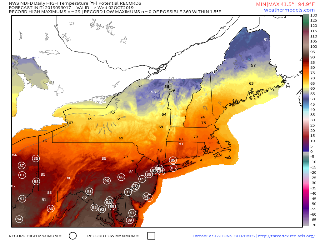
This brings us to Wednesday – the transition day. We’ll start off warm, and could get very warm, but a strong cold front will move through. Exactly when that front comes through is still a little up in the air, which will have a significant impact on the temperatures. If it comes through late enough, we could see some locations get into the 80s. Behind it, temperatures will quickly drop. We’ll also have some showers and possibly thunderstorms to deal with as the front moves across the region.
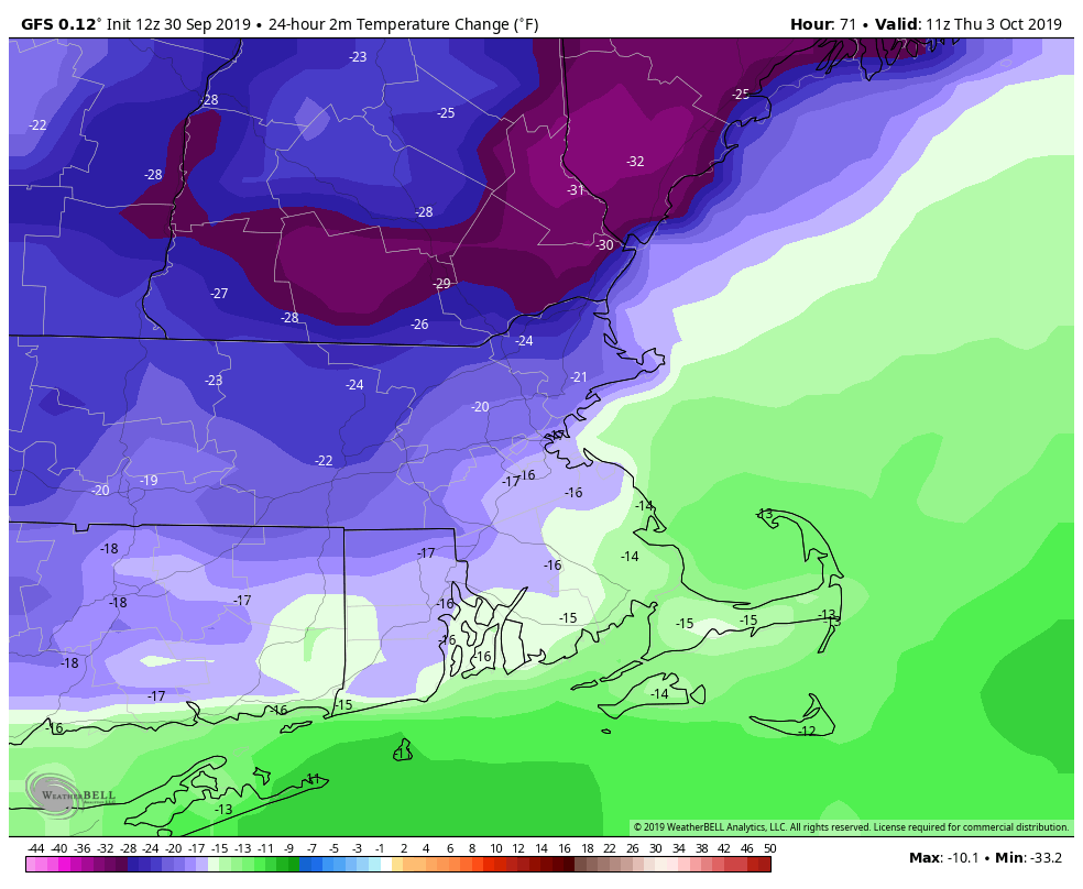
The front settles south of the region Wednesday night and we may even clear out a bit, but that will be short-lived. Another system quickly approaches from the west with rain likely for much of Thursday and into early Friday. The rain isn’t the only part of Thursday that you’ll hate. Temperatures will likely be 20-30 degrees colder than Wednesday, with highs only in the 50s. Yup, fall will finally arrive. High pressure builds in behind that system for Friday into the weekend, with cool conditions. Some frost is possible for much of the region.
Monday afternoon: Partly sunny. High 59-66, coolest along the coast.
Monday night: Partly to mostly cloudy, chance for a few showers, mainly north of the Mass Pike. Low 46-53, but temperatures may rise a bit after midnight.
Tuesday: A few showers possible early, then some sunshine may develop. Breezy and warmer. High 68-75.
Tuesday night: Mostly cloudy with some showers likely. Low 61-68.
Wednesday: Cloudy and mild with scattered showers, possibly a thunderstorm. Turning sharply cooler in the afternoon. High 73-80.
Thursday: A few sunny breaks early, mainly from the Merrimack Valley northward, otherwise cloudy with showers developing, becoming a steady rain late in the day and at night. High 52-59.
Friday: Cloudy with showers ending early, then becoming partly to mostly sunny and windy. High 57-64.
Saturday: Plenty of sunshine. High 55-62.
Sunday: More clouds than sun., breezy. High 59-66.
