Remember all that sunshine and the warm temperatures that we had in September? Yeah, that’s not in this week’s forecast. This week will be a reminder of what October is usually like around here.

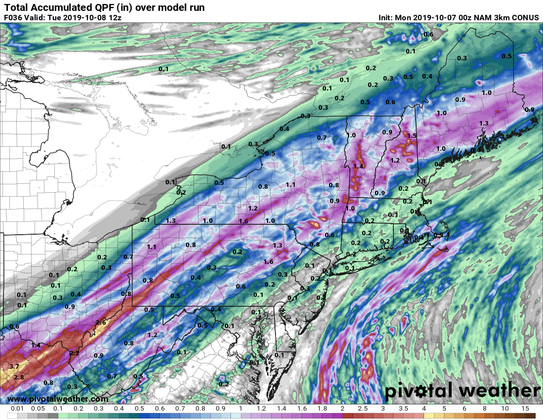
The week starts off with a mild day, but with plenty of clouds. An approaching cold front will bring in some showers by late afternoon, with some downpours possible during the evening and into the night. The rain comes to an end as the front pushes offshore, but it will stall out just south of the region. High pressure tries to build in from the north of Tuesday, but clouds may hang tough across southern parts of the region with the front just offshore, and a few showers are possible near the south coast.

By late Tuesday, low pressure will develop off the North Carolina coast and start drifting northward. It’s not going to move too much though with a ridge of high pressure off to the north and east, but the big question is – how far north does it actually get. Right now, it looks close enough to spread some occasional rain into the region by Tuesday night, mainly south of the Mass Pike, but possibly up into parts of New Hampshire and southern Maine. It will also produce east to northeast winds that may be gusty at times. This will result in some rather cool temperatures.
Oh, did we mention that the low will likely sit there until late Saturday when a cold front finally kicks it out to sea? Yeah, that means cool and occasionally wet conditions from Tuesday night into Saturday. Doesn’t that sound…..awful? (OK, that’s probably not a strong enough word, but we didn’t want to resort to profanity). High pressure finally brings drier weather in for Sunday behind the cold front.

One note about that cold front, the system generating the front will be moving across parts of the Plains states and the Upper Midwest before moving into southern Canada. Before crossing the border, it could produce quite the snowstorm across parts of the Northern Plains later this week. Parts of the Dakotas and Minnesota could see a couple of feet of snow. While they get snow quite often in the winter, they usually don’t get this much at once, and even for places like Minnesota and North Dakota, this is a little early in the year for a storm to produce that much snow. For example, in Grand Forks, ND, home of the University of North Dakota, the largest October snowstorm on record is 10.9″ from October 24-26, 2001. In Bemidji, MN, the October snowstorm record is just 8.0″, done twice – October 18-20, 1917, and again October 29-30, 1932.
Monday: Cloudy and breezy with showers developing late in the day from west to east. High 68-75.
Monday night: Plenty of clouds with showers likely, possibly a few downpours. Low 49-56.
Tuesday: Some sunshine may develop across southern New Hampshire, mostly cloudy elsewhere with a few showers possible across the South Coast and Cape Cod. High 60-67.
Tuesday night: Mostly cloudy and becoming breezy with showers possible, mainly south of Boston. Low 45-52.
Wednesday: Breezy and cool with periods of rain and showers likely. High 53-60.
Thursday: Cloudy, breezy, and cool again with occasional showers and drizzle. High 52-59.
Friday: More clouds, more drizzle, more showers at times too. High 55-62.
Saturday: Plenty of clouds with a few sunny breaks possible, but also some more showers and drizzle at times. High 57-64.
Sunday: A mix of sun and clouds. High 62-69.