Saturday is not going to be a pretty day around here, but most of you already knew that. There are some changes to our forecast though. Once again, we’ll start with the basics (which really haven’t changed), then work our way into the details (which have changed a bit).

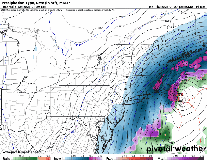
Low pressure will develop off the Southeast coast this afternoon and will head up the Eastern Seaboard tonight and Saturday, rapidly intensifying as it does so. The system will likely pass just south and east of Nantucket Saturday night, and pull away from the region on Sunday. A few snow showers are possible today as a cold front moves through, completely unrelated to the storm. What that front will do is bring colder air back in, so that we’ll be dealing with all snow across nearly all of the region, except possibly Nantucket and Outer Cape Cod.
OK, let’s get to the details. We’ll start with temperatures. North and west of Boston, temperatures will likely be in the teens for much of the storm, resulting in a fluffy snow. This will make cleanup easier, but also make it easier for accumulations to pile up quicker. South of Boston, temperatures will be in the 20s to start, but will drop during the day, so we’re also looking at a fluffier snow here as well. Across Cape Cod, temperatures will be closer to freezing, so it’ll be a wetter snow, with the possibility of rain mixing in, depending on how close the storm actually tracks. The general rule is that 1 inch of liquid equals about 10 inches of snow, which works fine with temperatures close to freezing. The colder you get, the higher the ratio gets. When temperatures drop into the teens, the ratio can get to 20:1, which means 1 inch of liquid results in 20 inches of snow. We’re not sure it’ll get that high, as there are other factors involved beyond the temperature at the ground, but it is certainly possible. The other thing to keep in mind is that the temperatures, combined with strong winds (see next paragraph), will result in very cold wind chills, so keep this in mind if you’re heading outside to do some shoveling during the storm.

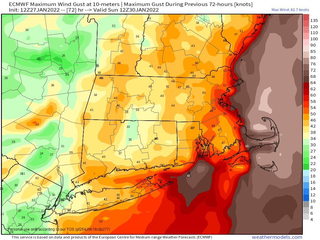
Next, we’ll get to the winds and coastal flooding. As the storm gets cranked up south of the region, winds will pick up on Saturday. Sustained winds of 15-25 mph are likely inland, with sustained winds of 20-40 mph along the coast. Wind gusts of 40-50 mph are likely inland, but along the coast, wind gusts of 50-70 mph seem likely, with higher gusts possible, especially across Cape Cod. Some trees and power lines could come down, so be prepared for power outages, but with a fluffier snow, there might be less widespread than you’d normally expect. The winds, combined with astronomical high tides, will result in some coastal flooding, especially at northeast and north-facing coastal areas during both the morning and evening high tides on Saturday.
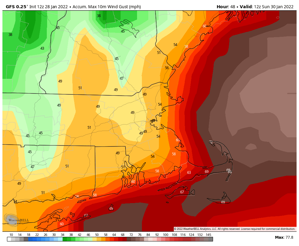
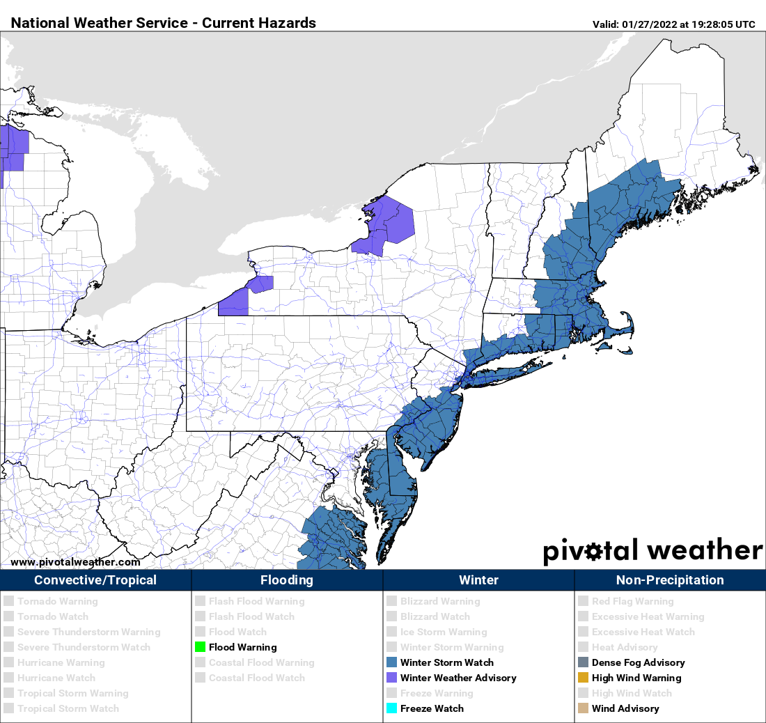
With strong winds and heavy snow (more on that in a moment), blizzard conditions are expected on Saturday. If you don’t have to go out, then don’t. Whiteout conditions will make travel nearly impossible during the afternoon and evening. The National Weather Service has issued a Blizzard Warning for most of eastern Massachusetts and Rhode Island, as well as the New Hampshire Seacoast and coastal Maine.
Sustained winds or frequent gusts ≥ 35 mph AND considerable falling and/or blowing snow frequently reducing visibility < ¼ for ≥ 3 hours.
Blizzard conditions need to be the predominant condition over a 3 hour period.
Official definition of a Blizzard Warning from the National Weather Service
Now to the part that you’ve all been waiting for – how much snow is going to fall? If you read our Weekend Outlook yesterday, or are a regular reader of the blog, then you know that we are normally very conservative in our snowfall forecasts – no hype here. Well, many of the forecast models continue to forecast insane snowfall totals, and most of the guys on TV are buying in. With that in mind, we are issuing an Extreme Hype Warning.
When an Extreme Hype Warning has been issued, it means you’ll see blanket coverage from the network stations around here, hourly updates even when they go to regular programming, and of course, obligatory live shots from (take your pick):
- The side of an Interstate
- Logan Airport
- A local DPW salt pile
- A beach showing the rough surf and coastal flooding
- A Dunkin Donuts where they are talking to a plow operator
- All of the above
You’ll also get network reports about how the snow is creating chaos in New York City, how it put Washington at a standstill (due to the 1-3 inches they’ll get), and possibly how it dumped heavy snow (a.k.a. 1 inch) on parts of the Southeast.
As for our forecast? We’re going to raise forecast amounts from what we had yesterday, but not to the levels that most of the media is forecasting. Light snow may develop by midnight along the South Coast, spreading northward over the ensuing few hours, reaching southern and central New Hampshire and southern Maine by 3-5am. Between about 10am and 7pm, it’s going to snow rather heavily. Snowfall rates of 1-2 inches per hour will be likely in many areas. However, there will be some embedded bands of intense snowfall, with snowfall rates of 2-4 inches per hour. If you’re under one of these bands for any length of time, your totals may end up higher than our forecast, while areas outside the band a few miles away have significantly less snowfall.
OK, we’ve rambled on enough, let’s go to the actual forecast totals:
Central NH (Lebanon/Laconia): 4-8″
Southern NH/Central MA (Concord/Manchester/Nashua/Fitchburg): 10-15″
Merrimack Valley/495 Belt/NH Seacoast (Portsmouth/Haverhill/Lowell/Framingham): 15-20″
I-95 corridor (Beverly/Boston/Providence): 18-24″
Southeastern MA/Cape Cod (Brockton/Weymouth/Plymouth/Taunton/Fall River): 20-26″ with some totals in excess of 30″ possible.

Once the storm pulls away, dry and colder conditions settle in for Sunday and Monday, before temperatures start to moderate. There are some indications for a big warmup late-week and a storm that will bring in rain, but it’s still several days away, so we wouldn’t put too much stock into that just yet,