After bringing heavy rain and gusty winds to portions of the Caribbean and Florida over the past several days, Tropical Storm Elsa made landfall in northwestern Florida this morning. It’s not done yet though, not by a longshot.
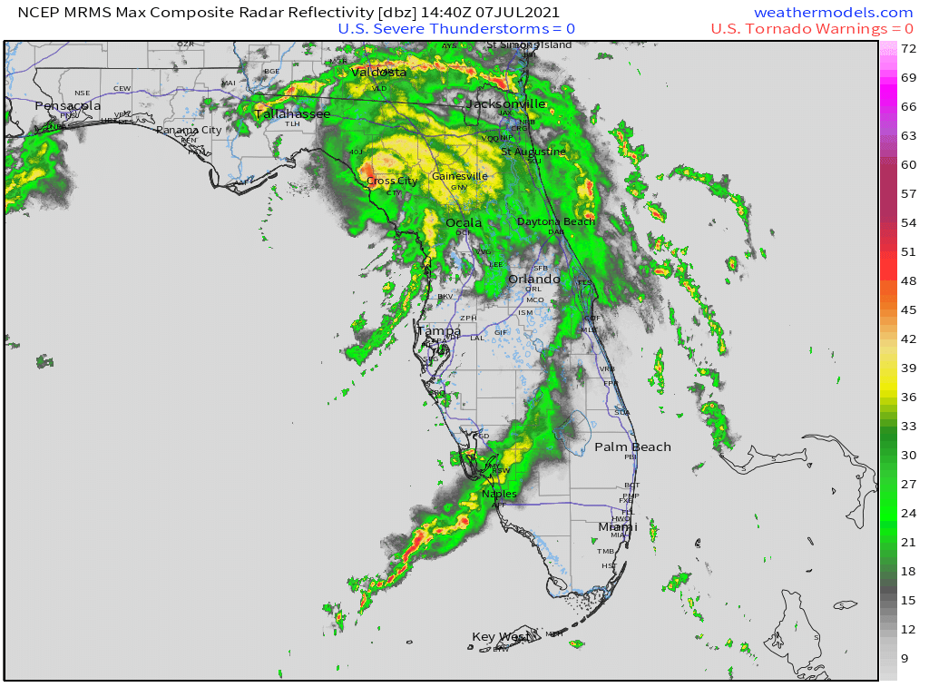
As of 2pm EDT, Tropical Storm Elsa was centered about 105 miles west of Jacksonville, Florida, moving toward the north at 14 mph. Maximum sustained winds have decreased to near 50 mph. Tropical Storm Warnings remain in effect for part of northwestern Florida, and for the Atlantic coast of Georgia and South Carolina. A Tropical Storm Watch is in effect north of there all the way up to northeastern New Jersey.
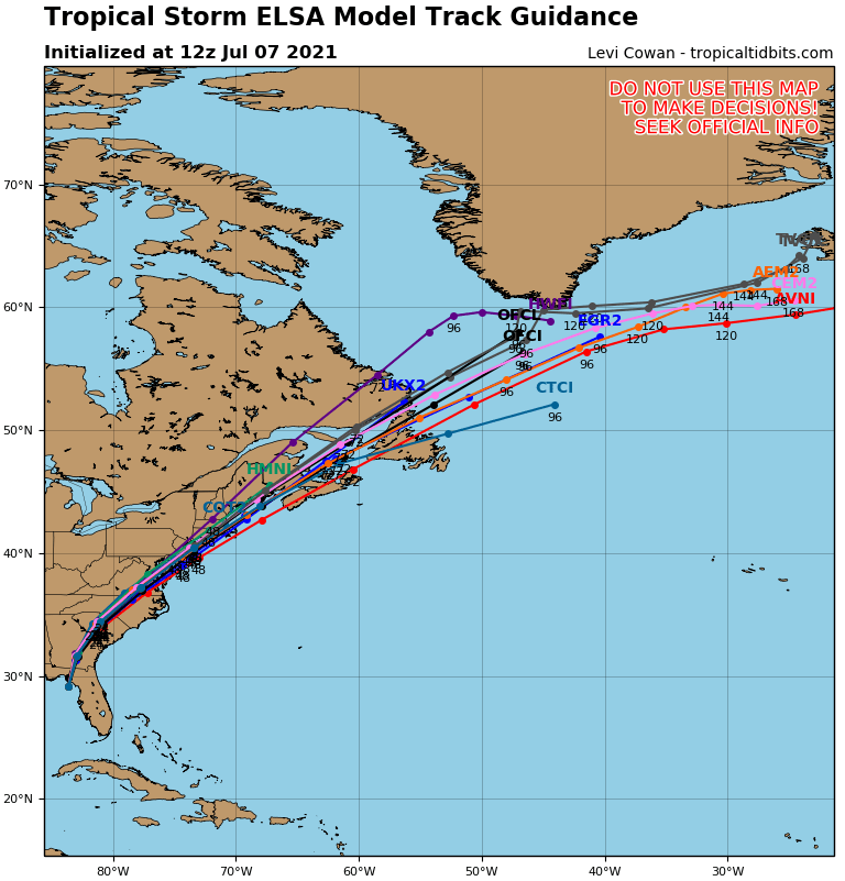
The forecast for the next 36 hours is fairly straightforward. Elsa will turn northeastward, moving across parts of Georgia, the Carolinas, and into Virginia while gradually weakening. Gusty winds, and heavy rain are likely, with rainfall totals of 3-5 inches and locally heavier likely producing flooding in many areas. In addition, to the east of the storm’s center, some tornadoes are also possible.
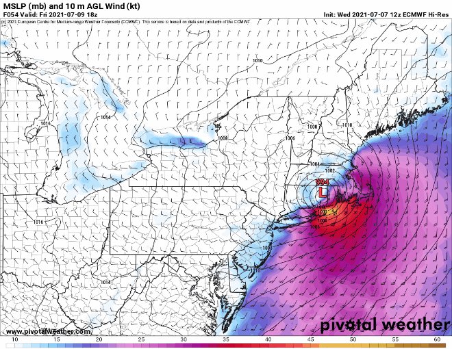
Once it gets into the Mid-Atlantic states later Thursday, we have a bit of uncertainty in the forecast. Elsa will continue northeastward, and may start to become extratropical. When this happens, the stronger winds cover a larger area, compared to tropical systems, where the strongest winds are found very close to the center. Many models show Elsa starting to strengthen a bit again. This is likely when it is starting to become extratropical. Elsa may move back over water south of Long Island, but that will depend on when it begins to turn more toward the east-northeast. This has implications for Southern New England.
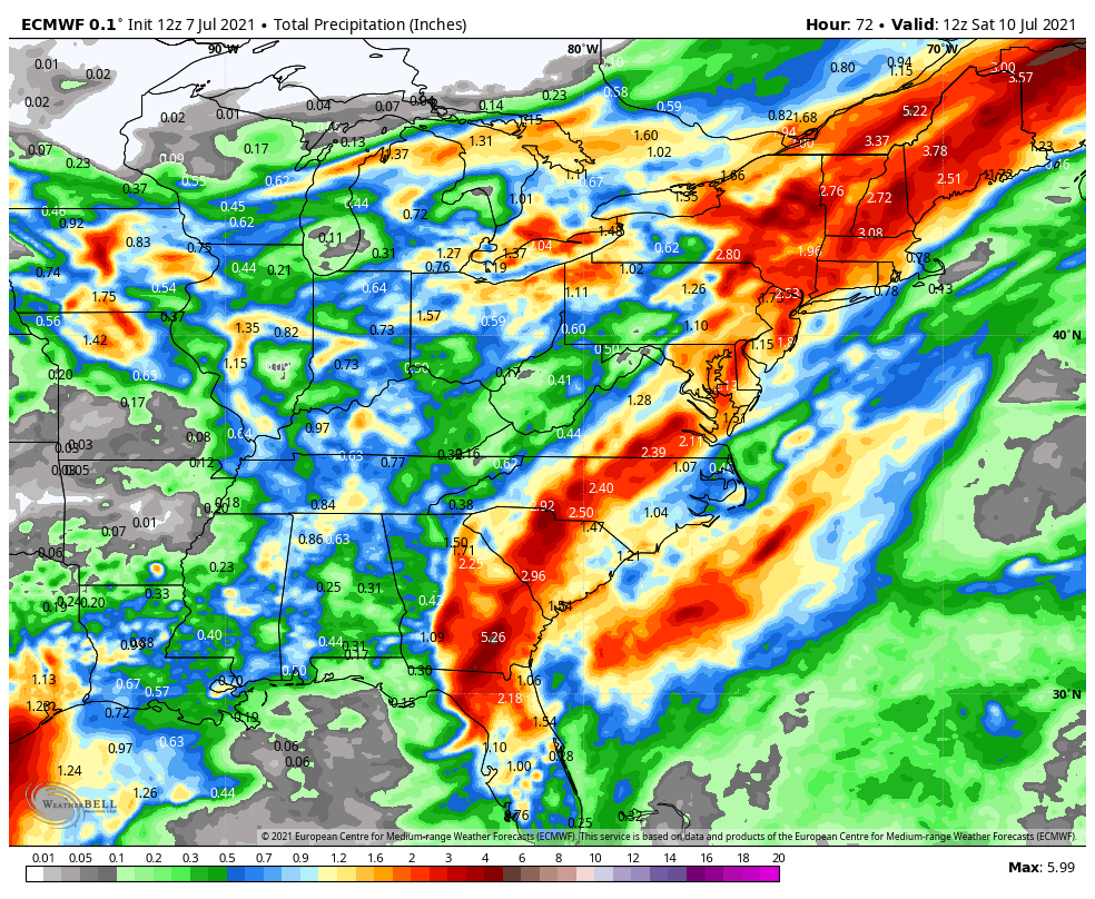
Elsa will continue to produce heavy rain and gusty winds across the Mid-Atlantic states and into Southern New England later Thursday into Friday. However, the strongest winds are found to the right of the center. If the storm passes near or just south of New England, that means that the strongest winds will stay offshore, possibly impacting Cape Cod and the Islands. However, if the storm stays inland, and moves across Southern New England, then a period of strong to damaging winds could impact parts of Connecticut, Rhode Island, and Southeastern Massachusetts on Friday. Sustained winds of 20-30 mph, with gusts of 50-60 mph would be possible. A track even farther to the west (which is possible), could result in those strong winds impacting the New York City, Providence, and Boston metropolitan areas on Friday.
Conditions will improve across New England on Saturday as Elsa (or what’s left of it) moves into Atlantic Canada, and beyond that, the Atlantic looks quiet for a while, which is fairly typical for early July. Plumes of Saharan Dust are making their way across the Atlantic and into the Caribbean, which suppresses tropical activity.
