A fairly active weather pattern is on deck for this week, with several bouts of unsettled weather expected.
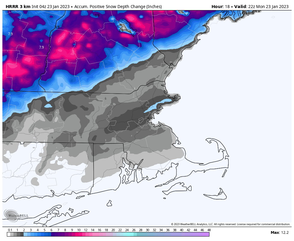
We’re starting the week off on a stormy note with low pressure passing south of the region. Colder air will work its way in behind the storm today, allowing the rain/snow line to move southward as the day progresses. So, even places that are still raining this morning will likely see some snow before the day is out and the storm pulls away. Areas south of the Mass Pike will likely see an inch or less of accumulation, with another 1-3 inches north of the Pike, and possibly a little more than that across southern New Hampshire. Everything ends this evening, then high pressure briefly builds in tomorrow with drier conditions.
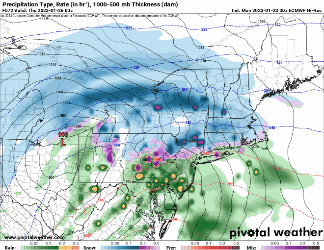
However, another storm will quickly follow for Wednesday. With some cold air in place, this one will likely start as snow across the region Wednesday afternoon, making for a rather messy afternoon commute. However, with the low passing west of us, and a secondary low pressure system developing right overhead, warmer air will move in, resulting in a change to rain Wednesday evening and night, ending Thursday morning. As that system pulls away, breezy and cooler conditions settle in late Thursday into Friday, but a cold front will approach the region on Saturday. That front may produce some snow showers Saturday afternoon and evening before it pushes offshore. Wel clear out behind it and turn colder, but yet another system quickly follows late Sunday, with some rain or snow showers possible late in the day ahead of a warm front.
Monday: Breezy with snow likely north of the Mass Pike, rain changing to snow south of the Pike. High 34-41 early, temperatures drop during the afternoon.
Monday night: Snow ending in the evening, followed by clearing, windy. Low 22-29.
Tuesday: Morning clouds, some afternoon sun, breezy. High 35-42.
Tuesday night: Clear through the evening, clouds return after midnight. Low 17-24.
Wednesday: Cloudy with snow developing in the afternoon, changing to rain from south to north during the evening. High 32-39.
Thursday: Windy with periods of rain, ending in the afternoon. High 39-46 north and west of I-495, 47-54 south and east.
Friday: Partly to mostly sunny, breezy, and colder. High 32-39.
Saturday: Mostly cloudy and breezy with a few snow showers possible, clearing late in the day. High 37-44.
Sunday: Becoming mostly cloudy and breezy, snow or rain showers possible late in the day. High 35-42.
