Some rain is on the way, but much of the weekend looks decent weatherwise.
A slow-moving cold front will make its way across the region tonight and Friday, bringing plenty of clouds in, with some rain likely, mainly on Friday. A few rumbles of thunder are also possible. We’re not expecting a widespread heavy rain like we had at times for most of the summer, but don’t expect to see much, if any, sunshine on Friday. The front pushes offshore Friday night, but showers may linger into Saturday morning across eastern Massachusetts. While there may be some sunshine developing, especially well west of Boston, during Saturday afternoon, clouds will linger in the east. Another wave of low pressure will ride up that front offshore, but will likely pass close enough to bring some rain back in for Saturday night and Sunday morning. This is a relatively new development in the models, but it shows up on several models, so we’re inclined to go with it. We should start to clear out again on Sunday, but an upper-level feature will be moving across the region, and it may kick off another shower or two during the afternoon. High pressure builds in for Sunday night and Monday with drier conditions.

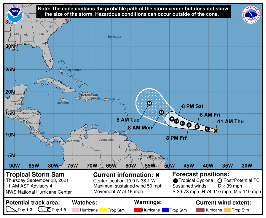
In the tropics, Tropical Storm Sam has developed over 1700 miles east of the Lesser Antilles. It is sat least 5 days away from potentially threatening any land areas, but Sam will definitely be a storm to watch. Most of the models develop Sam into a powerful hurricane over the weekend and early next week. Sam should continue on a west-northwest track across the Atlantic through the weekend. Beyond that? It’s still way too early to speculate on where Sam may go.
Thursday night: Partly to mostly cloudy with a few showers possible. Low 64-71.
Friday: Cloudy with scattered showers, possibly a thunderstorm. High 71-78.
Friday night: Mostly cloudy, showers ending from west to east. Low 55-62, a little milder across Southeastern Massachusetts and Cape Cod.
Saturday: Intervals of clouds and sun, chance for a few showers, mainly in eastern Massachusetts. High 68-75.
Saturday night: Mostly cloudy with more showers possible. Low 53-60.
Sunday: Any lingering showers end early, then becoming partly sunny with a chance for a late-day shower. High 68-75.
Sunday night: Clear to partly cloudy. Low 49-56.
Monday: A mix of sun and clouds. High 67-74.
