A warming trend is on the way for the weekend, but possibly some rain as well.
After a rather chilly start to the day, temperatures have moderated as high pressure moves offshore. Temperatures will continue to warm up into Friday and Saturday, though as the high moves off to our north and east, winds will shift into the northeast, allowing cooler air to slide back in later on Saturday and into Sunday.

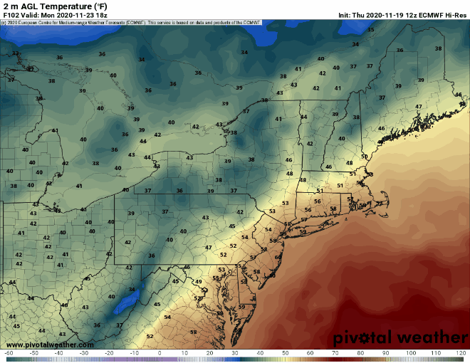
By later on Sunday, a warm front will move toward the region. Whether or not it makes it all the way through is still a question mark, but parts of the region, especially south of Boston, should see milder air move in for a while on Monday. The milder air will be preceded by some showers Sunday night and early Monday ahead of a cold front. While this won’t be drought-busting rainfall, every little bit helps at this point.
Thursday night: Partly cloudy. Low 35-42.
Friday: A mix of sun and clouds, breezy. High 53-60.
Friday night: Clear to partly cloudy. Low 39-46.
Saturday: Partly sunny. High 52-59.
Saturday night: Clear to partly cloudy, some low clouds, fog, and drizzle are possible along the coast. Low 27-34.
Sunday: Becoming mostly cloudy. High 42-49.
Sunday night: Showers likely, maybe mixed with a little sleet or wet snow at the start up into central New Hampshire. Low 34-41.
Monday: Showers end early, skies may clear out in the afternoon, breezy. High 53-60, possibly a little cooler in southern New Hampshire.
