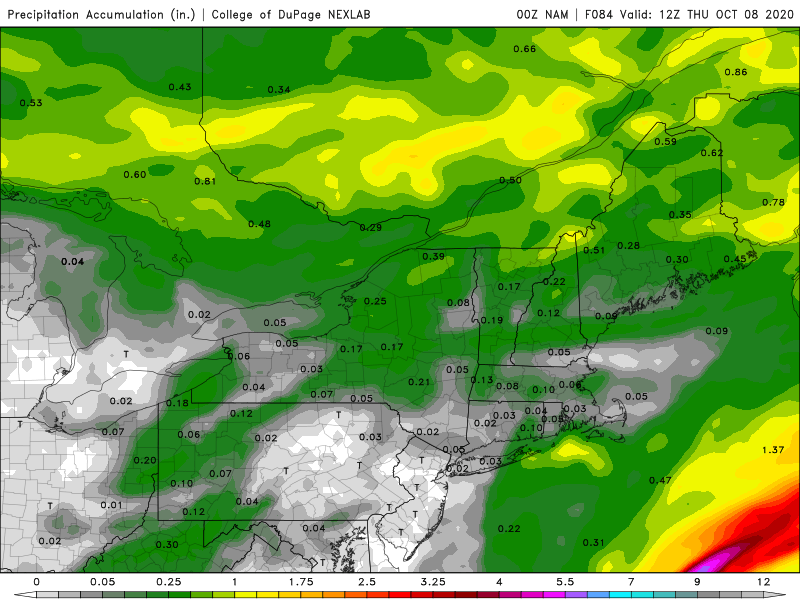
We’re not expecting much drought relief again this week, but it won’t be completely bone-dry either.
The week actually starts off with low pressure passing south and east of the region this morning. It will produce some showers across the Cape and Islands, and possibly into parts of southeastern Massachusetts, but once you get north and west of Interstate-95, there won’t be any rain to be found. The system pulls away during the afternoon and high pressure builds in, with skies quickly clearing out. The high will slide offshore tonight, but another weak system will move through on Tuesday, with some more clouds and possibly a few brief showers.
Clouds become more numerous on Wednesday as low pressure heads into the St. Lawrence Valley. While it’ll be warmer, we’ll also have some showers to deal with, and possibly a rumble of thunder as well. The system will drag a cold front across the region Wednesday night, bringing an end to the shower activity.
Behind the front, gusty northwest winds will usher cooler air into the region on Thursday despite a decent amount of sunshine. As the winds start to die down Thursday night, we’ll have clear skies, setting up a very chilly night, with some places possibly getting down close to freezing. Friday will be another cool day despite ample sunshine, but then high pressure will slide offshore, resulting in a warming trend for next weekend.

Monday: Cloudy during the morning with some showers south of Boston, becoming partly sunny in the afternoon. High 61-68.
Monday night: Clear skies, a little patchy fog is possible in a few spots. Low 45-52.
Tuesday: A mix of sun and clouds, chance for a few showers during the afternoon. High 62-69.
Tuesday night: Becoming mostly cloudy. Low 50-57.
Wednesday: Mostly cloudy and breezy with scattered showers developing, possibly a rumble of thunder. High 66-73.
Thursday: Sunshine and some afternoon clouds, breezy, and cooler. High 58-65.
Friday: Sunny and cool. High 52-59.
Saturday: Partly to mostly sunny, breezy, and milder. High 64-71.
Sunday: A mix of sun and clouds. High 69-76.

Finally, we’ll briefly mention the tropics. Tropical Storm Gamma will continue to produce heavy rain across the Yucatan Peninsula for a few more days as it drifts into the Bay of Campeche. Tropical Depression 26 will likely become Tropical Storm Delta today (it may already have done so by the time you read this). It will bring gusty winds and heavy rain to parts of Jamaica today, then the Cayman Islands and western Cuba over the next few days. It will then head into the Gulf of Mexico, and could threaten the central Gulf Coast later in the week as a hurricane. We’ll have a much more detailed post about the tropics later today or more likely on Tuesday.
