We’re into a new month, and some things will change, but some will remain the same this weekend.
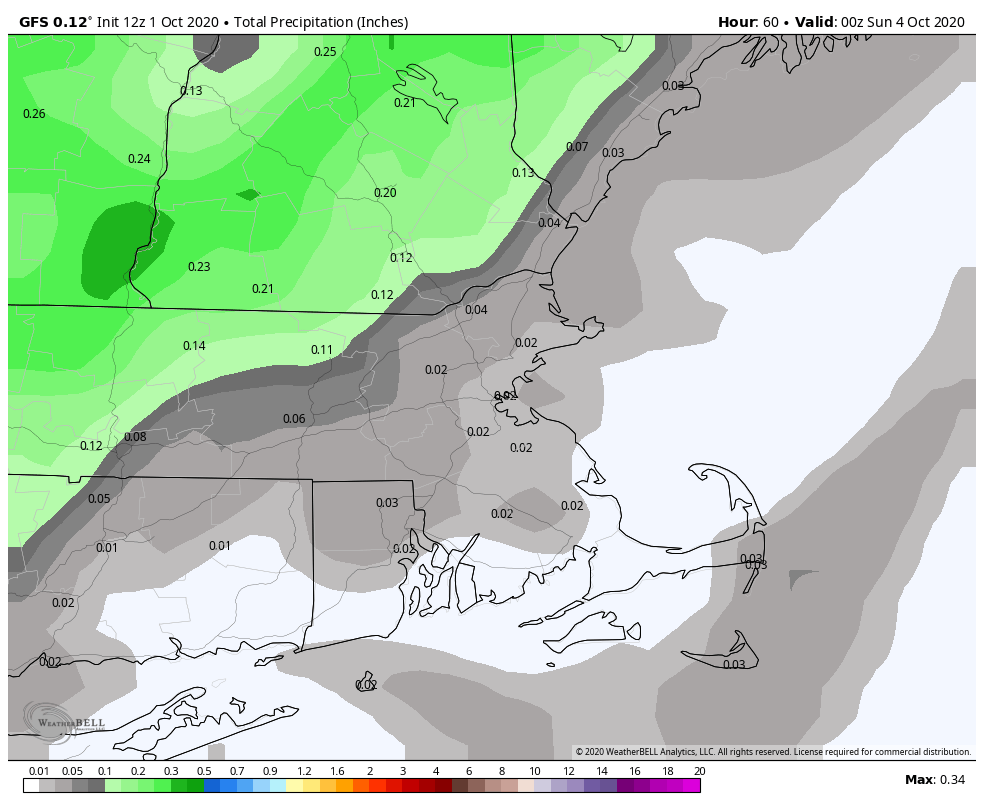
While we’re enjoying sunshine and warm temperatures this afternoon, the first changes are on their way. Clouds will stream in tonight ahead of a cold front. This front will bring some showers in on Friday, but like many of our recent systems, they’ll be fairly light, and won’t provide much, if any, help with our drought. Most of the activity will be north and west of Boston, with the possibility that it remains completely dry south and east of Interstate 95. It’ll be mild during the morning across eastern Massachusetts before the front moves through, but temperatures will likely drop during the afternoon.
High pressure builds in for the weekend with temperatures that are closer to normal, perhaps even a little below normal in spots. Sunday looks to be the better of the weekend days with plenty of sunshine. Saturday should still be a pretty good day, but a weak upper-level disturbance will help to trigger some clouds, especially during the afternoon. There may even be a few sprinkles or showers late in the day, mainly north of the Mass Pike. It’s nothing to worry about, but if you’ve got any outdoor plans during the afternoon and evening, don’t be surprised if there are a few raindrops.
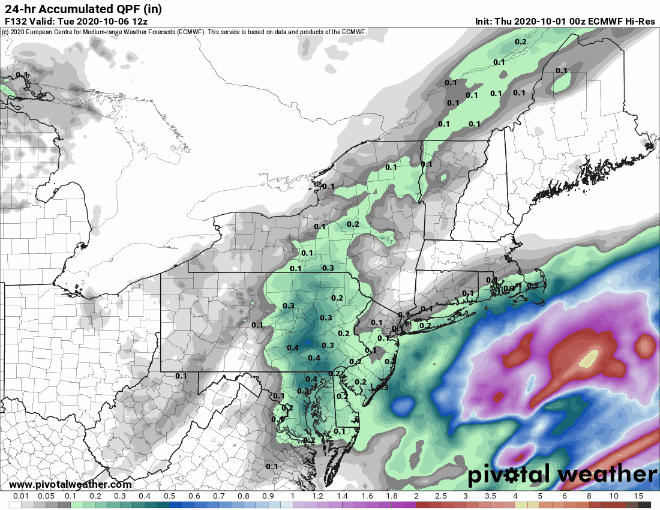
Monday brings more changes to the region. A storm system will likely bring some rain into the area as it passes to our south and east. How far north and west the rain shield extends, and how heavy the rain will be are still a bit uncertain. It looks like the heaviest rain should stay offshore, but it wouldn’t be a complete surprise if we get some steadier rain into the Cape and Islands and possibly southeastern Massachusetts. It also could be a bit breezy in these locations as well, again depending on how close the storm actually gets to the region. We’ll obviously have much more clarity on this in our Weekly Outlook early Monday morning.
Thursday night: Increasing clouds. Low 49-56.
Friday: Cloudy with some showers likely. High 59-66, a little warmer across eastern Massachusetts during the morning.
Friday night: Becoming clear to partly cloudy. Low 40-47, a little warmer in the urban areas.
Saturday: Partly sunny with a slight chance for a few late-day sprinkles or showers. High 61-68.
Saturday night: Clear skies. Low 40-47.
Sunday: Sunshine to start, some clouds start to move in late in the day. High 60-67.
Sunday night: Becoming mostly cloudy with showers possible by daybreak. Low 44-51.
Monday: Cloudy with a chance of showers, possibly some steadier rain across the Cape and Islands. High 57-64.
