The 2020 Hurricane Season has had two themes so far: 1. Tropical Storms that aren’t really tropical. 2. Storms that fall into the “Blink and you’ll miss it” category. We’ve got another one out there, and this is squarely in category #2.

A disturbance that moved from the Gulf of Mexico and into the Southeast last week moved off the South Carolina coast on Wednesday. After sitting over the warm waters of the Gulf Stream, thunderstorm activity began to increase, and a new center of circulation developed Thursday afternoon. Air Force Reserve Hurricane Hunters investigating the system determined that it had a closed circulation (barely), and the system was designated as Tropical Storm Fay.

Fay is the 6th named storm of the season (Whether all 6 deserved to be named is highly debatable), and is the earliest we’ve ever had an “F” storm in the Atlantic. The previous record was held by Tropical Storm Franklin during the 2005 season, which developed on July 22. Despite the record start in terms of named storms, most of the storms have been short-lived and of little impact. Meteorologists use a metric called ACE (Accumulated Cyclone Energy) to determine the severity of a hurricane season. It takes into account how strong storms are, how long they remain strong, and how long they last. Despite having 6 named storms so far, the Atlantic has an ACE of 7.4 this season. While this is more than double the normal through July 10 of 3.1, it is exactly the same as the Western Pacific Ocean, where only 2 storms have formed so far this year.

While there are still a few minor details that need to be determined, Fay’s future is fairly clear. With a ridge of high pressure in the western Atlantic, and a trough of low pressure moving into the Great Lakes, Fay should head northward for the next 24 hours, hugging the Mid-Atlantic coastline. The official forecast from the Hurricane Center has Fay make landfall near Atlantic City later today, but a slight jog to the east will keep the center offshore longer, with landfall farther to the north. A Tropical Storm Warning is in effect from Fenwick Island, Delaware to Watch Hill, Rhode Island, including Long Island Sound. This includes southern Delaware Bay as well all of Long Island and southern Connecticut, and also New York City.

Fay currently has maximum sustained winds near 60 mph (Edit: Yeah, right), and little additional strengthening is expected before landfall. The storm is moving northward at 12 mph, and should pick up a little speed today. This track will keep most of the strongest winds offshore, but right along the coast winds will remain brisk. Sustained winds near 40 mph were reported along the Delaware coast earlier this morning.

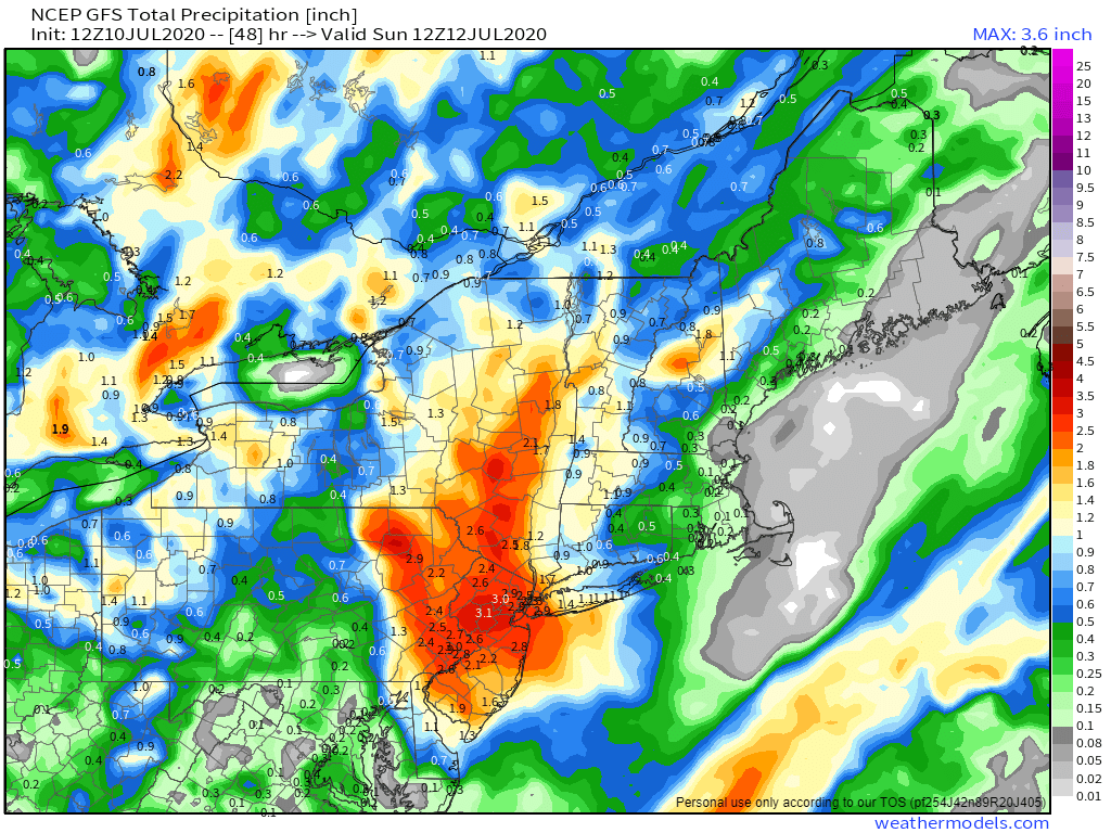
Fay’s biggest threat will be heavy rainfall that could lead to flash flooding, especially from the Mid-Atlantic states into eastern New York and western New England. Much of this region has been dry for a few months, and drought conditions are beginning to develop. Some of this rainfall will help alleviate that, but too much rainfall too quickly will just run off and not help much at all. By the time Fay pulls away early Saturday, rainfall totals of 2-5 inches are expected from the Delmarva Peninsula into western New England and eastern New York, mainly along and just west of the expected track of Fay. Some isolated totals in excess of 6 inches are possible. Amounts will taper off the farther east or west you head away from this area.
Once Fay dissipates, there don’t appear to be any other areas that may develop in the next week or two. It’s still early in the season, and easterly waves will begin rolling off of western Africa soon, with the climatological peak of hurricane season still more than a month away.
