Yesterday was the first day of the official hurricane season in the Atlantic. It also saw the formation of the third system of the season.

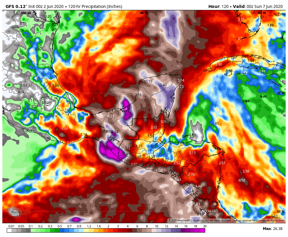
Tropical Depression Three developed in the Bay of Campeche Monday afternoon. The system is the remnants of Eastern Pacific Tropical Storm Amanda, which moved into southern Guatemala on Saturday. It has been producing heavy rainfall across portions of Guatemala, El Salvador, Honduras, and southeastern Mexico since Friday, and that will likely continue for another couple of days as the system mills around in the Bay of Campeche. As of early Tuesday morning, the system was centered about 100 miles west of Campeche, Mexico with maximum sustained winds near 35 mph, and was moving toward the west at 5mph. Conditions are favorable for additional strengthening, and the system could be upgraded to Tropical Storm Cristobal on Tuesday. Since this seems likely, the government of Mexico has issued a Tropical Storm Warning from Campeche to Puerto de Veracruz.
This season is the 6th one since 1851 that has seen 2 named storms form before June 1 (1887, 1908, 1951, 2012, and 2016 are the others). If this system is named in the next few days, it will be the earliest we’ve ever had a “C” storm in the Atlantic. The previous record was June 5, 2016, when Tropical Storm Colin was born.
The forecast for the system is fairly straightforward for the next few days. The system should mill around in the Bay of Campeche, producing heavy rainfall across southeastern Mexico and neighboring countries, with some strengthening likely. This will produce significant flooding, and mudslides in mountainous areas. As we get into the latter half of the week, things gets significantly more complicated. There are two distinct scenarios presented by the various computer models at this time. The first option is that the system turns northward, and moves across the Gulf of Mexico, heading towards the northern Gulf Coast towards next weekend while strengthening. The second option is that the system moves into southeastern Mexico and dissipates, then a new storm forms near or north of the Yucatan Peninsula, and heads northward later in the week. Either way, residents of the Gulf Coast should pay attention to the progress of this system as as the week goes on.

Most of the forecast models do not show this system reaching hurricane strength before moving towards the Gulf Coast, but a few do. This is consistent with early-season storms that impact the United States. Since 1851, only 18 hurricanes have made landfall during the month of June in the United States, and only one (Audrey in 1957) did so as a major hurricane. A hurricane hasn’t made landfall in the United States before July 1 since Hurricane Bonnie came ashore as a minimal hurricane near the Texas/Louisiana border on June 26, 1986. The earliest in the season that a hurricane has ever made landfall in the United States was June 9, 1966, when Hurricane Alma made landfall in the Florida Panhandle.
