June has arrived, which means that we are now officially in meteorological summer. It also means that Hurricane Season has officially begun in the Atlantic.
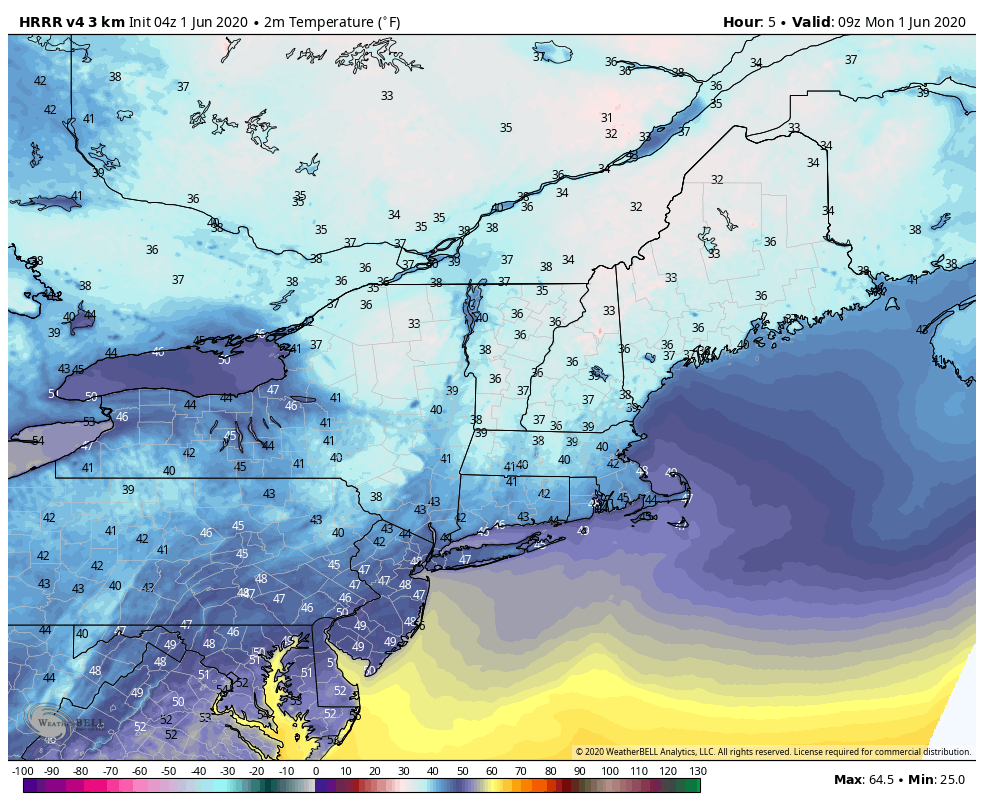
We start the week off on a cool note with high pressure at the surface and upper-level trough of low pressure moving across the region. This trough may help produce a few pop-up showers this afternoon, but will also help keep temperatures well below normal today. Another cool night is expected tonight, but not as cool as it was this morning. By Tuesday a warm front will be moving towards the area, with clouds streaming in ahead of it, and possibly a shower or two.
Warmer air moves in on Wednesday as low pressure heads toward the St. Lawrence Valley. With the warm air will be some shower activity and possibly a thunderstorm or two. We’ll remain warm and humid through Thursday and into Friday before another low pressure system passes north of the region. This will bring in more showers and thunderstorms late Friday and Friday night.

A cold front moves through early Saturday, but we’ll remain on the warm side with developing sunshine during the afternoon. Drier air will filter in behind the front, then high pressure builds in for Sunday with cooler conditions.
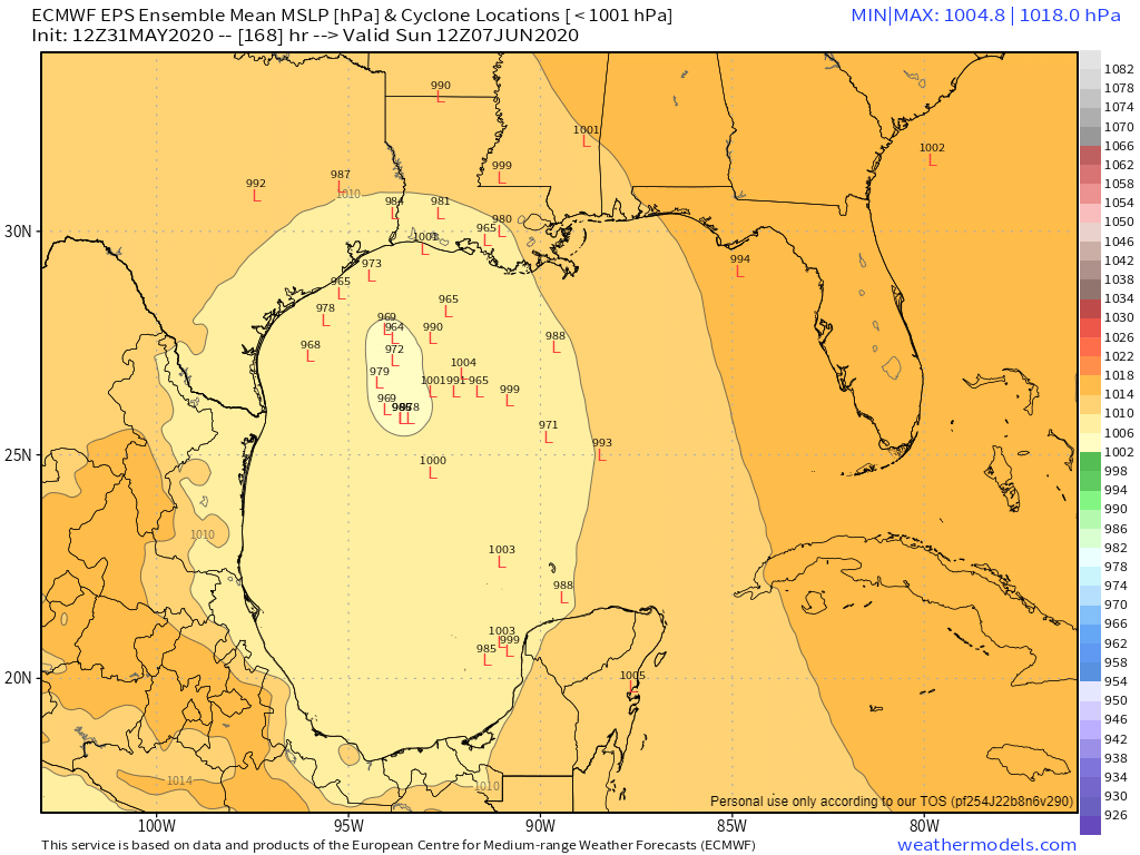
Over the weekend, we published our annual look at the upcoming hurricane season, which also contained some stats about how overdue we are for a storm up here, or, as a colleague said “me thinks our clock be tick’n!” We’ve already had 2 named storms this season (we’re still not convinced that “Bertha” was actually a tropical storm), but another system could be brewing in the Bay of Campeche. Conditions will be favorable for a system to develop later this week, and a majority of the forecast models do show a system developing, but they don’t agree on how strong it could get or where it could go. Obviously, we’ll keep an eye on it, and if it develops, we’ll keep you updated, but it will likely have little to no impact up here, except for possibly some rain as whatever is left of the system moves through, but that would be a good 10 or more days away, if at all.
Monday: Early sun, then clouds develop, with a chance for a few afternoon showers. High 59-66.
Monday night: Clear to partly cloudy. Low 43-50.
Tuesday: Thickening clouds, a few showers are possible late in the day. High 66-73.
Tuesday night: Partly to mostly cloudy with scattered showers. Low 51-58.
Wednesday: Intervals of clouds and sunshine, chance for a few showers, especially along the south coast. High 73-80.
Thursday: A mix of sun and clouds. High 77-84.
Friday: Becoming partly to mostly cloudy, chance for a few showers. High 79-86.
Saturday: Morning showers, then becoming partly to mostly sunny. High 77-84.
Sunday: A mix of sun and clouds. High 67-74.
