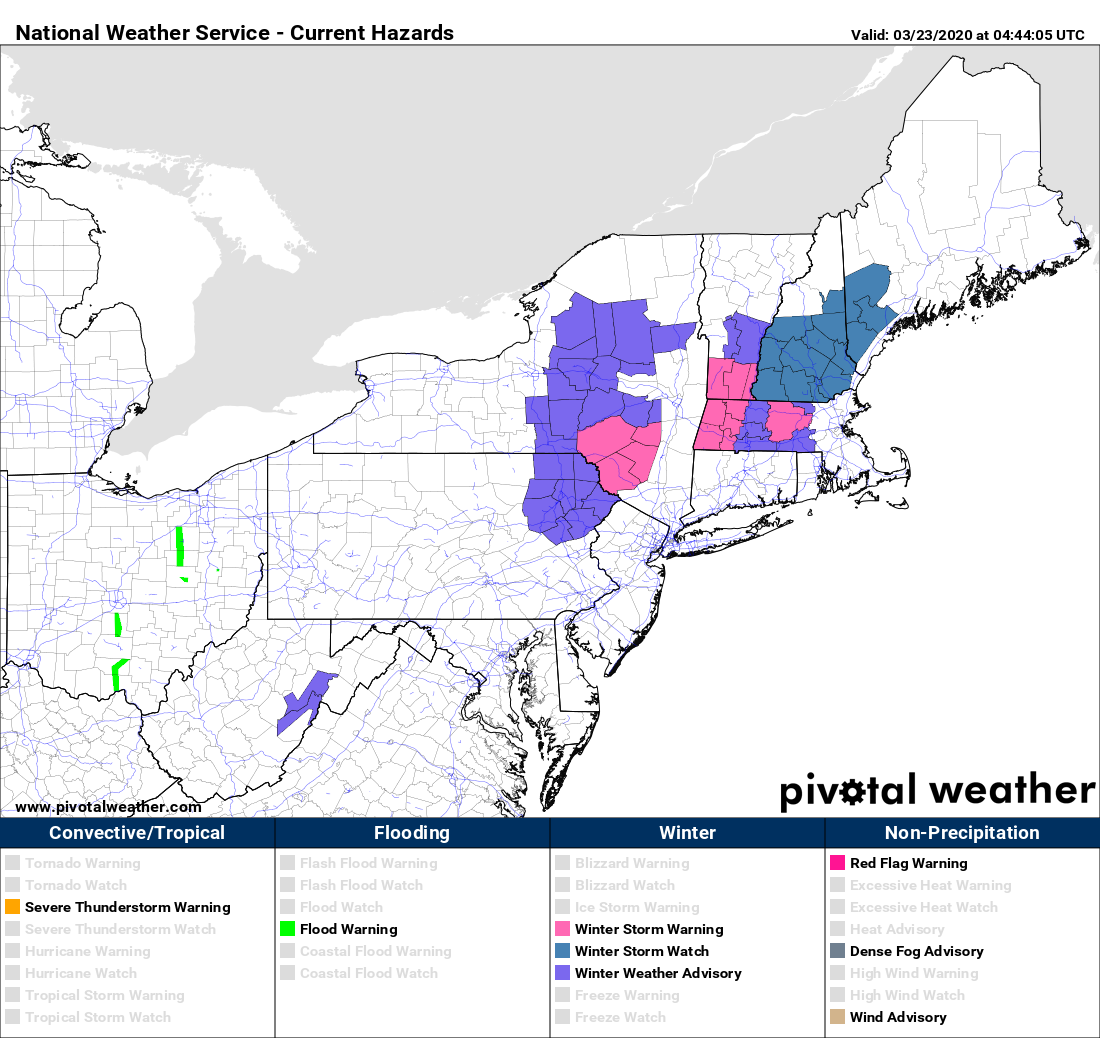
We’ve finally made it to Spring, so naturally, we’re expecting some snow. Look on the bright side – for many of you, it won’t have any impact on your commute!

Clouds will stream into the region this morning as low pressure starts to take shape off the Mid-Atlantic coastline. This system will strengthen as it heads northeastward, passing south and east of Nantucket early Tuesday. Ahead of it, we could see some flurries or snow showers develop late this morning thanks to an onshore flow, but the steadier precipitation associated with the storm arrives during the mid-to-late afternoon hours. There will be some dry air in place, so as the atmosphere moistens up, it will allow temperatures to drop, so we’ll see the precipitation start off as snow for most, with rain across southeastern Massachusetts and Rhode Island. Temperatures will likely be near or above freezing, so a quick change to rain is expected across much of eastern Massachusetts. The changeover should take place during the evening across the Merrimack Valley and New Hampshire Seacoast, and by midnight across the rest of southern New Hampshire. This will be a fast-moving storm, so everything should wind down before midnight. Even this close to the storm, we’ve got some significant discrepancies among the models as the how much snow to expect. There are still some models forecasting significant accumulations for parts of the area, and then there’s others like the GFS, playing the part of Alfred E. Neuman.

As for how much we’re expecting, we’ll get to that in a second. There are some facts both good and bad that go into that forecast, that we’d like to explain.
1. Temperatures will be right around freezing in many places, so what does fall as snow will be wet snow.
2. Elevation will play a role in amounts, as higher elevations should receive more snow, as they’ll be a bit colder.
3. Ground temperatures, especially pavement temperatures, are getting fairly mild now, so accumulations will be more likely on grassy surfaces.
4. The initial burst of snow will fall during the daytime. With the higher sun angle, that’ll make it a little tougher to accumulate as well. However, once it gets dark out, that isn’t a factor.
5. The closer you are to the ocean, the quicker precipitation will change to rain.
So, having said all that, here’s our forecast:
Southeastern Massachusetts/Southern Rhode Island – Zip, Zero, Nada
I-95 Belt (Boston-Providence) – A few flakes
Metro West/North Shore/Northern Rhode Island – An inch or so
Merrimack Valley/New Hampshire Seacoast – 1-2 inches
Southern New Hampshire (Nashua/Manchester/Concord) – 1-3 inches, maybe 4″ in a few spots
The jackpot will be from the Worcester Hills into the Monadnocks, where some places could see as much as 4-8 inches.

So, the storm pulls away and skies clear out on Tuesday. With sunshine, temperatures should get well into the 40s, maybe even some low 50s. So, you probably won’t even need to shovel, not that you really can go anywhere. The nice weather doesn’t last long as another system quickly follows for later Wednesday into early Thursday. This system will likely take a similar track to today’s storm, but the atmosphere will be a bit warmer, so this should be mainly rain, with some wet snow at the start across southern New Hampshire and possibly the Merrimack Valley.
High pressure builds back for Thursday into early Friday with drier conditions. We may be looking at yet another storm bringing in some rain on Saturday before drier weather returns on Sunday

Monday: Cloudy with snow developing in the afternoon, except rain across southeastern Massachusetts and southern Rhode Island. High 3542.
Monday night: Cloudy and breezy with snow changing to rain from southeast to northwest before ending. Low 31-38.
Tuesday: Becoming partly to mostly sunny. High 47-54.
Tuesday night: Clear during the evening, clouds move back in overnight. Low 30-37.
Wednesday: Cloudy and breezy with rain likely late in the day and at night, possibly mixed with some wet snow, mainly across southern New Hampshire and the Merrimack Valley. High 40-47.
Thursday: Mostly cloudy with showers ending early, some sun may develop in the afternoon. High 43-50.
Friday: A sunny start, then clouds return, breezy. High 49-56.
Saturday: Mostly cloudy with a chance of showers. High 47-54.
Sunday: A mix of sun and clouds, breezy. High 51-58.