Today is April Fool’s Day, but there’s no jokes in our forecast. Sure, there’s sarcasm, because that’s how we roll, but we’d never try and fool you. Having said that, we can tell you that there’s a little bit of everything in this week’s forecast, because, well, that’s called Spring in New England.
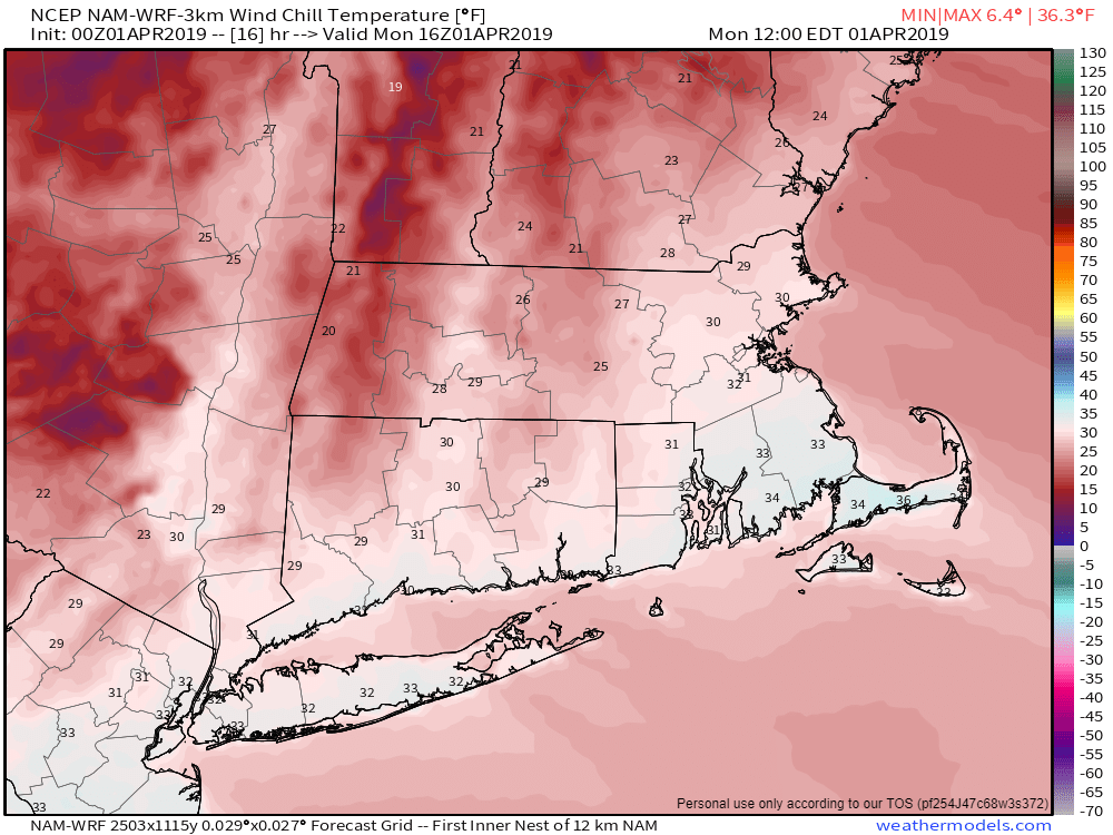
The week starts off on a sunny but chilly note as high pressure builds into the region. Even with sunshine, wind chills will be in the 30s this afternoon. The chill won’t last too long as temperatures will start to moderate on Tuesday as high pressure moves offshore. Clouds will start to move in late in the day on Tuesday as a storm system starts to move up the East Coast.
Low pressure will pass offshore to the south and east of the region, but should be close enough to bring in some rain for Wednesday morning. Some wet snowflakes could even be mixed in before daybreak, mainly from the hills of Worcester County into southern New Hampshire. The rain will light for much of us, but some heavier rain is possible across parts of southeastern Massachusetts and Cape Cod, where gusty winds are also expected. The system will be a fast mover, with clearing expected to start Wednesday afternoon.

High pressure returns for Thursday with dry conditions. However, the dry weather won’t last (does it ever really?) as the next system moves in for Friday. Again, we’re looking at rain, but don’t be surprised if you see some snowflakes at the start across parts of southern New Hampshire and maybe even the Merrimack Valley. High pressure builds back in for next weekend.
Monday: Sunshine, and lots of it, but also breezy. High 39-46.
Monday night: Clear to partly cloudy. Low 23-30.
Tuesday: A sunny start, clouds thicken up in the afternoon. High 44-51.
Tuesday night: Cloudy with showers developing towards daybreak. Low 32-39.
Wednesday: Rain during the morning, especially south of Boston, then skies clear out in the afternoon, breezy. High 52-59.
Thursday: A mix of sun and clouds, breezy. High 46-53.
Friday: Cloudy with showers likely. High 42-49.
Saturday: Showers ending early, then skies gradually clear out in the afternoon. High 54-61.
Sunday: Mostly sunny. High 55-62.
