No, we’re not expecting anything like that across the region this afternoon, but if you’ve got outdoor plans, you may want to keep an eye to the sky – we’ve got thunderstorms coming, and some of them could be strong to severe.
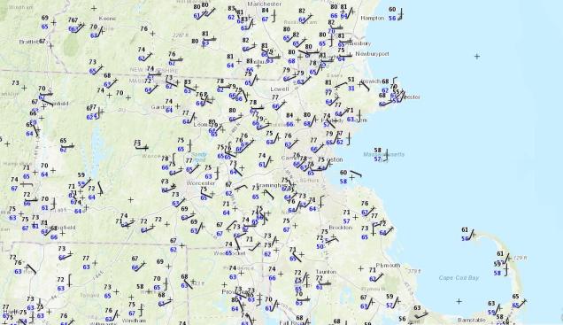
We’ve got a rather nice day in progress across the region, but changes are coming. At midday, temperatures are generally in the 70s to lower 80s away from the coastline, where seabreezes are keeping temperatures in the 50s to lower 60s. Dewpoints are creeping up, generally in the 60s now, which is humid by mid-May standards. We’ve also got plenty of sunshine, so temperatures should continue to climb into the afternoon. However, a cold front is starting to approach from the west. An area of showers and thunderstorms is moving into western Massachusetts at midday, and though these should weaken, they will spread cloud cover in, with some rain possible across northern Massachusetts and southern New Hampshire early this afternoon.

As that cold front approaches, a stronger line of thunderstorms is expected ahead of it. As you can see in the radar simulation above, this line should enter our region during the 5-8pm time frame, also known as the evening rush hour. Some of these storms will contain strong winds, heavy downpours, and frequent lightning. That will likely make the commute home for many people even worse than normal.
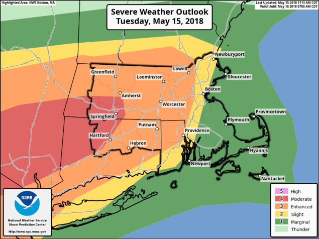
If it were just rain, wind, and lightning, it wouldn’t be a big deal. The problem is, it might be more than “just rain wind, and lightning.” Well away from the coastline, conditions will be favorable for severe thunderstorms to develop ahead of the front. As we mentioned in our Weekly Outlook, we still think the best odds for severe weather are from the Mid-Atlantic states into southeastern New York and western New England, but some severe storms could survive into eastern New England late this afternoon and evening. These storms should start to weaken quickly as they approach the coastal plain, but from interior Rhode Island into Central Massachusetts, the I-495 Belt of eastern Massachusetts, and Southern New Hampshire, we could see some fairly strong thunderstorms. We’ve already mentioned the frequent lightning and heavy downpours, but in the places we just mentioned, winds could gust to 60 mph or more with some of the stronger storms, which could result in more damage to places that already had lots of tree damage earlier this month.

In addition to the threats we listed in the last paragraph, there is also a low (but non-zero) threat for am isolated tornado or two this afternoon. No, we’re not expecting a tornado outbreak, but a brief tornado or two could spin up, especially across central and western portions of New England. In fact, if we do get one, it wouldn’t even be the first one this year in New England. Just last night, we found out that on May 4, a tornado tracked 35 miles through mostly (but not all) rural western and central New Hampshire.
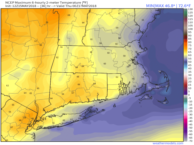
Behind the front, Wednesday will be a much cooler day. Easterly winds and some cloud cover will keep temperatures in the 50s along the coast, lower 60s inland. Sunshine and warmer temperatures will return on Thursday, so you’ll only have one day to complain about.
