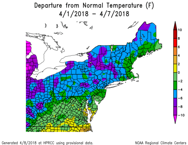
Since it seems like winter doesn’t want to end, a question we’ve been asked lately is “when is it going to finally warm up”? If you believe some of the guys on TV or the Facebook Forecasters, then the answer is “the end of this week.” However, we’re not so sure about that. Not yet, at least.

We start the week off with an area of high pressure keeping us dry on Monday. Tuesday will feature plenty of clouds along with some snow or rain showers as a weak system moves across the region. High pressure returns on Wednesday, with dry and cool conditions once again. The end of the week is where things get iffy.
On Thursday, low pressure moving into the Great Lakes will send a warm front towards the region. Some showers are likely ahead of this warm front, meaning Thursday will be a gray and possibly damp day. If the warm front does come through, and that’s far from certain right now, a cold front will move through at night as that low pressure system passes north of the region. That cold front will likely stall out south of New England. This leads to our next problem. Does it head northward again as a warm front?

Another storm system will move into the Midwest towards the end of the week. Some of the models are trying to have that system lift the front northward again, bringing very mild air into the region later Friday into Saturday. This is certainly possible. However, we’ll have plenty of cold air in place to the north, plus some very cold water off to our east. If you’ve lived here long enough, you know that warm weather doesn’t last too long around here, especially in April. Adding to our doubts is the fact that the models have the storm pass north and west of Chicago. A noted colleague once pointed out to us that with storms passing north and west of Chicago, warm fronts have plenty of trouble making northward progress around here, as they become too far removed from the main system, and lose the push that they need to head northward. This is more obvious in the winter, but since we’re still in a winter-type pattern, we’re taking note of that observation.
Finally, we get to Sunday. This is where things REALLY get complicated. If our warm front comes through, it’ll likely start heading southward again later Saturday as colder air tries to push back in. This could set us up for a VERY chilly Sunday. At the time this forecast was written early Monday morning, one model kept temperatures in the middle 30s to lower 40s all day Sunday, another kept temperatures in the 40s to lower 50s, while a third model had temperatures in the upper 60s and 70s (see maps below). So, there’s plenty of uncertainty. Meanwhile, another cold front will be approaching from the west, and low pressure will be riding out of the Gulf of Mexico along that front. That means that clouds and a few showers are likely. As the low pressure area gets nearer, we could be in for a period of heavy rain, but the timing of that, as well as the actual cold front, are still big question marks. The heavy rain could move in for Sunday night, it might move in Monday morning, or it might hold off until Monday night. Since next Monday is Patriots Day, this makes a BIG difference. We’ll know more on that later in the week.
Monday: Sunshine dimmed by thickening clouds in the afternoon. High 40-47.
Monday night: Partly to mostly cloudy. Low 27-34.
Tuesday: Mostly cloudy with some rain or snow showers possible. High 41-48.
Tuesday night: Becoming mostly clear. Low 25-32.
Wednesday: Sunshine and some afternoon clouds. High 47-54.
Thursday: Mostly cloudy and breezy with a few showers possible. High 51-58.
Friday: Partly to mostly cloudy, chance for a few showers. High 57-64, cooler along the South Coast.
Saturday: Intervals of clouds and sunshine, breezy, and warm. High 60-67, cooler along the South Coast. Temperatures may drop sharply in the afternoon from southern New Hampshire into eastern Massachusetts.
Sunday: Partly to mostly cloudy and breezy, more showers possible, especially late in the day. High 45-52, possibly milder south of Boston.

