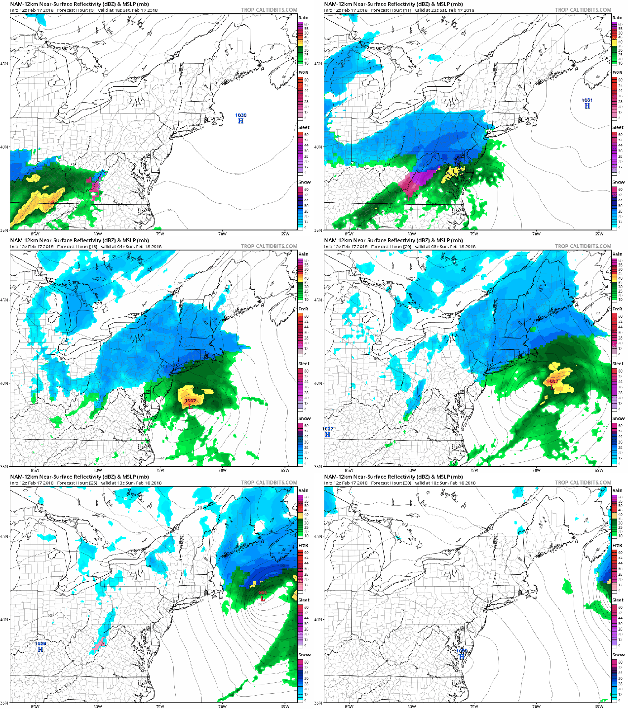
The last few days have been fairly mild around here, and even milder air is coming in for the first half of the upcoming week. So naturally, we’re talking about a snowstorm for tonight.
Low pressure is over the Tennessee Valley at midday, and will quickly move towards the Mid-Atlantic coastline this evening, passing south of New England as it intensifies tonight. Even though the sun is shining now, clouds will quickly move in this afternoon, with snow developing late this evening, around 9pm or so, give or take an hour. Snow will continue overnight, with the possibility for some briefly moderate to heavy snow. Since most of you will be sleeping, this shouldn’t cause too many problems. A change to rain seems likely across parts of Cape Cod and the Islands, possibly even into extreme southeastern Massachusetts.

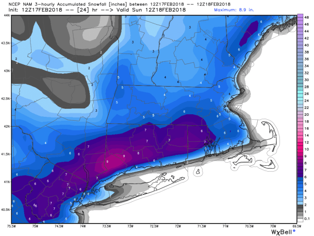
Everything winds down near or a little after daybreak. For most of us, a general 3 to 5 inches of snow is expected, with a few spots possibly seeing 6 or 7 inches. Across Cape Cod, where a change to rain is likely, amounts of 1 to 3 inches seem more plausible at this time.

The snow won’t last too long though. The sun will return Sunday afternoon, with temperatures getting up into the 40s. That will help to quickly melt a lot of what fell overnight. Temperatures will drop back below freezing Sunday night, so things may ice up once again. Use caution if you’re heading out for anything. Even warmer weather is heading in for the start of the week. A warm front will move through on Monday, with some showers preceding the front late in the day. Once the front moves through, unseasonably warm conditions are expected for Tuesday and especially Wednesday. On Tuesday, high temperatures should get into the upper 50s and 60s away from the South Coast. On Wednesday, we could challenge some record highs, with some places possibly making a run at 70 degrees. A cold front will move through late in the day on Wednesday, bringing an end to the warm weather, so enjoy the early taste of Spring while it’s here.
