There’s nothing spooky about the forecast this week. Most of the week will be a treat, with very little in the way of tricks.OK, now that we’ve got the requisite back Halloween puns out of the way, we can get to the actual forecast.
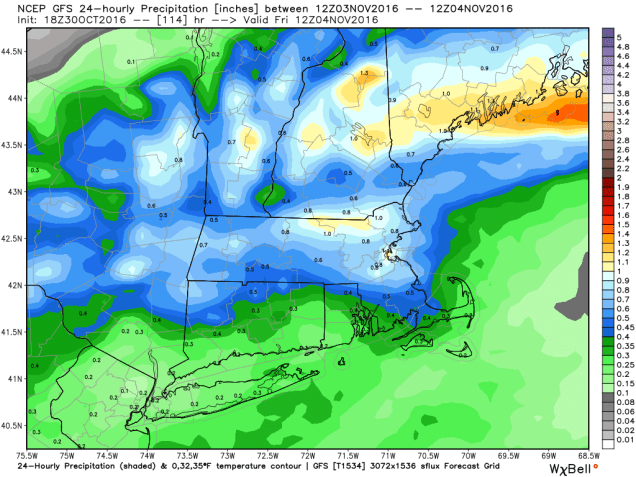
High pressure will keep the region dry today and Tuesday. A weak system passes by to the north Tuesday night and Wednesday, bringing in some clouds, but it doesn’t look like we’ll see any precipitation.While we’ll be cool today and tomorrow, we will start to warm up on Wednesday. While Thursday will also be warm, we’ll be dealing with rain by afternoon as a cold front approaches the region. The rain will continue into Thursday night, but be gone by the time you wake up Friday morning. High pressure returns for Friday and Saturday with cool conditions returning. Another weak system comes through on Sunday, with some additional showers expected.
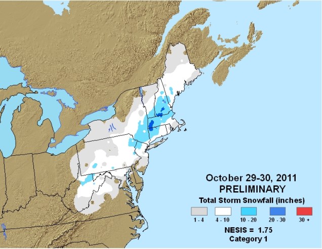
Considering how bad things can get around here for Halloween, this week’s forecast isn’t that bad. Just 4 years ago, we were cleaning up after Sandy. Just one year earlier, we were digging out from a record blizzard. Also, 25 years ago, the so-called “Perfect Storm” was battering the region.
Monday: Becoming mostly sunny and breezy. High 45-52.
Monday night: Mostly clear skies. Low 28-35.
Tuesday: Sunshine and a few clouds. High 50-57.
Tuesday night: Partly cloudy. Low 38-45.
Wednesday: Intervals of clouds and sunshine. High 61-68.
Thursday: Cloudy and breezy with rain likely in the afternoon and evening. High 63-70.
Friday: Partly to mostly sunny. High 46-53.
Saturday: A mix of sun and clouds. High 47-54.
Sunday: Mostly cloudy with a chance for a few showers. High 45-52.
