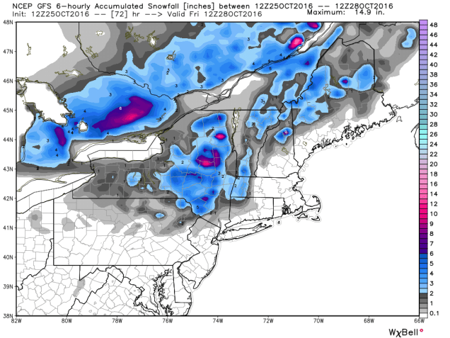
By now, you’ve probably heard from your favorite TV meteorologist that there’s snow in the forecast for Thursday. While parts of the region will likely see some snow on Thursday, the vast majority of us will not.
High pressure will provide us with some chilly weather for the next few days. Temperatures will likely dip near or below freezing across much of the area tonight and again Wednesday night. So, we’ve got cold air in place, and a storm system heading our way on Thursday. That means it’s going to snow, right? As famed college football analyst Lee Corso would say “Not so fast my friend”. Allow us to explain.

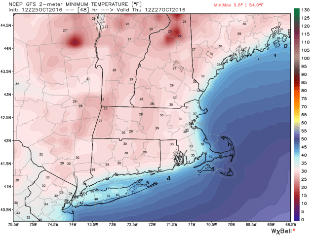
As that high pressure area moves off to the east, winds will shift into the east and southeast across the region. Water temperatures off the coast are still in the 50s to lower 60s, so a wind off the water will allow temperatures to moderate. Thursday will still be a chilly day, with temperatures mainly in the 40s, but the air will remain dry, thanks to the high pressure area. As the precipitation arrives from the west during the afternoon, it will fall into that dry air, evaporating before it hits the ground. This will also allow temperatures to drop through a process called evaporational cooling. Temperatures may drop into the upper 30s to lower 40s before the air moistens up enough for the precipitation to hit the ground.

With temperatures likely near or just above 40, we’re looking at mainly rain across most of our region. Oh sure, there could be a renegade snowflake or ice pellet mixed in at the start across parts of southern NH or central MA, but for the most part, we’re looking at rain, and possibly a decent amount of it. Much of the region could receive between 0.75″ and 1.50″ of rain from this system, which will help put a dent into the ongoing drought.
Farther to the north and west, especially across the higher elevations of the Berkshires, Monadnocks, and the mountains of Northern New England, temperatures will be cooler, and the precipitation will arrive faster, thus increasing the chances that it starts as snow. Even in these locations, warmer air will move in Thursday night, allowing the snow to change over to rain. Before that happens, we could see a little accumulation, especially at the higher elevations, where a few inches may accumulate. The best chance for accumulating snow actually looks to be across the Adirondacks of northeastern New York, where the warm air will have a tough time getting in.

Once we get past this system, we could be looking at a wet weekend and start of next week. A couple more storms may move across the region, bringing us several bouts of much-needed rainfall. It does not look like there will be more snow with these systems, except possibly across the mountains of northern New England.