Spring begins today, and we’ve got some nice weather for a few days, but the latter half of the week may not be as nice.
High pressure will be in control through Wednesday with dry weather and a warming trend expected. It’ll still be breezy today, but winds should diminish into Tuesday. Clouds will start to increase on Wednesday ahead of a warm front. That front will produce some showers Wednesday night into early Thursday, setting up a very mild day, with some showers possible. The front will sag southward as a cold front late in the day, likely stalling out near or just south of New England. Another wave of low pressure rides along that front on Friday with some additional showers likely, depending on where the front stalls out. With some cooler air in place, we could see some wet snow mix in across northern Massachusetts and southern New Hampshire if the front does stay out near the South Coast, but these are the types of details that are kind of fuzzy this far out, and will need to be fine-tuned later this week. Another low pressure likely moves up the St. Lawrence Valley over the weekend with a secondary low pressure system passing south of New England, but the details regarding timing and precipitation type with this system vary depending on which model you look at.

Monday: Wall-to-wall sunshine, breezy. High 45-52.
Monday night: Clear to partly cloudy. Low 25-32.
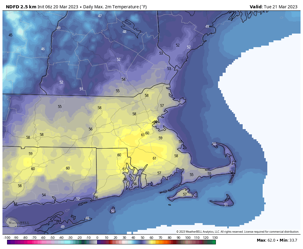
Tuesday: A mix of sun and clouds, breezy during the afternoon. High 53-60.
Tuesday night: Partly cloudy. Low 29-36.
Wednesday: Some morning sun, then becoming mostly cloudy with showers possible at night. High 51-58, cooler at the coast.
Thursday: Cloudy and breezy with a few showers early, then becoming more numerous late in the day and into the evening. High 52-59.
Friday: Cloudy, more showers possible, breezy. High 48-55.
Saturday: Cloudy and breezy with a chance of rain or possibly snow, especially north and west of Boston. High 40-47.
Sunday: More clouds than sun with a chance for showers early, breezy. High 44-51.
