Much of the upcoming week will feature quiet weather, a welcome change from the active pattern we’d had over the past few weeks.
The week starts off with high pressure providing us sunshine and seasonable temperatures, but low pressure will continue to intensify in Atlantic Canada, producing gusty winds across the region for the next few days. A weak system will move out of the Great Lakes on Tuesday, likely passing south and west of the region, but it may be close enough for a few rain or snow showers. Wednesday and Thursday will feature intervals of clouds and sunshine with a few rain or snow showers along with gusty winds as disturbances rotate around low pressure south of Nova Scotia. By Friday, high pressure builds in with more sunshine and lighter winds.

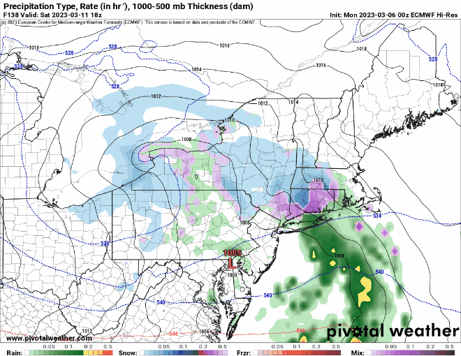
Unfortunately, next weekend does not look as quiet. Most of the models are showing the potential for a storm system to impact the region next weekend, but they differ considerably on the details, including timing, placement, strength, and precipitation type. Hopefully, things will become clearer later this week.
Monday: Sunshine and some afternoon clouds, windy. High 41-48.
Monday night: Partly cloudy, breezy. Low 22-29.
Tuesday: Becoming partly to mostly cloudy, breezy, chance for a rain or snow shower. High 32-39.
Tuesday night: Partly cloudy, breezy. Low 22-29.
Wednesday: More clouds than sun, breezy, a rain or snow shower possible, mainly across Cape Cod. High 39-46.
Thursday: Partly to mostly cloudy, breezy, chance for a rain or snow shower, mainly near the coast. High 39-46.
Friday: Mostly sunny. High 40-47.
Saturday: Mostly cloudy, breezy, chance for snow or rain. High 38-45.
Sunday: Mostly cloudy, windy, chance for snow or rain. High 36-43.
Also, a remainder that Daylight Saving Time begins next Sunday at 2am, so you’ll lose an hour or sleep, or if you’ll be at work, you’ll have an hour less of work.
