The weather pattern will start to quiet down again this weekend, but not before some of us get some snow on Friday.
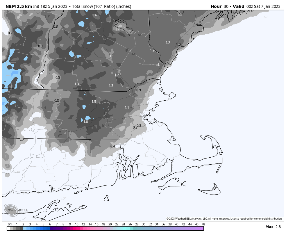
Drizzle and fog (and a little freezing drizzle) will gradually taper off tonight as a cold front continues to push offshore. An upper-level system quickly follows for Friday. With colder air in place, precipitation will be mainly in the form on snow north and west of Boston, while areas near the coast and south of Boston likely see mostly rain, with some snow mixed in, especially as everything winds down. Snow likely develops during the late morning hours and ends during the evening. It should be mostly light, but some bursts of moderate to perhaps heavy snow are possible. For accumulations, south and east of I-95 will have some slush at most. Areas north and west of I-95 are looking at a general 1-2″ with some spots possibly picking up 3-4″ if these heavier bursts do materialize. We’ll still have some clouds around on Saturday, then we should clear out for Sunday and Monday with seasonably chilly conditions expected.
Thursday night: Plenty of clouds, drizzle and fog linger, especially during the evening. Low 31-38.
Friday: Mostly cloudy, light snow developing north and west of I-95, rain south and east, possibly changing to snow late in the day. High 35-42.
Friday night: Snow and rain end in the evening, then skies become partly cloudy. Low 27-34.
Saturday: Intervals of clouds and sunshine. High 36-43.
Saturday night: Becoming mostly clear. Low 19-26.
Sunday: Sunshine and a few clouds. High 31-38.
Sunday night: Partly cloudy. Low 23-30.
Monday: Partly sunny. High 37-44.
