There was very little tropical activity around the world during July and August, but as the calendar has flipped to September and we approach the peak of Hurricane Season (especially in the Atlantic), several storms have developed.
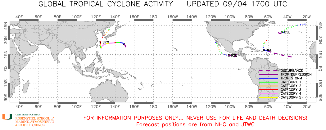
The storm that is the biggest threat to land is actually in the Western Pacific Ocean. Typhoon Hinnamnor is centered about 210 miles west-northwest of Okinawa, Japan, moving toward the north at 9 mph. Maximum sustained winds are near 120 mph. A little additional strengthening is possible today before a weakening trend begins. The forecast for Hinnamnor is for gradual weakening as it moves northeastward over the next 24 hours. The center will pass close to or across southeastern portions of South Korea on Monday as a typhoon, with top winds still in the 100-110 mph range. Storm surge will likely be confined to just a small portion of the South Korean coastline, but that area includes the city of Busan, the 2nd most populous city in South Korea. Busan is also the 6th busiest port in the world. Heavy rain and gusty winds are likely across much of the Korean Peninsula, but also could impact parts of eastern China (near Shanghai) today, and parts of Japan over the next few days.

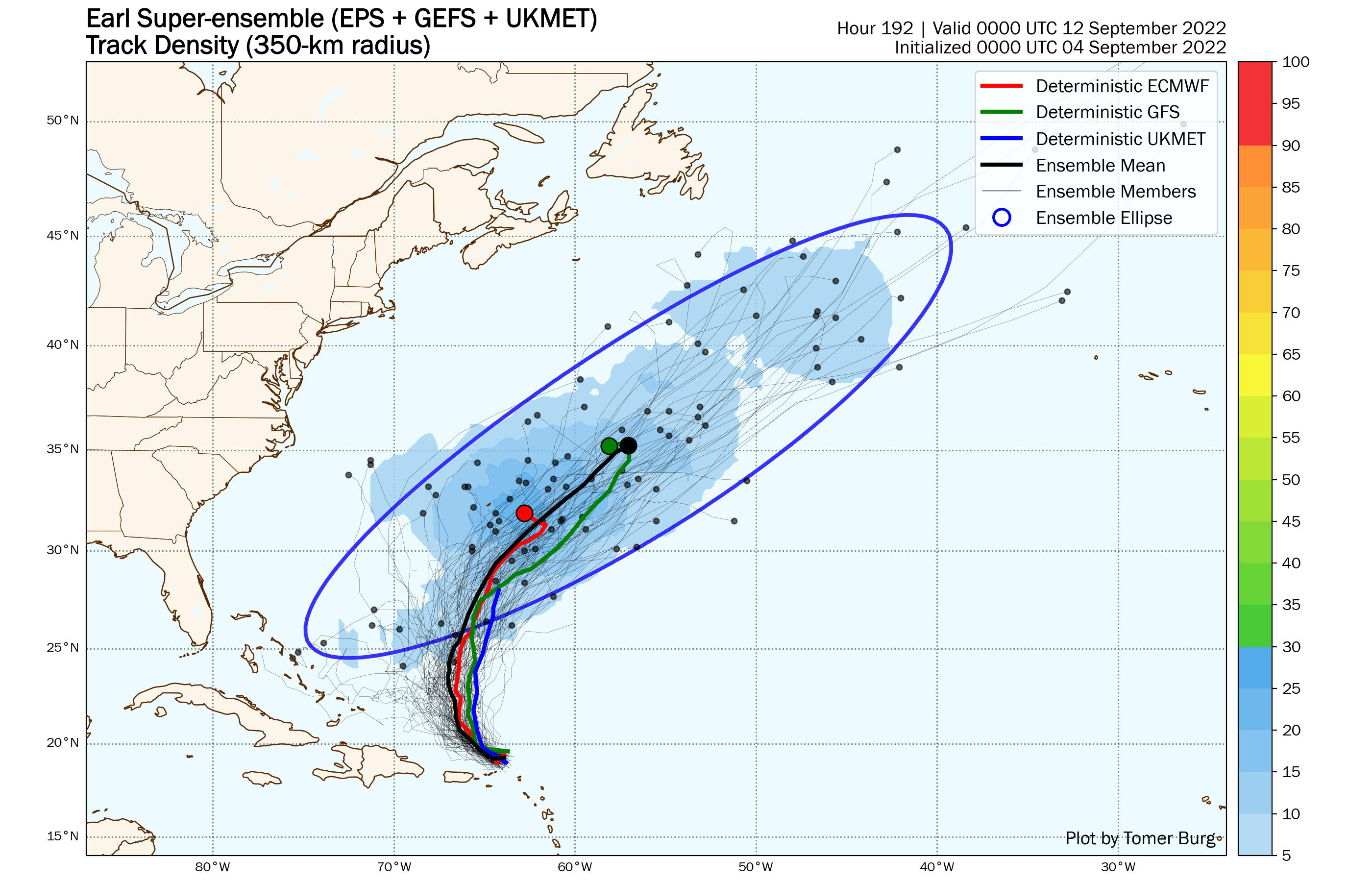
In the Atlantic, after going nearly two months without a named system, we now have twostorms to track. Tropical Storm Earl developed Saturday night east of the Lesser Antilles. As of midday Sunday, Earl was centered about 85 miles north-northeast of St. Thomas, USVI, moving toward the northwest at 3 mph. Maximum sustained winds are near 50 mph. Earl is bringing some gusty winds and heavy downpours to parts of Puerto Rico, the Virgin Islands, and northern Leeward Islands today and will continue to do so into Monday as it drifts toward the northwest and eventually north. The forecast for Earl calls for a turn more toward the north on Monday, with gradual strengthening expected. Earl is expected to become a hurricane by Tuesday and could become a rather potent storm by mid-to-late week. The official forecast from the National Hurricane Center calls for Earl to eventually turn more toward the northeast, heading out over open water southeast of Bermuda. However, as is usually the case with tropical systems, this is hardly a lock. An upper-level trough of low pressure moving into the central Atlantic is expected to help turn Earl toward the northeast and out to sea. If that trough moves a little faster, Earl may not make the northeast turn, at which point, the track becomes highly uncertain. Another trough of low pressure will be moving toward the East Coast while a ridge of high pressure settles in across the western Atlantic. This could increase the threat to Bermuda before the next trough moves in and kicks Earl out to sea. If you’re wondering about whether Earl could threat the East Coast, it is highly unlikely at this point, but the odds are not zero. A few members of the various Ensemble forecasts do show a significantly more westward track to Earl, but the vast majority still show a track out to sea (or near Bermuda then out to sea).
Out in the North Atlantic, Hurricane Danielle, the first hurricane of the season in the Atlantic, is strengthening this afternoon. As of midday, Danielle had maximum sustained winds near 80 mph and was centered nearly 1000 miles west of the Azores. Danielle is nearly stationary right now, but it is expected to start moving toward the northeast and then east over the next few days. Some additional strengthening is possible tonight and Monday, but after that it will start moving over cooler water, and a gradual weakening trend will begin. Danielle is expected to become extratropical later this week, and could bring heavy rain and gusty winds to parts of the British Isles as a strong extratropical system toward the end of the week.

Finally, Tropical Depression 12-E has developed off the southwest coast of Mexico. As of midday, it was centered about 225 miles south-southwest of Acapulco, moving toward the west at 10 mph. Maximum sustained winds are near 35 mph. The forecast calls for steady strengthening, and the system could become a tropical storm later today or tonight, and a hurricane early this week. A turn more toward the northwest is expected early this week, and the system could threaten parts of the Baja Peninsula toward the latter half of the week. By the end of the week, the system, or what’s left of it, could bring some heavy rainfall into parts of the Southwest and Southern California, enhancing what has already been a very active monsoon season.

With the climatological peak of hurricane season in the Atlantic about a week away, and the peak of the Eastern Pacific season encompassing most of September, additional storms are likely to form over the next few weeks.
