Better enjoy today, because much of the upcoming week isn’t looking that nice.
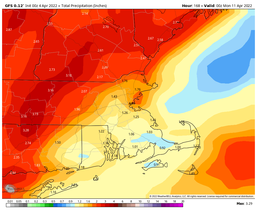
High pressure builds in today with some sunshine and seasonably mild temperatures, but that will be enough to make this the best day of the week. Tuesday might not be that bad either, with some sunshine in the morning, but clouds will start to move in during the afternoon ahead of a low pressure system heading toward the Mid-Atlantic states. That system will pass south of the region Tuesday night into Wednesday with rain likely. Wednesday just looks like a cool, damp day, not that unusual for early April. Temperatures may be marginally cold enough for some wet snow across central and possibly southern New Hampshire, but any accumulation would likely be confined to grassy surfaces, and mainly before daybreak Wednesday. Again, this is not that unusual for early April.

That system will pull away later on Wednesday, but another one quickly follows for Thursday into Friday. This one will bring another round of rain in, and it could be heavy once again. In fact, Thursday looks like a washout at this point. The Red Sox are scheduled to open the season at Yankee Stadium at 1pm Thursday, and the odds of that game happening look pretty slim at this point. Expect it to be bumped to Friday afternoon.

That system will pull away late Friday, but an upper-level low moves into the Northeast for the weekend, keeping plenty of clouds around, with a few showers possible each afternoon. We also have to keep an eye on a storm system offshore, but right now, it looks to be too far offshore to have any impact, expected possibly bringing some showers to the Outer Cape.
Monday: A mix of sun and clouds. High 49-56.
Monday night: Partly cloudy. Low 30-37.
Tuesday: Morning sunshine, increasing afternoon clouds. Showers may develop near the South Coast late in the day. High 54-61.
Tuesday night: Cloudy with showers likely, possibly mixed with wet snow across central New Hampshire. Low 36-43.
Wednesday: Periods of rain and showers, tapering off by evening. High 44-51.
Thursday: Rain likely. High 47-54.
Friday: Plenty of clouds with more showers, possibly some afternoon sunny breaks. High 59-66.
Saturday: A mix of sun and clouds, chance for a shower. High 56-63.
Sunday: More clouds than sun, a shower or two possible. High 51-58.
Finally, we’ll mention that the models are showing the potential for a significant warmup next week. While we wouldn’t be surprised if there’s at least one very warm day in there, we’re skeptical that an extended warmup is on the way. For one, the water is still very cold, leaving us susceptible to seabreezes or even back-door cold fronts that will bring in much cooler air off the Atlantic. Also, if the upper-level ridge sets up a bit too far to the west, we stay on the cooler side of things. As we said, some of the models show a significant warmup, but beyond a day or two in the middle of next week, they haven’t been consistent is showing it lasting into the end of the week or beyond. We’ll obviously delve more into this next weekend.
