We’ve got some rather typical December weather coming up this week with the possibility of some snow, temperatures in the 60s, and thunderstorms. Wait, what?
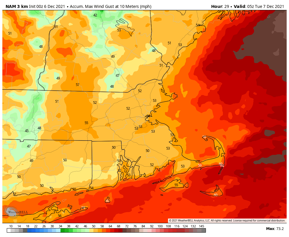
Low pressure will move across southeastern Canada today, dragging a warm front across the region this morning. Some showers are likely ahead of the front, but once it pushes through, gusty southerly winds will bring unseasonably mild conditions in. A Wind Advisory is in effect for the afternoon and evening for parts of southeastern Massachusetts and southern Rhode Island, as those southerly winds could gust as high as 40-50 mph at times. Temperatures should get to 60 in much of the region despite plenty of clouds, though it wouldn’t be surprising if we saw more than a little sunshine during the afternoon, which could allow for even milder temperatures than we’re currently expecting.
A strong cold front will move through by evening, with another round of showers ahead of that front, possibly even some thunderstorms. As the much cooler air sweeps in behind the front on gusty west to northwest winds, we could see a few wet snowflakes mix in with the rain before it ends across parts of southern New Hampshire.
High pressure builds in on Tuesday with dry and seasonably cool conditions, though there are some indications that a few streamers of lake-effect snow could eventually survive the trip eastward and move across the region during the afternoon. It shouldn’t amount to anything more than some scattered flurries, but it is a possibility. Clouds move right back into the region by Tuesday evening ahead of another storm system.
Editorial note: With an active and fast-moving pattern in place, many of the forecast models have been struggling mightily to the point of being useless beyond 2 or 3 days. With that in mind, everything below is highly uncertain, with lower confidence than usual. We’re giving you our current thoughts and “best guess” for lack of a better term, but there’s a decent chance that all of this could change, especially later in the week.
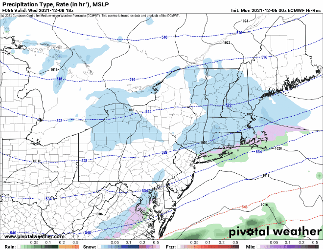
There is considerable uncertainty in the evolution and track of our mid-week storm system, but the basics are that it will move off the Mid-Atlantic coastline and pass south of New England. How far south is unknown at this point, and will have a significant impact on the forecast. The models are nowhere near close to a consensus at this point, with solutions that range from a track well to the south with little to no impact, to a track closer to the region with the potential for a period of light to perhaps moderate snow across the region with rain near the south coast. For now, our preliminary thinking is a track a decent ways south of the region, with just some light snow, with rain right along the coast. Obviously this is subject to change, and depending on how things look, we may write another blog post tomorrow, since this could be the first accumulating snow of the season for parts of the region. Given the high degree of uncertainty, we’re not going to mention any amounts at this point, and if you see anyone online or in the media posting snow maps you should ignore them, because they’re just as clueless as everyone else.
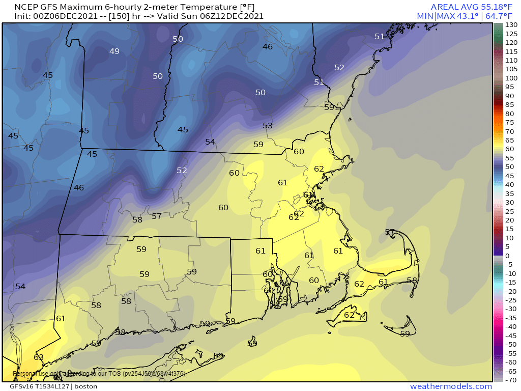
High pressure builds back in for Thursday with dry and chilly conditions, then another storm may quickly follows for Friday. Some of the models show little to no precipitation with this system others show the chance for some rain, starting as snow north and west of Boston. We’ll obviously have a better idea on this system when we get to our Weekend Outlook on Thursday, but for now, we’re just going to call it a chance of rain or snow. That system moves out Friday night, but the active pattern remains in place, with yet another system quickly moving in for the weekend. This one looks much milder, with rain and breezy conditions, though it could end as some snow across the interior as colder air moves in on the backside of the storm.
Monday: Early showers, then some sunny breaks develop during the afternoon, becoming windy and mild. High 62-69.
Monday night: Showers and possibly some thunderstorms during the evening, skies start to clear out late at night. Some wet snow may mix with the rain before it ends from southern New Hampshire into central Massachusetts. Low 27-34.
Tuesday: Partly sunny and much cooler, clouds stream back in late in the day. Chance for a few flurries. High 36-43.
Tuesday night: Mostly cloudy. Low 23-30.
Wednesday: Cloudy with a chance of snow, except snow or rain along the coast. High 31-38.
Thursday: Partly to mostly sunny. High 32-39.
Friday: Mostly cloudy with a chance of rain or snow. High 42-49.
Saturday: Mostly cloudy, breezy, and mild with a chance of showers. High 53-60.
Sunday: Showers may mix with wet snow before ending in the morning. becoming partly sunny in the afternoon. High 43-50.
