Tropical Storm Elsa has its sights set on Cuba and Florida over the next couple of days.
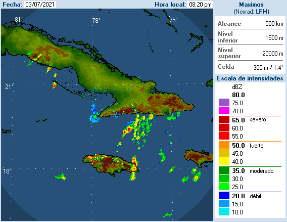
After weakening to a Tropical Storm, Elsa has been battering parts of the Dominican Republic, Haiti, and Jamaica with strong winds and heavy rainfall over the past couple of days. Cuba is starting to feel the effects, and they’ll become more widespread today and Monday. Tropical Storm Watches and Warnings are in effect for Jamaica, most of Cuba, parts of the Cayman Islands, as well as the Florida Keys and parts of South Florida.

As of midday Sunday, Elsa was centered about 50 miles north of Kingston, Jamaica, moving toward the west-northwest at 13 mph. Maximum sustained winds were near 60 mph. While the storm may strengthen a little today, weakening is expected tonight as the center crosses Cuba. Once it reemerges in the Florida Straits on Monday, it will head northward toward the Florida Keys. While the water is plenty warm enough to support some intensification, shear will begin to increase as well, which acts to weaken the storm. The current forecast calls for the system to maintain its intensity Monday and Tuesday. Since intensity is usually the hardest thing to forecast in tropical systems, we wouldn’t be surprised if it re-intensified back into a hurricane, nor would we be surprised if it continued to weaken as it is moving northward off the west coast of Florida.

Once Elsa crosses the Florida Keys it will continue northward, eventually turning northeastward as it moves around the edge of a large ridge of high pressure centered over the western Atlantic. When it starts making that northeast turn will determine where landfall is expected in Florida. At this point, anywhere from Fort Myers to Pensacola could be the spot. Either way, heavy rain is likely across Florida over the next couple of days, especially western Florida. Rainfall totals of 4-8 inches and locally heavier will result in flooding in some areas.
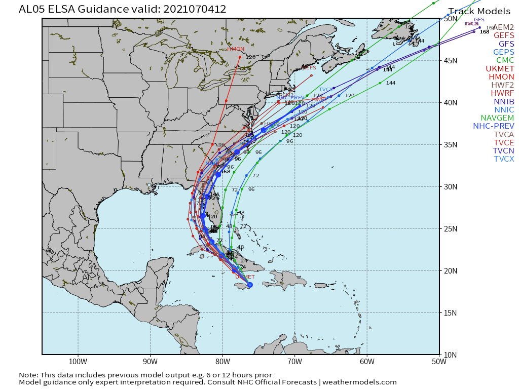
Once it makes the turn, we have another question that we can’t answer yet – when will the center re-emerge over the Atlantic? Obviously, the longer it remains over land, the weaker it will be, but if it were to move offshore closer to northern Florida or Georgia instead of over North Carolina, there would be a window for a little strengthening as it moves over the warm waters of the Gulf Stream. Either way, it will bring heavy rain and gusty winds to parts of Georgia and the Carolinas toward the middle of the week. Once it moves back offshore, it should continue northeastward and out to sea while becoming extratropical later this week. Depending on how far north it actually gets, it could interact with a frontal system and bring some rainfall to parts of eastern New England by the end of the week, but there’s a lot that has to happen first before we can have any clarity on that possibility.
