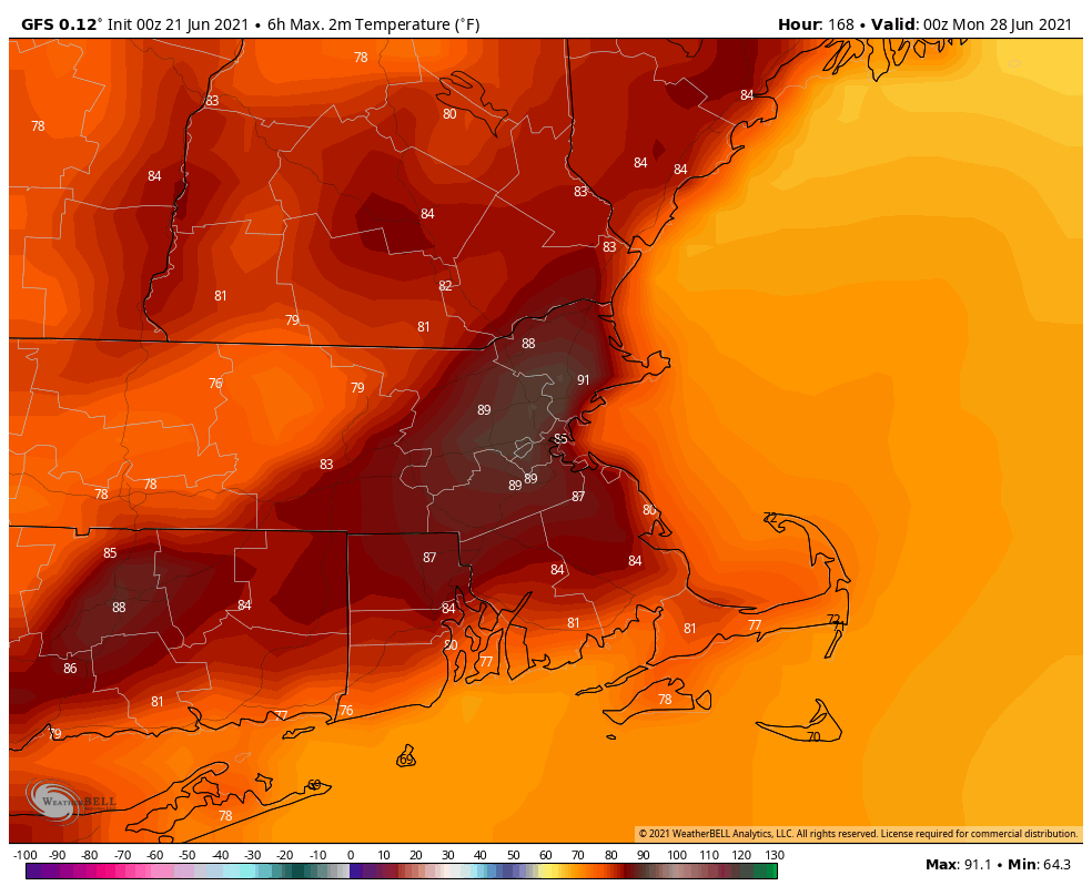
Now that we’re officially into summer, we’ve got weather that is appropriate for the season.
The week starts off with high pressure moving offshore and a cold front approaching from the west. This will provided the region with hot and humid conditions, but the bulk of the thunderstorm activity should remain to our north and west, though a few showers and storms could make their way into our area. They’ll become a bit more numerous tonight and possibly again on Tuesday as the front gets closer, eventually moving offshore late in the day on Tuesday.

While the front is approaching, “Tropical Storm Claudette” will pass south and east of the region. We’ve criticized the National Thunderstorm Naming Hurricane Center in the past for some of the storms that have gotten names, and this one is no exception. When it was moving through the Gulf at the end of last week, it was a disorganized storm that lacked a well-defined center, but was producing plenty of thunderstorms. Miraculously, it managed to have a center suddenly become well-defined (their definition of “well-defined” is different than many others), right as it was making landfall, so that way, it could be named. Funny how that worked out. Once over land, it quickly weakened (imagine that?) and dropped a ton of rain across the Gulf Coast and the Southeast. Early this morning, while the center was still over the Carolinas, it managed to strengthen again, without a well-defined center (don’t see too many large bodies of warm water in the middle of North Carolina). It should move offshore today, and the forecast calls for it to strengthen over the Gulf Stream again, then become extratropical on Tuesday south of Nova Scotia. OK, enough ranting from us about a storm that will have no impact here other than a little rough surf over the next few days.

High pressure builds in for Wednesday and Thursday with cooler and drier conditions once again. As the high moves offshore on Friday, humidity levels and temperatures will start to creep up once again, with a few showers possible as a warm front moves through. By Saturday, low pressure will be heading into the Great Lakes, sending another frontal system toward the region. Some showers and thunderstorms are possible, but it looks like we’ll have a better chance at them next Sunday as the front gets closer.

Monday: Partly sunny and breezy, just a slight chance for a late-day shower or thunderstorm. High 85-92, cooler along the South Coast.
Monday night: Mostly cloudy, some patchy fog may develop near the South Coast, a few showers and thunderstorms are possible. Low 64-71.
Tuesday: Plenty of clouds with scattered showers and thunderstorms expected. High 78-85.
Tuesday night: Showers ending from northwest to southeast, followed by gradual clearing. Low 50-57.
Wednesday: Plenty of sunshine, perhaps some lingering clouds across Cape Cod. High 71-78.
Thursday: Sunshine and a few clouds. High 75-82.
Friday: Intervals of clouds and sunshine, chance for a few showers. High 75-82.
Saturday: A mix of sun and clouds, breezy, some showers and thunderstorms are possible. High 79-86.
Sunday: Partly sunny and breezy with a chance for more showers and thunderstorms. High 80-87.