Temperatures will be riding the rollercoaster this week, but in general, we’ll be on the dry and cool side much of the time.
High pressure builds in today with temperatures that are not only significantly cooler than what we had over the weekend, but below normal for late May. Despite plenty of sunshine, temperatures will only be in the 60s to lower 70s today, with the coolest readings along the coast, thanks to a seabreeze off the still-cool Atlantic. After a chilly night tonight, temperatures will start to moderate on Tuesday as high pressure moves offshore and winds become southwesterly.

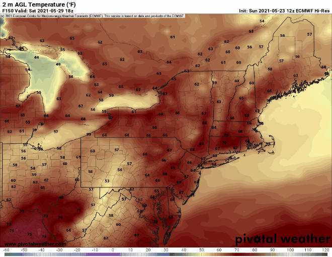
Low pressure will head into southeastern Canada on Wednesday, dragging a warm front across the region early in the day. This will result in a return of heat and humidity. A few showers or storms could accompany the warm front, but the temperatures will be the big story, as most of us will get well into the 80s once again, with lower (perhaps middle) 90s possible. The heat won’t last long though, as a cold front will swing through the region Wednesday evening or night, with some showers and thunderstorms likely ahead of it.

High pressure builds in behind the front on Thursday with drier and cooler conditions. This brings us to the Memorial Day Weekend. There is still some uncertainty among the models as to what we can expect next weekend. The models are in decent agreement that we’ll have high pressure centered over southeastern Canada while low pressure moves out of the Midwest and into the Mid-Atlantic states before spending much of the weekend south of New England while only slowly drifting eastward. They mostly agree that this means we’ll be on the cool side from Friday into Monday, with temperatures mainly below normal. What they don’t agree on is exactly where the low pressure system tracks, and whether it will send any precipitation our way (which also has an impact on the temperature forecast). For now, we’re going to lean on the dry side and be optimistic, but there is a chance that the long weekend could feel more like mid-Spring than the “traditional start of summer.” We should have a better handle on it for our Weekend Outlook on Thursday.
Monday: Sunshine and a few clouds. High 65-72, cooler along the coast.
Monday night: Clear to partly cloudy. Low 46-53.
Tuesday: A mix of sun and clouds, breezy. High 73-80, cooler along the South Coast.
Tuesday night: Variably cloudy, just a slight chance for a shower or thunderstorm. Low 57-64.
Wednesday: Partly sunny, breezy, and humid, showers and thunderstorms possible late in the day and at night. High 84-91, cooler along the South Coast.
Thursday: Partly to mostly sunny. High 77-84, cooler along the coast.
Friday: Partly sunny. High 59-66.
Saturday: Partly to mostly sunny. High 61-68.
Sunday: Partly to mostly sunny. High 62-69.
Memorial Day: A mix of sun and clouds. High 64-71.
