We’ve reached the last full week of the year, and also the winter solstice. Winter officially begins at 5:02am, so by the time most of you read this, astronomical winter will have begun. That doesn’t mean it will feel like winter every day this week.
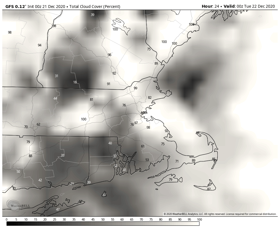
If you’re heading out early this morning, use a little extra caution, as there may be some black ice, especially away from the coastline. If you’re down the Cape, there’s some rain around this morning, but it should be gone by midday as a low pressure area pulls away from the region. For the rest of us, today will just be a cloudy day, with temperatures fairly typical of late December. We may get a few breaks in the clouds this evening, which would allow you to view the conjunction between Saturn and Jupiter. Otherwise, it’ll remain mostly cloudy overnight and into Tuesday as another weak system moves through with a few rain or snow showers. Once that system moves through, we clear out for Wednesday as high pressure builds in, but it will be chilly.
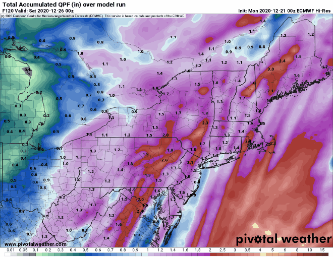
This brings us to Christmas Eve. Low pressure will be heading into the Great Lakes, with milder air moving in ahead of it. Many of the forecast models are showing the potential for strong winds, heavy rainfall, and unseasonably warm temperatures for Christmas Eve into early on Christmas Day before a strong cold front moves across the region. Given the recent performance of the models this far in advance, plus some of the model trends we’ve already seen, we’re a bit skeptical. Yes, we expect it to be mild with some rain. However, we’re not yet convinced that temperatures will be in the upper 50s to lower 60s with 1-2 inches of rain (or more), like many of the models are showing. The system will drag a strong cold front through on Christmas morning, with temperatures dropping quickly on Christmas Day. Now, it won’t be anything like Christmas Day in 1980, but it will be enough for any untreated surfaces to ice up, and possibly for some snow showers. We’ll obviously have a better idea about this system in our Weekend Outlook, which will likely be published on Wednesday this week.
(For those wondering, the temperature in Boston on Christmas Day, 1980 was 35 degrees at midnight. A strong cold front moved through just after midnight, and the temperature dropped to -7 by 10am, and only got back up to -2 in the afternoon. Add in the northwest winds of 10-20 mph all day long and it was a brutally cold day.)
Behind that system, high pressure will build in next weekend with drier and colder weather, which is pretty much what you’d expect in late December. There are some indications that our active pattern may continue into next week with more storminess possible.
Monday: Showers end across Cape Cod in the morning, otherwise, plenty of clouds with a few sunny breaks High 35-42.
Monday night: Partly to mostly cloudy. Low 23-30.
Tuesday: Intervals of clouds and sunshine with a rain or snow shower possible. High 35-42.
Tuesday night: Clear to partly cloudy. Low 21-28.
Wednesday: Sunshine fades behind increasing late-day clouds. High 33-40.
Christmas Eve: Cloudy and breezy with showers possible late in the day, and a period of steady rain likely at night. High 43-50.
Christmas Day: Rain may change to snow before ending around midday. High 45-52 early, then temperatures quickly drop in the afternoon.
Saturday: Partly sunny. High 26-33.
Sunday: Partly to mostly sunny. High 27-34.
