This outlook will be rather brief, because the forecast is rather simple. We’ll dry out today and Saturday, then heat and humidity return for Sunday and Monday.
Friday: Becoming partly to mostly sunny and less humid. High 80-87.
Friday night: Mostly clear skies. Low 63-70.
Saturday: Partly to mostly sunny. High 83-90.
Saturday night: Clear to partly cloudy. Low 66-73.
Sunday: A mix of sun and clouds, hot, and humid. High 88-95.
Sunday night: Partly cloudy and muggy. Low 69-76.
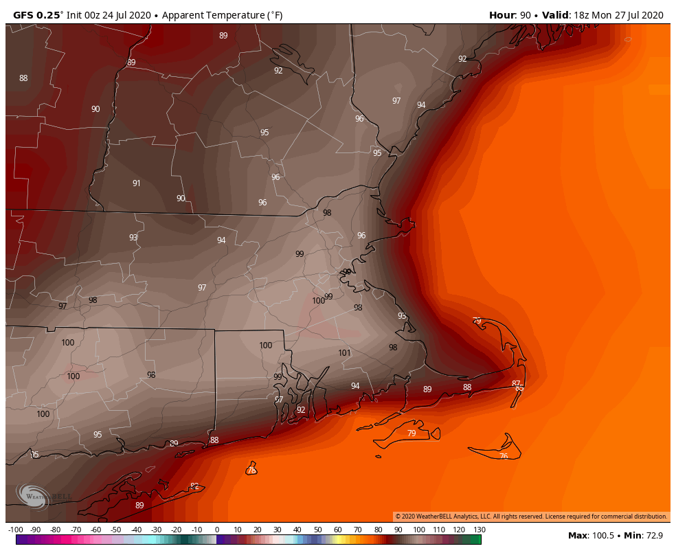
Monday: Partly sunny, hot, and humid. High 89-96.

We’ll likely publish another blog on the tropics late Friday, but here’s a quick update for you. Tropical Depression 8 has become Tropical Storm Hanna. Tropical Storm Warnings are now in effect for much of the Central and Southern Texas coast, all the way to the mouth of the Rio Grande. A track towards South Texas is likely with landfall on Saturday. Heavy rain is still the main threat. Tropical Storm Gonzalo looks a little healthier this evening, and will likely cross the southern Windward Islands on Saturday. Once it gets past the islands, its future is still very uncertain. In the Eastern Pacific, Douglas is now a Category 4 Hurricane, but will likely start to weaken today. It should pass very close to or right across the Hawaiian Islands on Sunday as either a weakening hurricane or a strong tropical storm.
