Memorial Day is the “traditional start of summer”, and we’ll certainly have some summer-like weather this week, just not on Memorial Day.
The forecast for this week is actually fairly simple. We start the week out with plenty of low clouds and some fog for your Memorial Day morning. With high pressure east of Nova Scotia and low pressure south of New England, a light southeast flow is bringing in plenty of moisture in the form of cloud cover. Some patchy drizzle is possible along the coast as well. As we head into the afternoon, the clouds will start to break up away from the coast, allowing for some sunshine, but the low clouds and fog/drizzle may hang tough along the coast. The cloudcover, combined with winds blowing off the still-chilly Atlantic, will keep temperatures well below normal along the coast, but inland, temperatures will be much warmer, especially where sunshine develops. The low clouds and fog return Monday night, but things start to change in a big way on Tuesday.

By Tuesday, high pressure will settle southward, with more of a south to southwest flow developing across the Northeast, this will allow warmer air to start to move in. Temperatures should jump into the 70s and lower 80s, but coastal locations, especially ones facing south, will stall cooler. Wednesday should feature even warmer weather. By Thursday, you’ll start to notice an increase in humidity, with a few pop-up showers possible in the afternoon.

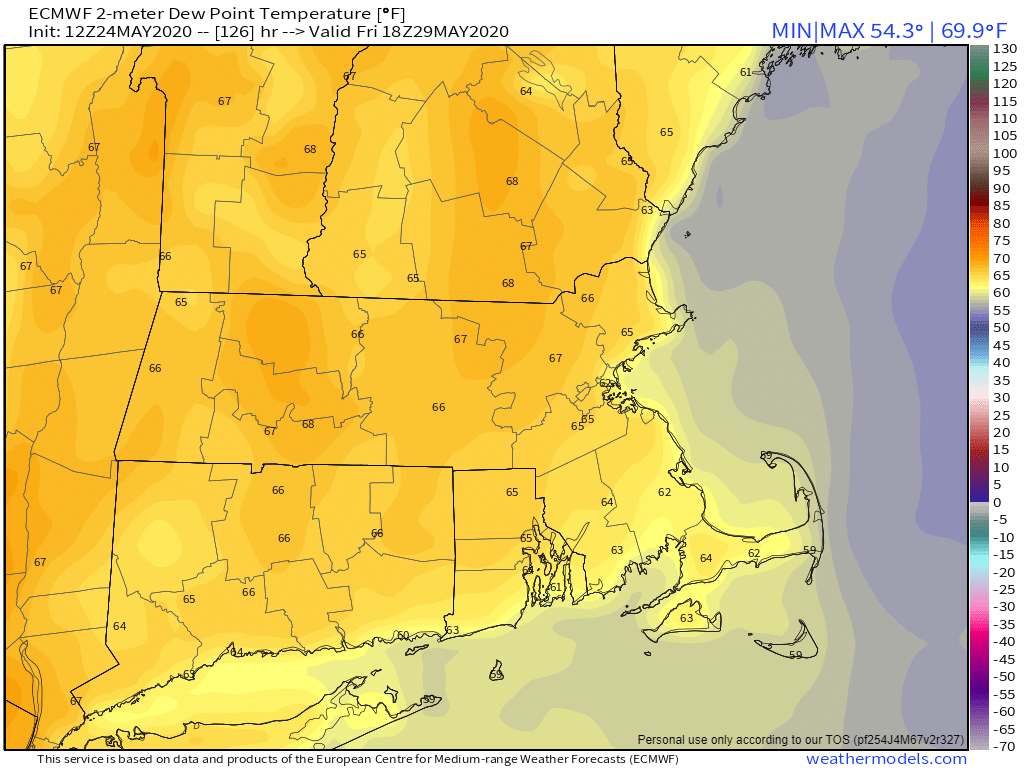
As we head into Friday, a cold front will be approaching the region. This will bring in more cloudcover, with showers and thunderstorms expected, especially during the afternoon and evening. How much sunshine we get and when the front actually moves through will determine how warm we’ll get and how strong the storms will be. We’ll have more clarity on that situation on Thursday in our Weekend Outlook. Behind the front, high pressure builds in for the weekend with drier conditions.
Memorial Day: Low clouds and fog along with some patchy drizzle during the morning, then skies become partly sunny away from the coast in the afternoon. Some sunny breaks may develop along the coast late in the day. High 64-71, except 56-63 right along the coast.
Monday night: Low clouds and fog return. Low 50-57.
Tuesday: Becoming partly to mostly sunny. High 79-86, cooler along the coast.
Tuesday night: Clear to partly cloudy during the evening, low clouds and fog may move back in, especially along the coast. Low 56-63.
Wednesday: Partly to mostly sunny. High 83-90, cooler along the coast.
Thursday: Sunshine filtered through some high clouds, breezy, more humid, chance for a pop-up shower or thunderstorm in the afternoon. High 82-89, much cooler along the coast.
Friday: Partly to mostly cloudy, breezy, and humid with showers and thunderstorms likely during the late afternoon and evening. High 76-83.
Saturday: Becoming partly to mostly sunny. High 72-79.
Sunday: A mix of sun and clouds. High 68-75.
