Today was supposed to be our unofficial start to Spring. Patriots Day is when we finally feel like Spring has arrived. Thousands of runners heading from Hopkinton to Boston. Sox fans having hot dogs and beer for breakfast with first pitch at 11:05am for the only morning game in the major leagues all season. Re-enactments of Paul Revere’s ride and the Battles of Lexington and Concord. Instead, it’s just another day with people stuck in their houses, but the weather wasn’t going to be that great to be outside anyway.

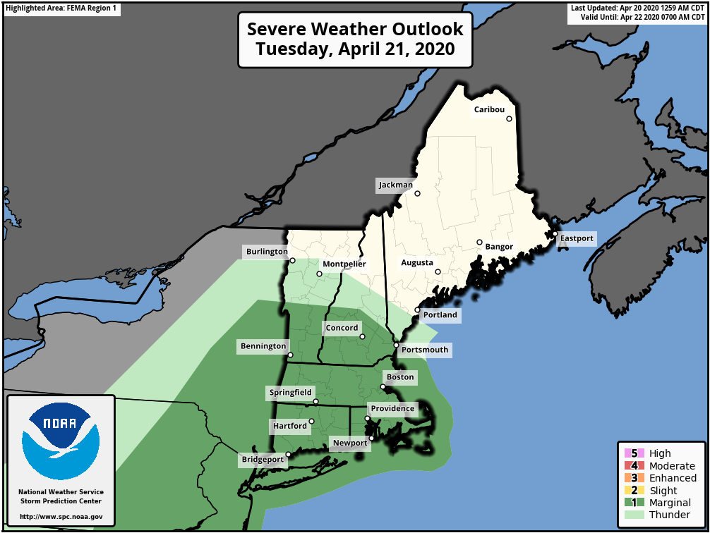
The week starts of with low pressure passing well south and east of New England. In fact, it’ll be far enough offshore that aside from a few showers across the Cape and the Islands, most of us will just have clouds and cool temperatures. Tuesday will be a different story. We’ll have some sunshine to start, but low pressure moving across southern Canada will drag a strong cold front across the region. As that front moves into the region showers and some thunderstorms are expected during the afternoon and into the evening. We’re not expecting widespread severe weather like they had along the Gulf Coast, but a few storms could become strong, with gusty winds, heavy downpours, and possibly some small hail.
Behind the front, skies quickly clear out Tuesday night, but strong northwest winds will usher much cooler air into the region. It will remain breezy and chilly on Wednesday as an upper-level low crosses the region, with a few sprinkles possible. High pressure then builds in for Thursday with milder conditions, but clouds will start to move as another storm system heads toward the region.

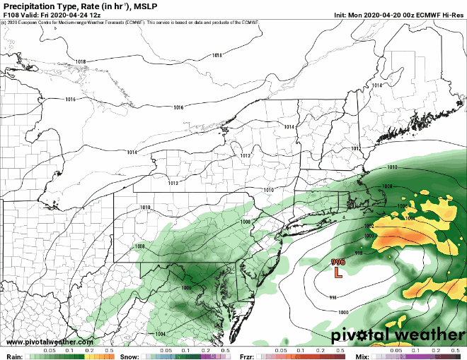
Low pressure will move out the Tennessee Valley then re-develop off the Mid-Atlantic coastline Thursday night, heading northeastward on Friday. This is where the uncertainty starts to increase. There are some models that show the system staying just a bit too far south, with most of the rain confined to the South Coast or offshore. Other models have showers move in Thursday night, with rain, possibly heavy at times through the day on Friday, ending late in the day. One model even has the rain change to snow before ending across parts of southern New Hampshire and northern Massachusetts. At this point, any of these solutions could be valid. For now, we’re going somewhere in the middle, with Friday being a rather wet day, with the heaviest rain south of the Mass Pike.
We’ll dry out a bit on Saturday, but another system quickly follows, but again, there’s questions about the timing and evolution of that system. It looks like we’ll have some showers come through Saturday night, then a stronger coastal storm may move in for somewhere around Sunday and/or Monday. Next Sunday could be a rainy and possibly windy day, but it’s still a little early to be sure. Then again, it’s not like most of us would have any outdoor plans anyway.
Monday: Plenty of clouds, chance for a few showers across the Outer Cape and Islands. High 48-55, coolest along the coast.
Monday night: Skies clear out. Low 30-37.
Tuesday: Sunny during the morning, then clouds return, showers and thunderstorms likely during the afternoon, becoming breezy. High 51-58.
Tuesday night: Showers and storms end in the evening, then clearing, windy, and colder. Low 27-34.
Wednesday: Sunshine and some afternoon clouds. High 41-48.
Thursday: Sunshine gradually fades behind increasing afternoon clouds. High 51-58.
Friday: Cloudy and breezy with rain likely, especially south of the Mass Pike where some heavier rain is possible. High 48-55, coolest along the coast.
Saturday: Some morning sun, then clouds return, breezy. High 54-61, cooler along the coast.
Sunday: Cloudy with more rain possible. High 48-55.
