We’ve actually got a quiet week coming up. The weekend might not be quiet, but we don’t have much to worry about before then.

A large area of high pressure will build in and remain in control through Friday. That means we’ll have dry and chilly conditions through Wednesday, but as the high slides off to the east, temperatures will moderate for Thursday and Friday, likely to above normal levels for late January. That should allow the snow from Saturday’s storm to melt for the most part. The only exception to the dry forecast is across Cape Cod, especially the Outer Cape, where some ocean-effect snow showers are possible today and again on Tuesday.
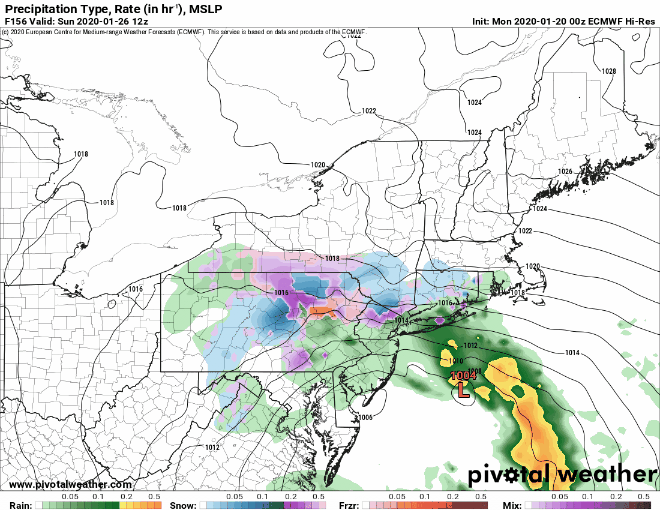
Next weekend, things get complicated again. We’ll have a low pressure system moving towards the Great Lakes and a secondary area of low pressure developing near the Mid-Atlantic states. Some of the models show an upper-level low pressure area moving toward the East Coast at the same time, which would slow down or even stall out that developing surface low. The forecast will obviously depend on the development and track of that low, and at this point, it’s still 5-6 days away, so we’re not even going to attempt to nail down any details. We’ll just say that the potential is there for a long-duration storm that could produce snow or rain (or both). Obviously, the best chance for snow would be farther inland. Assuming this storm develops and looks like it will have a significant impact on the region, we’ll do a special blog post later in the week.
Monday: Partly to mostly sunny, except plenty of clouds across Cape Cod with a few snow showers possible, mainly across the Outer Cape. High 21-28.
Monday night: Clear and cold. Low 8-15, possibly a little colder across southern New Hampshire and into the Merrimack Valley.
Tuesday: Partly sunny, chance for a few snow showers across Cape Cod, mainly the Outer Cape. High 22-29.
Tuesday night: Clear to partly cloudy. Low 10-17.
Wednesday: Plenty of sunshine, not as cold. High 30-37.
Thursday: Sunshine and a few clouds, milder. High 37-44.
Friday: Partly to mostly cloudy. High 38-45.
Saturday: Cloudy with a chance of snow or rain. High 34-41.
Sunday: Cloudy with a chance of snow or rain. High 36-43.
