We’ve got a little bit of everything coming this week – snow, rain, cold and mild temperatures. Let’s get right to the details.
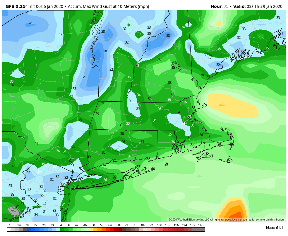
A weak system moves across the region today, bringing in some snow showers, which will probably be just rain showers across southeastern Massachusetts and Rhode Island. This is not a big deal for early January. Skies will clear out behind the system tonight, but that will be short-lived, as clouds quickly come back in on Tuesday ahead of the next storm system. This one will also bring in some light snow, mainly south of the Mass Pike Tuesday night into Wednesday, with some rain possible across Cape Cod. Again, this doesn’t look like a big deal, but some places could see an inch or two of accumulation. The bigger story will be strong winds behind the system, which may gust to 40 mph.
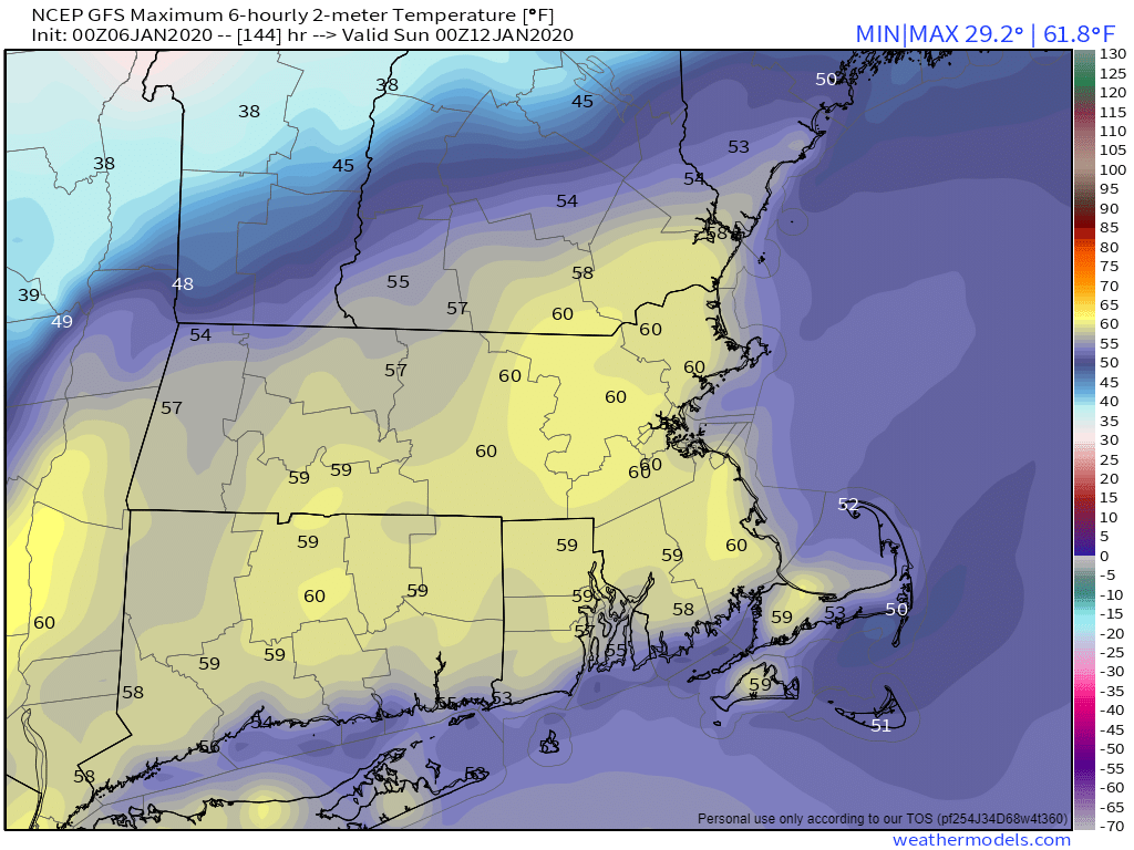
High pressure builds in again for Thursday with much colder conditions, but then again, it’s January, it’s supposed to be cold. High temperatures may struggle to get to freezing across much of the area. Again though, this will be short-lived. A warm front moves through on Friday, with a little bit of precipitation ahead of it. This should be mainly in the form on rain, but a little sleet or freezing rain is possible across the interior. Much milder weather settles in behind the front later Friday into Saturday. Temperatures on Saturday could get into the 50s across the area. The problem is, we’ll have some rain to deal with, possibly a quite a bit of it, as a cold front will be approaching. The front moves through Saturday night, but the precipitation could linger into early Sunday. With colder air moving in, and precipitation hanging around, the potential will be there for some wintry weather, especially from the Merrimack Valley into Southern New Hampshire. Right now, it looks like the cold air will be slow to move in, so the precipitation will likely end as rain across the rest of the area. We’ll keep an eye on this as the week goes on.
Monday: Mostly cloudy with some snow showers likely, rain showers across southeastern Massachusetts. High 30-37.
Monday night: Becoming mostly clear. Low 23-30.
Tuesday: Morning sunshine, then clouds stream back in during the afternoon. High 33-40.
Tuesday night: Cloudy with light snow likely, mainly south of the Mass Pike, possibly mixed with rain across Cape Cod. Low 23-30.
Wednesday: Light snow ends early, then some clearing takes place in the afternoon, becoming breezy. High 32-39.
Thursday: Sunshine starts to fade behind increasing afternoon clouds. High 23-30.
Friday: Cloudy, breezy, and milder with a chance for a few showers, possibly mixed with a little sleet across the interior. High 43-50.
Saturday: Cloudy and windy with periods of rain and showers. High 50-57.
Sunday: Rain ends in the morning, possibly as a wintry mix from the Merrimack Valley into Southern New Hampshire. Temperatures will start the day in the middle to upper 30s (lower 40s south of Boston), then hold steady or drop during the afternoon.
