Ice in your drink? That’s a good thing. Ice on an injury? It helps, so it’s good too. Ice on the roadways? Not good at all. Unfortunately, some of you may have to deal with that this morning.
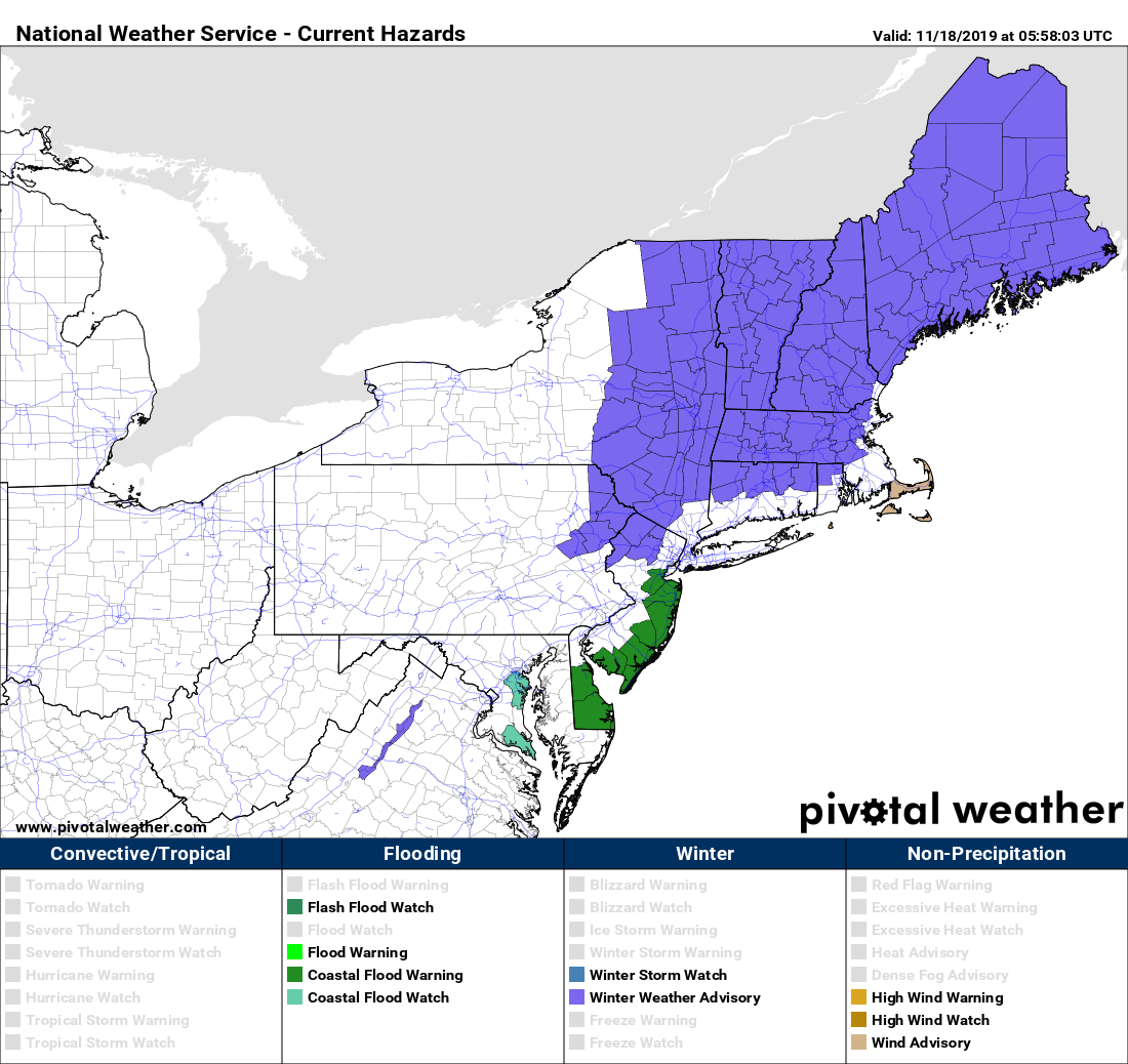
The low pressure system that brought heavy rain, strong winds, and coastal flooding to the Carolinas over the weekend will pass south and east of New England today, bring some of those same issues here, but also introducing other problems. It will bring in some rainfall to our area today, with some strong winds, especially across Cape Cod and southeastern Massachusetts. Some coastal flooding is possible across eastern Massachusetts around high tide as well. However, the biggest problem will already be ongoing (or maybe even over) by the time most of you read this.
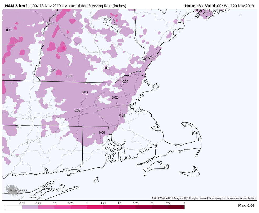
Some light precipitation will move into the region this morning ahead of the system. Temperatures will also be below freezing, mainly north and west of Interstate 95. What happens when you have subfreezing temperatures at the surface, warmer air aloft, and some precipitation falling? If you guessed freezing rain and/or freezing drizzle, then you are correct! That’s bad news if you’ve got to be out and about on the roads this morning. Most cities and towns should have pre-treated the roads, but some of the side roads and also bridges and overpasses could be a little slick this morning, so use caution and give yourself a little extra time. Temperatures should warm above freezing most places this morning before the steadier and heavier rain arrives, so there shouldn’t be too many problems.
After a miserable day today (temperatures in the 30s, gusty winds, and rain – you have a better word to describe it?), the system pulls away tonight, but one last batch of precipitation moves through overnight and early Tuesday as an upper-level low pressure area moves across the Northeast. This will be mostly rain, but as some colder air starts to move in behind the storm, some wet snowflakes could mix in, especially across the higher terrain from central Massachusetts into southern New Hampshire.

Once the system pulls away, we dry out on Tuesday, but the clouds remain in place into Wednesday as another system passes offshore. This one will be too far offshore to produce anything more than clouds, but it will help to bring colder air down from the north. High pressure builds in for Wednesday night and Thursday with clearing and chilly weather.
Clouds come back late Thursday as low pressure heads toward southeastern Canada. That low passes by to the north and west on Friday, dragging a cold front across the region. It will get mild ahead of the front, but some more rain is expected as well. Once the front moves through, high pressure builds back in for Saturday with another shot of cold weather. Sunday is still up in the air a bit. We’ve got one model showing a weak system passing by to the north, with a few snow showers, while another model has a system moving in from the southwest, with some rain, and a third model has high pressure building in.

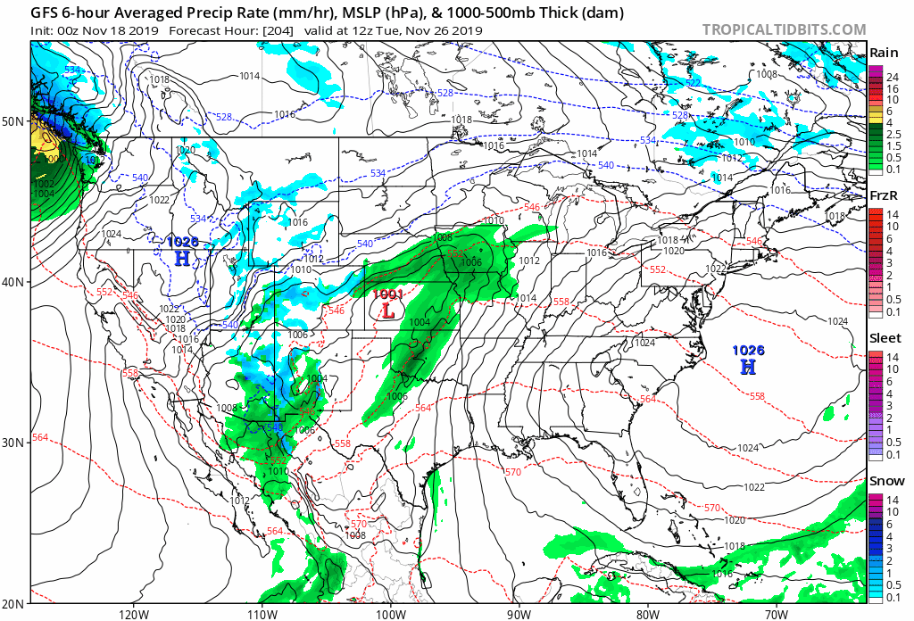
If you’re looking ahead to Thanksgiving already, well, it’s too early to try and pin down any specifics, but most of the models have a fairly potent storm system moving out of the Midwest and towards the Northeast sometime in the Wednesday/Thursday timeframe. For now at least, the models are showing mostly rain, but again, it’s a long ways away. If you’re traveling for the holiday, just keep an eye on the forecast. We’ll have more details in next week’s outlook obviously.
Monday: Cloudy and breezy (windy across Cape Cod) with some freezing drizzle north and west of I=95 in the morning, changing to plain rain by midday. Occasional showers becoming a steady rain during the afternoon south and east of I-95. High 33-40 north and west of Boston, 40-47 south of Boston.
Monday night: Cloudy with some showers likely. Low 32-39.
Tuesday: Mostly cloudy with showers ending in the morning, possibly mixed with some wet snow over the higher terrain. High 40-47.
Tuesday night: Partly to mostly cloudy. Low 27-34.
Wednesday: Plenty of clouds. High 38-45.
Thursday: That big bright thing in the sky returns, though some high clouds move in late in the day. High 41-48.
Friday: Mostly cloudy and milder with some showers likely. High 49-56.
Saturday: Becoming partly to mostly sunny and colder. High 38-45.
Sunday: Clouds return again with a chance for some showers. High 40-47.
