
Are you ready? Ready for Winter? It’s coming, and quickly. Better enjoy today, because after that, it’s going to get cold.
We start the week off with high pressure in control, but we’ll have plenty of clouds as a cold front begins to approach the region. That front will move through on Tuesday, with some rain likely ahead of it. Low pressure will develop along this front and move right across the region on Tuesday. Ahead of the low and the front, it will be somewhat mild, but once the front moves through in the afternoon, that’s when things start to happen.
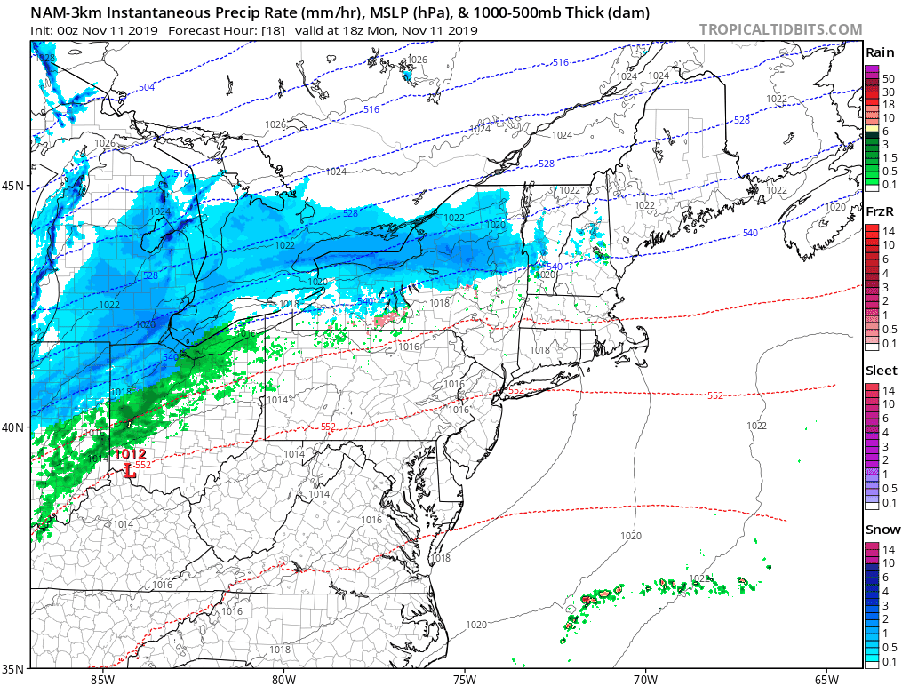
Colder air comes surging in behind the front, and temperatures will quickly drop Tuesday afternoon. Rain will likely change over to sleet and snow from northwest to southeast. Now we’re not talking about a lot of snow, probably an inch or less in most spots, and mainly on grassy surfaces, but snow will be the least of the concerns. Gusty winds will help to dry out the roads, and ground temperatures remain fairly mild, but with temperatures dropping into the 20s by late Tuesday, we could see some ice developing, especially on elevated surfaces like bridges and overpasses. So, if you’re going to be out and about Tuesday evening or night, use caution.

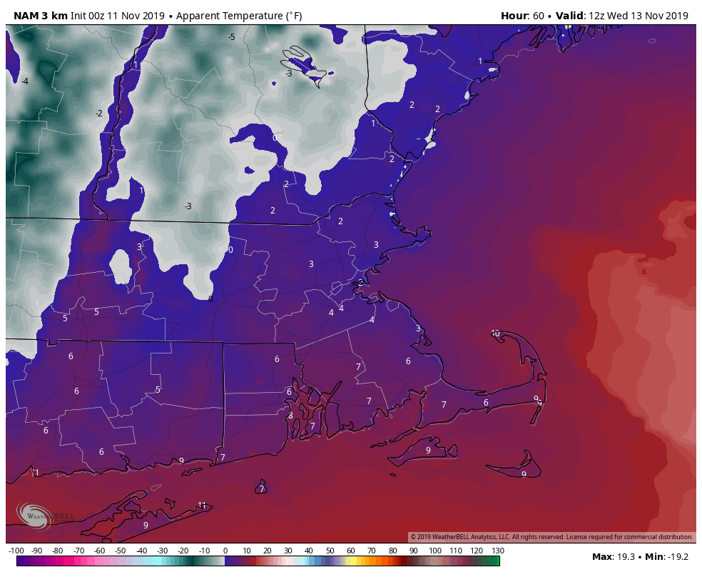
We’ve covered the snow potential, and the potential for slick roads, but here’s the biggest issue we’ll be dealing with – it’s going to be cold. When we say “cold”, we mean “COLD”. As in, record low temperatures Wednesday morning across most of the region. As in wind chills (another phrase most of you don’t like) in the single numbers (Fahrenheit, not Celsius). Yeah, it’s going to feel like January Tuesday night into Wednesday. Oh yeah, we forgot to mention that Wednesday may see highs in the 20s to lower 30s.

Winds will diminish for Thursday, but it will remain chilly. Temperatures should start to moderate a little on Friday as high pressure slides offshore. Of course, another cold front comes through Friday night and then we get cold again next weekend, but probably not quite as cold as Tuesday night and Wednesday. Temperatures will still be well below normal.
Monday: Mostly cloudy with a few showers possible, mainly north of the Mass Pike. High 41-48 north and west of Boston, 49-56 south of Boston.
Monday night: Cloudy with showers developing late at night. Evening low 34-41 north and west of Boston, 42-49 south of Boston. Temperatures may rise after midnight
Tuesday: Cloudy and breezy with showers likely, changing to sleet and snow during the afternoon. Morning high 42-49 north and west of Boston, 50-57 south of Boston, then temperatures quickly drop in the afternoon.

Tuesday night: Any lingering snow showers end in the evening, then clearing, breezy, and colder. Low 13-20.
Wednesday: Sunny, breezy, and cold. High 25-32.
Thursday: Intervals of clouds and sun, a few flurries are possible at night. High 34-41.
Friday: Sunshine to start, then clouds move in during the afternoon. High 43-50.
Saturday: Sunshine and some afternoon clouds. High 31-38.
Sunday: A mix of sun and clouds. High 37-44.
