Summer in October continued on Sunday, but a cold front will bring cooler conditions in today. So, are we finally into fall weather for good? To borrow a phrase from college football analyst Lee Corso – “Not so fast my friend.”
We’ll start the week off with high pressure building in, bringing cooler conditions to the region. In fact, temperatures may be below normal today. Some locations could even see some frost Tuesday morning. Don’t be alarmed, it is October, and this does frequently occur at this time of year. Tuesday looks to be on the cool side as well. After that? The warmth returns. High pressure slides offshore, and we warm right back up with dry conditions for the rest of the week and into the weekend.

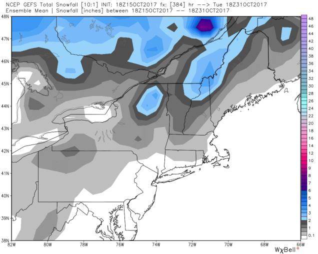
It does look like the warm weather party will come to a crashing halt early next week, with a pattern change becoming more and more likely. A flip to below normal temperatures and more precipitation looks to be in the offing. In fact, some places could even see their first flakes of the season late this month. (Yeah, we just said that. Deal with it.) We’ll get into more detail on this in next week’s outlook. For now, enjoy the warm weather.

Monday: Some lingering showers across Cape Cod and SE Mass early in the day, otherwise skies will gradually clear from northwest to southeast. High 54-61.
Monday night: Becoming mostly clear and chilly with some patchy frost. Low 35-42, but some of the normally colder locations could drop close to 30.
Tuesday: Plenty of sunshine. High 51-58.
Tuesday night: Clear skies. Low 42-49.
Wednesday: Sun, sun, and more sun. High 64-71.
Thursday: Sunshine and some afternoon clouds, breezy. High 68-75.
Friday: Partly to mostly sunny. High 62-69.
Saturday: Sunshine and a few clouds. High 69-76.
Sunday: A mix of sun and clouds. High 72-79.

Finally, we will discuss former Hurricane Ophelia. As of early Monday morning, Ophelia has transitioned into a post-tropical storm. In other words, it’s just another low pressure system now, albeit a strong one. It’s likely going to cross Ireland and the northern UK over the next day or two. Strong winds and heavy rain are expected. While some of the media are playing the hype game, the truth is, they get storms like this all the time in the fall, winter, and spring, many of which are even stronger. The difference this time is that the storm has tropical origins, so it will likely bring in more rain than your typical North Atlantic storm moving into the UK. It’s not rare, and it’s not unusual. Plenty of former tropical cyclones have become post-tropical and crossed the Atlantic, impacting the UK in the past.