It’s been a warm and dry summer for most of the region, but the next few days will feature some very hot weather and unlike much of the summer, some extreme humidity.
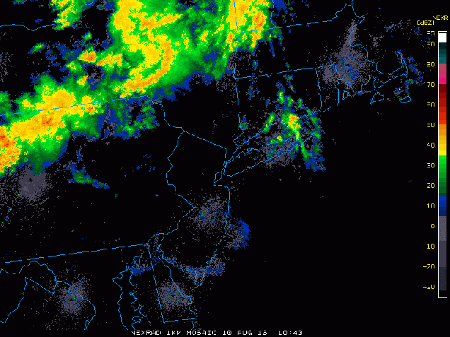
A weak upper-level disturbance moved across the region this morning, bringing some much needed rainfall to the region. The cloud cover and rainfall has kept temperatures mainly in the 70s to lower 80s, but dewpoints have jumped into the upper 60s and 70s across the area. That moisture is going to remain in place for the next several days, but will be accompanied by some very hot weather.
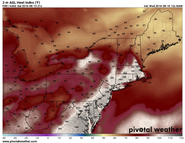
Once some patchy fog burns off Thursday morning, we;ll have sunshine across the area. Since we’re going to start the day in the 70s, temperatures will quickly spike into the 80s and 90s by midday. South to southwest winds will keep temperatures in the 80s along the south coast, but elsewhere, highs will soar well into 90s. When you factor in the humidity, the heat index will be near or just over 100 degrees. As a result, a heat advisory has been issued for much of eastern Massachusetts from Noon until 7pm on Thursday. If your plans include outdoor activities, make sure you follow the usual precautions – drink plenty of liquids and stay out of the sun as much as possible.

Thursday isn’t the only hot day though, and in fact, it might not even be the hottest day this week. Friday will feature conditions similar to Thursday, but Saturday could be even hotter. Temperatures will soar well into the 90s once again, with heat indices topping 100 across much of the region.
While some showers and thunderstorms may pop up both Friday and Saturday afternoons to provide a little relief from the heat, it’s an approaching cold front that will bring an end to the heat wave. When that front arrives is still a big question mark. Some models want to bring the front through the region Saturday night, while others wait until later on Sunday. This obviously has a big impact on temperatures for Sunday across the region. What the models all agree on is that the front will stall out near the area at some point on Sunday, and then waves of low pressure will ride along the front. South of the front temperatures will still be in the 80s to lower 90s with fairly high humidity, while north of the front temperatures will be in the 70s to lower 80s with lower humidity. The waves riding along the front will likely bring in some beneficial rainfall later Sunday into Monday, before the front finally pushes farther to the south. Neither day should be a washout, but we certainly need the rain. We’ll have more details on that later in the week as things become a little clearer.
