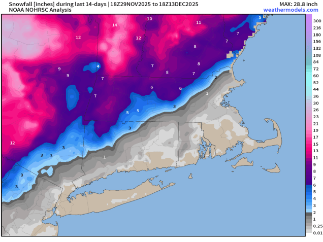
The first half of the week should be quiet, but things could change during the latter half.

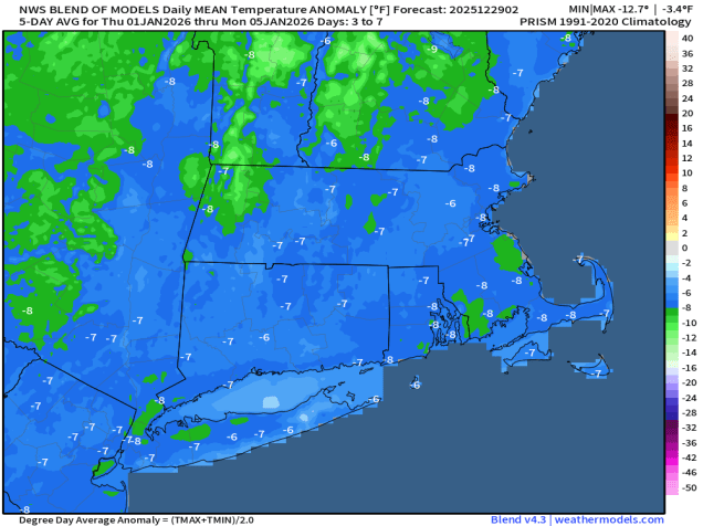
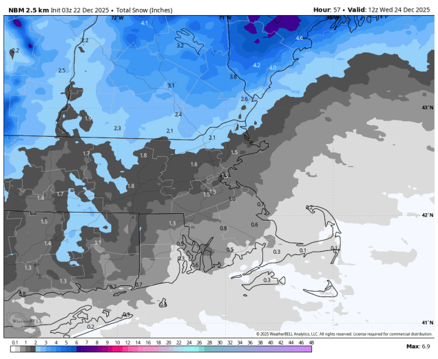
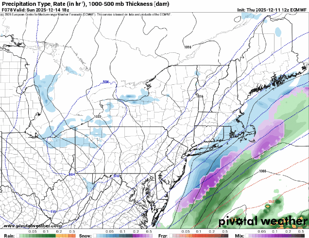
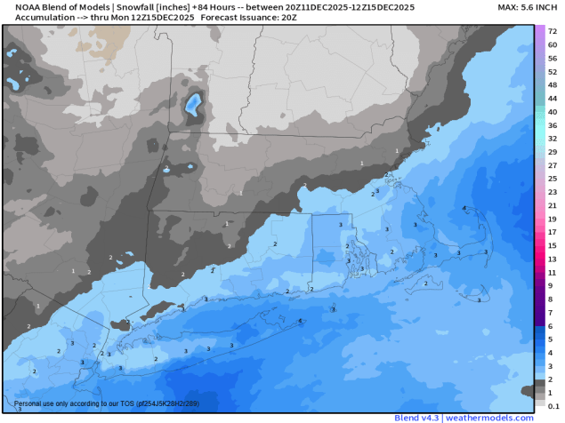
High pressure builds in with dry weather today, but the storm system that brought yesterday’s rain will intensify in Atlantic Canada today, producing some gusty winds. As the high slides off to the east, temperatures will start to moderate on Tuesday, but clouds will start to move in ahead of a fast-moving system heading our way. That system passes north of the region on Wednesday with some rain showers possible, but much of the day may end up dry. After that, things start to change. At the upper levels of the atmosphere a large trough of low pressure will shift to the Eastern US, resulting in colder weather returning to the region. A low pressure area is expected to develop and move up the East Coast on Thursday, but the forecast models have a wide range in potential scenarios with this storm, with anything from a miss offshore to a decent amount of snow to more rain than snow. At this point, it’s too early to pin down one scenario as the models keep changing their tune with every run, so we’re just going to keep the forecast vague for now, but if it does look like a threat for snow, we’ll do a special blog post beforehand. High pressure should bring drier weather in for Friday and Saturday, but there’s the chance for another coastal system on Sunday, though this one looks more like a wave riding up along a cold front right now. Again, there is a tremendous amount of uncertainty, so we’re going to keep the forecast vague for now, and hopefully have more clarity when we get to our Weekend Outlook on Thursday.

Monday: Sunshine and some afternoon clouds, breezy. High 32-39.
Monday night: Clear to partly cloudy. Low 25-32.
Tuesday: Partly to mostly sunny, clouds start to move in late in the day. High 37-44.
Tuesday night: Becoming mostly cloudy. Low 30-37, temperatures may hold steady or rise a little overnight.
Wednesday: Plenty of clouds, chance for a few showers. High 42-49.
Wednesday night: Cloudy. Low 30-37.
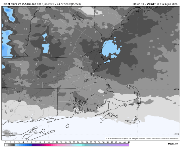
Thursday: Mostly cloudy, chance for a little snow or rain. High 39-46.
Thursday night: Mostly cloudy, breezy, chance of snow. Low 17-24.
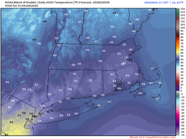
Friday: Intervals of clouds and sun, breezy, any snow ends early. High 26-33.
Saturday: Partly sunny. High 31-38.
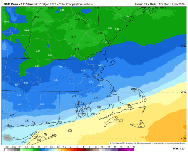
Sunday: Partly to mostly cloudy, chance for a little snow or rain. High 32-39.