Astronomical summer begins Friday night (10:41pm EDT to be exact), but we’re going to have some summer weather for a good portion of the upcoming week.

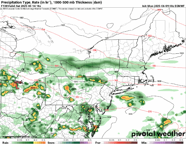
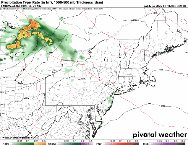
We’re starting the week off with high pressure in control, keeping us dry, but temperatures will remain a little below normal for mid-June, but changes are coming. Low pressure heading into southern Canada will send a warm front our way on Tuesday, but it likely doesn’t arrive until nighttime, keeping us on the cool side once again. There could be a few showers ahead of a warm front, but most of us should stay dry. The warm front moves through, setting up a much warmer and more humid day on Wednesday. Again, there is a chance for a few widely scattered showers or thunderstorms, but they shouldn’t be that common. Thursday, however, could be an interesting day weather-wise. A cold front will be approaching the region from the west. Ahead of it, it will be a very warm and humid day, and with the approaching front, some showers and thunderstorms are likely. There are several factors we need to pay attention to, the biggest one being the timing of the front, but the potential exists for some strong to severe storms. We’ll keep an eye on this, and will post an update on Wednesday if severe weather looks more likely. Behind the front, dry and somewhat cooler air settles in for Friday, though an upper-level disturbance moving through could trigger another pop-up shower or two. This brings us to Saturday, and for the first time in a while, it looks like it will be dry. There’s plenty of time for things to change, but our stretch of wet Saturdays *could* be ending this week. Another weak system may bring in a few showers or thunderstorms on Sunday.
Monday: Intervals of clouds and sun. High 69-76, coolest along the coast.
Monday night: Partly to mostly cloudy, slight chance for a shower, patchy fog may develop. Low 53-60.
Tuesday: More clouds than sun, chance for a few showers. High 68-75, coolest along the coast.
Tuesday night: Mostly cloudy with a few showers, mainly during the evening, fog may redevelop. Low 56-63.
Wednesday: Becoming partly sunny, a shower is possible. High 76-83, a little cooler across the South Coast and Cape Cod.
Wednesday night: Partly cloudy, patchy fog possible. Low 62-69.
Thursday: A mix of sun and clouds, showers and thunderstorms likely in the afternoon, breezy. High 84-91, cooler along the South Coast and Cape Cod.
Thursday night: Showers and storms ending in the evening, then becoming clear. Low 61-68.
Friday: Sunshine and some afternoon clouds, slight chance for a shower. High 77-84.
Saturday: Partly to mostly sunny. High 77-84.
Sunday: Partly sunny, chance for a shower or thunderstorm. High 81-88, cooler across the South Coast and Cape Cod.