Temperatures will be quite mild for half the week, and quite chilly for half the week. In between, some much needed rain is on the way.
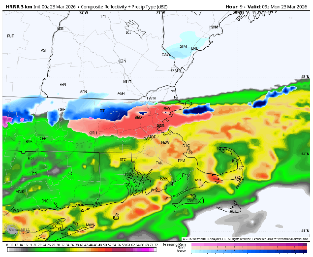
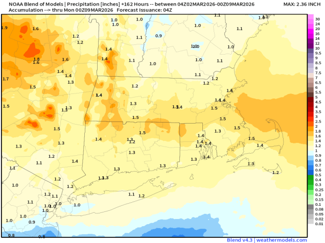
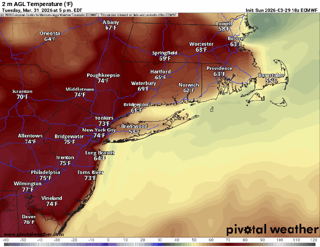
The week starts off with high pressure moving off the East Coast, with southwest winds around the high bringing milder weather in, though the South Coast and Cape Cod will remain cooler as a southwest wind is a seabreeze off the still-chilly Atlantic. Tuesday could be a bit trickier. A backdoor cold front will be dropping southward, bringing some showers into the region. How far south the front gets before stalling out will have a big impact on the temperature forecast. South of the front, temperatures will likely get into 60s (cooler near the South Coast), while north of the front, temperatures will only be in the 40s. This boundary will lift back northward at night.
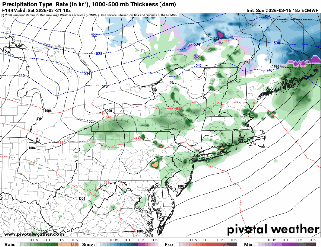
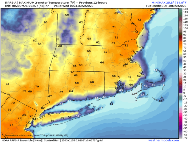
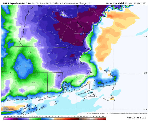
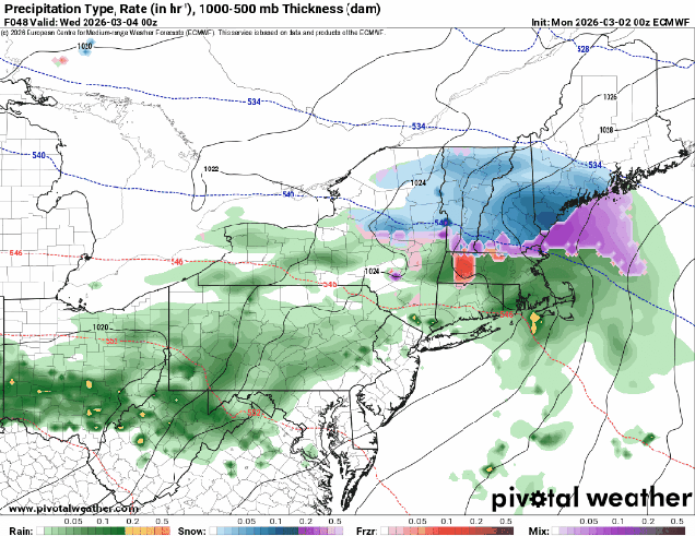
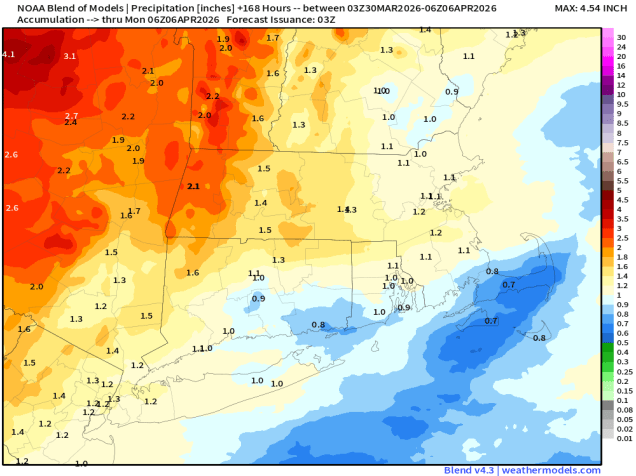
Wednesday will likely be a mild day across the region, but low pressure crossing northern New England will drag a cold front through, with another round of showers and possibly some thunderstorms ahead of the front during the afternoon. Much cooler air settles in behind the front for Wednesday night and Thursday, but the front will stall out to our south and a wave of low pressure will ride along it, bringing in some additional rainfall. Friday has the potential to be another tricky day, and it’s also the Red Sox home opener, so a lot of people will be paying attention to this forecast. Another wave of low pressure will ride along the front late Friday and Friday night, with some more showers, but for now, it looks like much of the day will stay dry. The question is in the temperature forecast. Some models have the wave passing farther north, bringing the front back through as a warm front, some keep it farther south, with chilly weather remaining in place. Some additional showers possible on Saturday, then Sunday looks similar to Friday, with another system possibly dragging the front northward, allowing warmer air to briefly return before showers and another cold front move in.

Monday: Intervals of clouds and sun, breezy. High 60-67, cooler near the South Coast and Cape Cod.
Monday night: Partly to mostly cloudy, chance for some late-night showers. Low 43-50.
Tuesday: More clouds than sun with some showers likely, especially in the morning. High 58-65, cooler near the South Coast and Cape Cod, temperatures may drop during the afternoon, especially along the coast and into parts of northeastern Massachusetts and southern New Hampshire..
Tuesday night: Partly to mostly cloudy, breezy, chance for a shower or two. Low 42-49, temperatures start to rise after midnight.
Wednesday: Plenty of clouds with a few sunny breaks early, breezy, showers developing in the afternoon, possibly a thunderstorm. High 67-74, cooler near the South Coast and Cape Cod.
Wednesday night: Mostly cloudy with more showers, mainly during the evening. Low 34-41.
Thursday: Lots of clouds, chance for a few showers, much cooler. High 39-46.
Thursday night: Cloudy with some showers possible. Low 31-38.
Friday: Mostly cloudy. High 51-58.
Saturday: Mostly cloudy, chance for a few showers. High 50-57.
Sunday: Cloudy with a chance for more showers. High 57-64.