Someone call Ripley, because Believe It or Not, there’s rain in the forecast for part of the weekend.

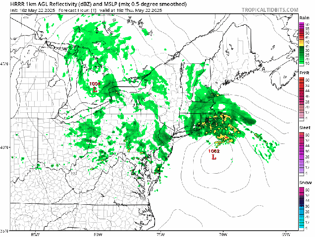
After a hot and somewhat humid day today, changes are on the way as a slow-moving cold front makes its way toward the region. We’ll see clouds become more numerous tonight and Friday, with some showers and thunderstorms likely on Friday, especially in the afternoon, and mainly north of the Mass Pike. Some of these storms may produce strong winds and heavy rain which could lead to areas of flooding, so if you’ve got outdoor plans, keep an eye on the radar. It’ll still be quite warm and humid, but not as hot as today.
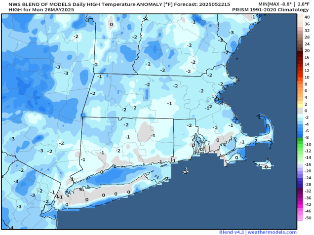
The cold front finally moves through on Saturday, accompanied by some additional showers, but they shouldn’t be that heavy. They’ll also be accompanied by cooler temperatures behind the front. Sunday will be the pick of the weekend as high pressure builds in with more comfortable conditions, though there will still be some clouds around as an upper-level disturbance crosses the region. We also have more smoke from Canadian wildfires drifting in on Sunday, resulting in hazy skies at times. Monday is a little uncertain at the moment. Many of the models had been showing high pressure remaining in control with a weak low pressure system passing well to the south, but some of those models are bringing the system a lot farther northward now, possibly bringing in more showers on Monday. We’re going to be cautiously optimistic for now that it should remain mostly dry, but with low confidence.

Thursday night: Partly to mostly cloudy, a few showers or thunderstorms possible during the evening. Low 61-68.
Friday: Some morning sun, otherwise becoming mostly cloudy with showers and thunderstorms developing, some could produce heavy downpours and strong winds. High 78-85, cooler along the coast.
Friday night: Mostly cloudy, showers and thunderstorms wind down before midnight. Low 57-64.
Saturday: Plenty of clouds with more showers likely. High 70-77.
Saturday night: Any lingering showers end in the evening, then becoming partly cloudy. Low 54-61.
Sunday: Intervals of clouds and hazy sunshine. High 70-77, cooler across Cape Cod.
Sunday night: Partly to mostly cloudy. Low 52-59.
Monday: Partly sunny. High 66-73.