Some milder weather is on the way once again, but so is some rain.
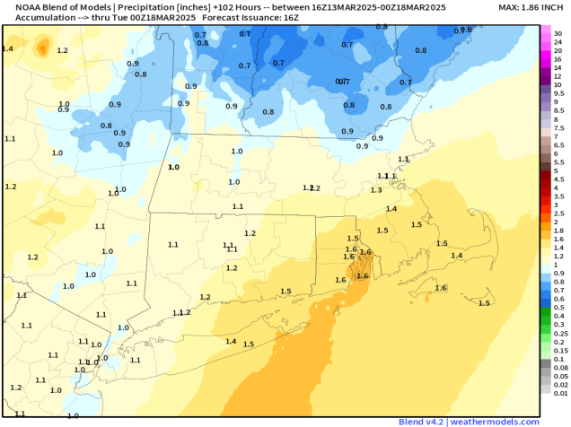
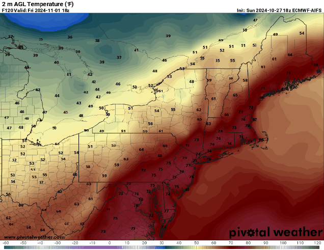
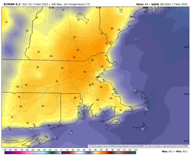
High pressure will remain in control for the next day or two, keeping us on the cool side into Friday, especially near the coast, thanks to east to northeast winds off the chilly Atlantic. We will see some sunshine developing on Friday. Skies may clear out enough tonight to allow you to view the total lunar eclipse, but that is far from a guarantee. As the high moves offshore on Saturday, winds shift into the south and southwest, bringing milder air back in, but also some clouds ahead of a storm system slowly making its way eastward. This storm will produce quite a bit of severe weather from the Mississippi and Ohio Valleys to the Gulf Coast over the next few days, but we’re not expecting that once it moves in. What we are expecting is strong southerly winds on Sunday, possibly gusting to 40-50 mph or higher. This will result in a very mild day away from the South Coast, with temperatures likely getting well into the 60s in many spots. As the cold front trailing the system draws nearer, we’ll see a few showers in the afternoon, becoming more widespread at night, some of them heavy, and some thunderstorms are possible. The front will slow down Sunday night, keeping the rain going into at least Monday morning. Once the front finally pulls away in the afternoon we may see some late-day clearing.
Thursday night: Partly to mostly cloudy. Low 27-34.
Friday: A mix of sun and clouds. High 48-55, a little cooler along the coast.
Friday night: Increasing clouds. Low 32-39.
Saturday: Partly sunny. High 54-61, cooler along the South Coast and Cape Cod.
Saturday night: Mostly cloudy. Low 42-49, temperatures may start to rise after midnight.
Sunday: Plenty of clouds, chance for a shower or two in the afternoon, becoming windy. High 61-68, cooler along the South Coast and Cape Cod.
Sunday night: Cloudy with periods of rain, some of it could be heavy, a thunderstorm is possible, windy at times, especially in the evening. Low 46-53.
Monday: Rain ends in the morning, some clearing late in the day. High 51-58, temperatures may start to drop in the afternoon.